
Bute, Balnakailly


Enclosure (Period Unassigned), Knocking Stone (Period Unassigned), Township (Medieval) - (18th Century)
Site Name Bute, Balnakailly
Classification Enclosure (Period Unassigned), Knocking Stone (Period Unassigned), Township (Medieval) - (18th Century)
Alternative Name(s) Balnacoily, Ballycally
Canmore ID 78663
Site Number NS07SW 29
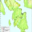
NGR NS 01873 73938
Datum OSGB36 - NGR
Permalink http://canmore.org.uk/site/78663


- Council Argyll And Bute
- Parish North Bute
- Former Region Strathclyde
- Former District Argyll And Bute
- Former County Buteshire
NS07SW 29 01873 73938.
Recorded during survey of deserted settlements; records are held in the Bute Museum. The basic list has been forwarded to NMRS.
Sponsors: Bute Antiq Natur Hist Soc; St Andrews Heritage Services.
Proudfoot 1993d; Hannah and Proudfoot 1994.
A farmstead, comprising one roofed building, three unroofed buildings and three enclosures is depicted on the 1st edition of the OS 6-inch map (Argyllshire 1869, sheet clxxxii). Three unroofed buildings are shown on the current edition of the OS 1:10000 map (1979).
Information from RCAHMS (AKK) 29 September 1998.
NS 0187 7394 Township remains: Located just outside of oak wood, on terrace 0.5km inland from Balnakailly Bay. Planted around with spruce c.1987. This is a large site, with at least 5 buildings of different ages (the latest is 17 x 6m), a byre, yard and 2 enclosures. There is also a knocking stone. In record from 1590.
Buteshire Natural History Society (1991-9).
NS 0187 7394 Site 186 Balnakailly
This farm lies within the former Forest of Bute, which was a royal forest in the 15th century. The ancient oak wood around the lower reaches of the Balnakailly burn formed the core of this forest, and the site of the steading lies on a terrace just outside the dyke surrounding the wood. It is in record from 1590. The site is large and complex, with at least five buildings of differing age, a byre and yard, and two further enclosures. Balnakailly survives in form rather closer to that of a typical highland township than most other Bute sites. Desertion occurred c.1865 after a period of decline. In 1986/7 the site was planted around with spruce as part of a programme of local afforestation, and cultivation remains have been obscured.
E Proudfoot and A Hannah 2000
This farmstead is situated on a NE-facing terrace in a clearing in commercial woodland. It comprises five buildings, a garden and an enclosure. The method of construction of the buildings includes turf on stone footings and faced rubble-built walls standing to wall-head height. Two buildings stand on the N and W sides respectively of a small garden. The larger building (NS 01873 73939), on the N side of the garden, measures 14.3m from E to W by 5.4m transversely within faced rubble walls 0.7m in thickness and up to 1.6m in height. Three cruck-slots are visible in the interior, one in the N wall and two others (one of them blocked) in the S wall. There are also two entrances in the S wall, one leading directly into the small garden, the other leading, through its N end, into the W building, which measures 8.7m from N to S by 4.4m transversely within faced rubble walls up to 1.2m in height. There is a second entrance into this building in its S end. Of the three other buildings in the farmstead, one lies beyond the midden-pit immediately E of the largest building and two more lie to the NNW of the building. All have been reduced to low wall-footings.
‘Ballycally’ is depicted on Roy’s Military Map (1747-55), though about 400m W of its actual location, and shown more accurately on a contemporary estate map (Foulis 1758-9; RHP 14107), which depicts 'Balnacoily' as three buildings and an enclosure with cultivation to the N and E. The farmstead is also depicted on Mackinlay's map of North Bute (1823), which appears to show one building and at least two enclosures. The 1st edition of the OS 6-inch map (Argyllshire and Buteshire 1869, Sheet CLXXXII) records one roofed building (the largest), three unroofed buildings, the garden, two other enclosures and an area of cleared ground to the E. At the end of the 19th century ‘Balnakailly’ comprising two roofed buildings and the garden, which are shown on the 2nd edition OS map (Argyllshire and Buteshire 1901, Sheet CLXXXII SE).
Visited by RCAHMS (AGCH, GB) 1 June 2009.
Antiquarian Mapping (1758 - 1759)
Antiquarian Mapping (1823)
Field Visit (1991 - 1999)
NS 0187 7394 Township remains: Located just outside of oak wood, on terrace 0.5km inland from Balnakailly Bay. Planted around with spruce c.1987. This is a large site, with at least 5 buildings of different ages (the latest is 17 x 6m), a byre, yard and 2 enclosures. There is also a knocking stone. In record from 1590.
NS 0187 7394 Site 186 Balnakailly
This farm lies within the former Forest of Bute, which was a royal forest in the 15th century. The ancient oak wood around the lower reaches of the Balnakailly burn formed the core of this forest, and the site of the steading lies on a terrace just outside the dyke surrounding the wood. It is in record from 1590. The site is large and complex, with at least five buildings of differing age, a byre and yard, and two further enclosures. Balnakailly survives in form rather closer to that of a typical highland township than most other Bute sites. Desertion occurred c.1865 after a period of decline. In 1986/7 the site was planted around with spruce as part of a programme of local afforestation, and cultivation remains have been obscured.
E Proudfoot and A Hannah 2000
Field Visit (1 June 2009)
The township of Balnakailly is situated on a NE-facing terrace in a clearing in commercial forestry. It comprises five buildings, a stone built fold, an enclosure and field banks. The construction type ranges from turf on stone footings to faced rubble built walls, standing up to wall head height. The largest building (at NS 01873 73939) is aligned E-W, and measures 14.3m by 5.4m transversely, within faced rubble walls 0.7m in thickness and up to 1.6m in height. There is an entrance in the S side, into the fold and there is one cruck slot in the N side wall and two in the S side wall, one of which has been blocked. The NE corner of the building has been re-built and there is an entrance in the S side wall, towards the W end, which appears to be a later insert. This entrance opens into a second building immediately to the S, which abuts the larger building. This building measures 8.7m by 4.4m transversely, within faced rubble walls that stand up to 1.2m in height. It is aligned N-S and there is an entrance in the S end. There is a further building to the E of the largest building and two to the NNW. There is a midden pit to the E of the largest building. The field banks extend to the NW and S of the buildings. The site is named 'Balnacoily' and depicted as three buildings on the Foulis map of 1758-9 (RHP 14107/70), with a yard to the E and cultivation remains to the N and E. The site is also depicted on Mackinlay's map of 1823, showing what appears to be one building and at least two enclosures. The site is depicted on the 1st edition of the OS 6-inch map (Argyllshire and Buteshire 1869, Sheet CLXXXII) as one roofed building, which is the largest building, three unroofed buildings, three enclosures and an area of cleared ground to the E of the buildings. Two roofed buildings and an enclosure are depicted on the 2nd edition OS map (Argyllshire and Buteshire 1901, Sheet CLXXXII SE). On the date of visit the knocking stone could not be located.
Visited by RCAHMS (AGCH, GB) 1 June 2009.

