Ladykirk And Norham Bridge
Road Bridge (19th Century)
Site Name Ladykirk And Norham Bridge
Classification Road Bridge (19th Century)
Alternative Name(s) River Tweed; Ladykirk, Norham Bridge
Canmore ID 77641
Site Number NT84NE 50
NGR NT 89006 47292
Datum OSGB36 - NGR
Permalink http://canmore.org.uk/site/77641
- Council Scottish Borders, The
- Parish Ladykirk
- Former Region Borders
- Former District Berwickshire
- Former County Berwickshire
NT84NE 50 89006 47292
For associated tollhouse (Lower Toll Cottage, adjacent to W), see NT84NE 52.
Ladykirk & Norham Bridge [NAT]
OS 1:10,000 map, 1980.
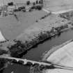
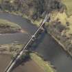
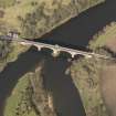
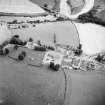
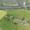
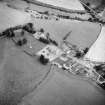
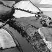
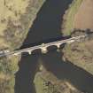
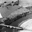
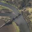
The B listed bridge over the Tweed between Ladykirk, Scotland and Norham, England is visible on large scale vertical air photographs, (OS 71/050/032, flown 1971).
(Undated) information in NMRS.
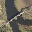
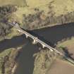
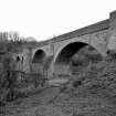
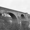
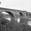
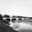
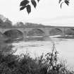
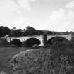
(Location cited as NT 890 473). Ladykirk-Norham Bridge, and tollhouse, built 1885-7, engineers Codrington and Brereton. A 4-span bridge, with dressed-stone arch rings, coursed-rubble spandrels and wing walls. The central pier has a rounded cutwater carried up to form a pedestrian refuge; the other piers have triangular cutwaters. The arches are segmental.
J R Hume 1976.
Ladykirk & Norham Bridge & Tollhouse, 1885-7, Thomas Codrington & Cuthbert Brereton, engineers. Four broad arches, red sandstone rock-faced with ashlar dressings, apsidal central cutwater with similar projection in parapet, outer cutwaters triangular and broached. Built for the Tweed Bridges Trust.
C A Strang 1994.
This bridge carries an unclassified public road over the River Tweed to the S of Ladykirk village (NT84NE 48). The river here forms the boundary between the parishes of Ladykirk, Scotland (to the W) and Norham, England (to the E).
The location assigned to this record defines the point at which the span crosses the main channel of the river, and thus the national boundary. The available map evidence suggests that it extends from NT c. 88964 47289 to NT c. 89130 47271.
Information from RCAHMS (RJCM), 1 February 2006.
Construction (1885 - 1887)
Photographic Survey (October 1961)
Photographic survey of Ladykirk and Norham Bridge, Berwickshire, by the Scottish National Buildings Record in 1961
Project (2007)
This project was undertaken to input site information listed in 'Civil engineering heritage: Scotland - Lowlands and Borders' by R Paxton and J Shipway, 2007.
Publication Account (2007)
This bridge, with its four segmental masonry arches, was erected over the Tweed from 1885–87 by G. Meakin and J. W. Dean to a design of Thomas Codrington. It has two 90 ft central spans flanked by 85 ft spans, all of hollowspandrel construction, and is 16 ft wide. The bridge replaced a bold laminated timber segmental arch-truss bridge with two 190 ft spans designed by J. Blackmore and erected in 1838.
R Paxton and J Shipway 2007
Reproduced from 'Civil Engineering Heritage: Scotland - Lowlands and Borders' with kind permission from Thomas Telford Publishers.
Sbc Note (15 April 2016)
Visibility: Standing structure or monument.
Information from Scottish Borders Council


