
Pricing Change
New pricing for orders of material from this site will come into place shortly. Charges for supply of digital images, digitisation on demand, prints and licensing will be altered.
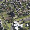
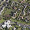
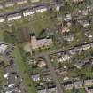
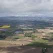
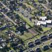
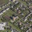
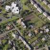
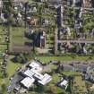
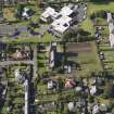
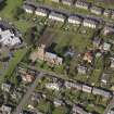
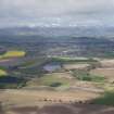
Kirriemuir, General


Burgh (Medieval), Town (Medieval) - (Post Medieval)
Site Name Kirriemuir, General
Classification Burgh (Medieval), Town (Medieval) - (Post Medieval)
Canmore ID 77465
Site Number NO35SE 55
NGR NO 385 539
NGR Description Centred NO 385 539
Datum OSGB36 - NGR
Permalink http://canmore.org.uk/site/77465


- Council Angus
- Parish Kirriemuir
- Former Region Tayside
- Former District Angus
- Former County Angus
Note (1984)
Kirriemuir NO 386 539 NO35SE
Kirriemuir was erected a burgh of barony in 1458-9.
RCAHMS 1984.
(Pryde 1965, 51, no. 145; NMRS record cards NO 35 SE 3, 4, 5, 14).

