Pricing Change
New pricing for orders of material from this site will come into place shortly. Charges for supply of digital images, digitisation on demand, prints and licensing will be altered.
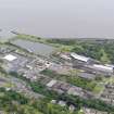
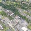
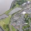
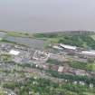
Bo'ness, Union Street, Dock
Dock (19th Century)
Site Name Bo'ness, Union Street, Dock
Classification Dock (19th Century)
Alternative Name(s) Hms Stopford; Bo'ness Harbour; River Forth; Inner Forth Estuary
Canmore ID 75308
Site Number NT08SW 101
NGR NT 00148 81864
Datum OSGB36 - NGR
Permalink http://canmore.org.uk/site/75308
- Council Falkirk
- Parish Bo'ness And Carriden
- Former Region Central
- Former District Falkirk
- Former County West Lothian
NT08SW 110.00 00159 81840
Dock
(disused) [NAT]
OS (GIS) Master Map, June 2009.
NT08SW 110.01 NT 00000 81893 Entrance Lock
Extends onto map sheet NS98SE.
See also:
NS98SE 113 Bo'ness, Harbour
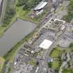
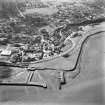
(Location cited as NT 000 819). Bo'ness harbour, opened after rebuilding 1881. A roughly rectangular wet dock, protected by a timber W pier. Disused and decaying.
J R Hume 1976.
The disused dock and associated lock have been drained and the mud level in the bottom is 4m - 5m below the edge of the dock. From the 1st edition OS map it is clear that the dock was built on reclaimed land since 1865. A railway runs along the southern edge of the dock.
Site recorded by GUARD during the Coastal Assessment Survey for Historic Scotland, 'The Firth of Forth from Dunbar to the Coast of Fife' 20th February 1996.
This enclosed dock may be envisaged as a development of and from the tidal or mud harbour (NS98SE 113) at Bo'ness, which lies adjacent to the ENW.
Information from RCAHMS (RJCM), 29 June 2009.
The former London and North Eastern Railway docks were utilised during World War II for Tank Landing Craft training and commissioned as HMS Stopford in 1942.
B Lavery 2004.
Characterisation
This site falls within the Industrial and Shoreline Area of Townscape Character (NT08SW 167), which was defined as part of the RCAHMS Urban Survey Programme 2013. Text relating to the historical development and topography, and present character of the Industrial and Shoreline Area of Townscape Character can be viewed at site NT08SW 167.
Information from RCAHMS (LK), January 2014


