
Caen Burn


Field System (Period Unassigned), Hut Circle(S) (Prehistoric)
Site Name Caen Burn
Classification Field System (Period Unassigned), Hut Circle(S) (Prehistoric)
Canmore ID 7488
Site Number ND01NW 8
NGR ND 010 191
Datum OSGB36 - NGR
Permalink http://canmore.org.uk/site/7488


- Council Highland
- Parish Kildonan
- Former Region Highland
- Former District Sutherland
- Former County Sutherland
ND01NW 8 010 191.
(ND 010 191) Hut Circles (NR). (Three shown A-C).
OS 6" map, (1964)
Three hut circles were located during field investigation.
Visited by OS (J L D) 25 May 1960.
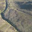
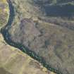
On an E-facing moorland slope is a settlement of three heather-covered hut circles ('A'-'C'), with each hut built onto the slope. They are oval and range in size internally from 'A' 8.0m SE-NW by 7.0m to 'C' 7.0 m SE-NW by 6.0m. The walls have spread to an average of 2.0m broad, and the entrances are in the SE. There are a number of clearance heaps, particularly around 'B', and a few lynchets visible, but any field pattern has been obscured by peat cover.
Resurveyed at 1:10 560.
Visited by OS (J B) 12 May 1976.

