
Following the launch of trove.scot in February 2025 we are now planning the retiral of some of our webservices. Canmore will be switched off on 24th June 2025. Information about the closure can be found on the HES website: Retiral of HES web services | Historic Environment Scotland
Falkirk, Pleasance


Roman Fort (Roman)
Site Name Falkirk, Pleasance
Classification Roman Fort (Roman)
Alternative Name(s) Hodge Street
Canmore ID 74326
Site Number NS87NE 42
NGR NS 8873 7972
Datum OSGB36 - NGR
Permalink http://canmore.org.uk/site/74326


- Council Falkirk
- Parish Falkirk
- Former Region Central
- Former District Falkirk
- Former County Stirlingshire
NS87NE 42 8873 7972
The first phase in the excavation of a development site in the Pleasance of Falkirk was completed in August 1991. The north-east corner of a Roman Fort was located. The fort pre-dated the Antonine Wall, but was associated with Antonine pottery. The ditch was 2.9m deep from the Roman ground level and c.5m wide. A second ditch, only 1.9 deep, led off this corner for a distance of 13m before itself turning to the S. These diches had been deliberately backfilled and a stone foundation for a timber building laid over them. At the same time new timber buildings of post-hole construction were erected beyond the eastern ditches of the original enclosure. These buildings belong to the annexe of a new Roman Fort, presumably reconstructed with the arrival of the Antonine Wall. Hearths and kilns attest the nature of this second phase. On the Roman abandonment of the site a layer of dark brown cultivation soil accumulated over the buildings.
Further work is scheduled for the end of 1991.
Sponsors: Falkirk Museum, KDL Homes , Historic Scotland, GAS
G B Bailey 1991a
By the end of February 1992, 80% of the 3/4 acre development site in the Pleasance of Falkirk had been excavated. The remainder was not accessible. Six major phases of occupation were noted :
Phase I: Pre-Roman - represented by a curving palisade trench.
Phase II: Roman - three large ditches defended the eastern side of a Roman Fort. The outer ditch was 1.8m deep and 3.0 wide; the middle ditch appeared to have dimensions similar to the middle one. Beyond these was a V-shaped gully, 50cm deep, whose fill produced evidence for wooden stakes suggesting that it was an additional defensive barrier. A butt-end terminated the outer ditch to the S and may indicate the position of a road.
Phase III: Roman - all the ditches were deliberately backfilled by the Romans and timber buldings and roads were constructed over them. A kiln and an oven belong to this period.
Phase IV: Post-Medieval - two furrows, with an average width of 4m and a separation of 2m, ran down the eastern side of the site. Their upper fills contained 17th century tobacco pipes.
Phase V: Victorian - in the 18th century a vast quantity of clay was dumped over the western margin of the site adjacent to Pleasance Lane. Then in 1850 a Victorian villa was constructed and the grounds landscaped by importing a metre of topsoil.
Phase VI: Second World War - during the war the estate was used as a detention centre. The slit trenches dug throughout the grounds disturbed all earlier deposits.
All the Roman pottery was Antonine in date.
Sponsor: Falkirk Museum
G B Bailey 1992.
NS 8858 7969 The SW corner of the defensive ditches of the Roman fort at Falkirk were found immediately to the N of the old course of the Goat Burn. The excavated area included two ditches and the stream itself. The inner ditch measured c.6m wide on the turn and was 1.5m deep from the level of the surrounding natural. 4m down the hillslope a second ditch occurred, 4.0m wide and 1.9m deep. Its V-shaped profile had been preserved by a lining of clay, from which an amber bead was recovered. Crossing these ditches at right angles was another, flat-bottomed ditch, 1.4m deep and 1.9m wide. The location suggests that it served as a sewer drain. It was subsequently modified by inserting a clay brick wall along its western side, narrowing the channel to only 0.3m at the bottom.
When the fort was abandoned, only the inner ditch appears to have been partially backfilled using rampart material. It and the outer ditch then slowly silted up. After a considerable accumulation of soil over the outer ditch had occurred, a blacksmithing establishment was placed here. There was no pottery associated with this horizon, and it was sealed by a cultivation soil containing 13th-17th-century pottery. Presumably, therefore, the blacksmith's shop dates to around the 10th century AD. The overlying cultivation soil averaged 0.8m deep and represents the infield of the late Medieval burgh of Falkirk.
Sponsors: Historic Scotland, Falkirk Museum
G B Bailey 1993
NS 887 797 Foundation trenches for an extension to 12 Rosehall Terrace were dug in March 2006 by Falkirk Museum and the stratigraphy recorded. The trenches projected 4m N of the existing building over a 5m frontage and were 0.8m wide. The site lies within the annexe to the fort at Falkirk, just to the S of the Military Way as it emerges from the E gate. A N/S metalled road, 2.6m wide with a slight camber, lay central to the excavation trenches. Two postholes of a timber structure on the same alignment bordered it on the W. On the E side of the road there was a gulley or beam slot, butting onto which was a stone paved hearth. 0.8m S of the hearth an E/W slot may mark the back wall of a building fronting the Military Way. Roman pottery was associated with these levels.
A curving flat-bottomed gully/ditch, 1.2m wide and 0.6m deep, cut into these levels S of the latter building. It contained broken sandstone and a small deposit of quartz pebbles, as well as Roman pottery. Unfortunately its function and date are uncertain. All of these features were cut into by 18th-century cultivation beds belonging to a nursery. There was 0.8m of material overlying the Roman horizon.
Archive lodged with Falkirk Museum.
Geoff Bailey, 2006.
Field Visit (20 March 1957)
NS87SE c. 886 798 (unnoted)
Roman Fort, Falkirk (Site).
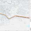
The distance between the forts of Mumrills and Rough Castle, nearly 5 miles, is twice the normal distance between the forts on the Antonine Wall, so that the existence of an intermediate station in the neighbourhood of Falkirk can be safely assumed. No remains of such a fort have survived, but chance finds of pottery, worked stones and hearths suggest that it was situated on high ground in the district known as the Pleasance, overlooking the hollow through which the now concealed West Burn once ran (1).
The hoard of nearly 2000 Roman coins which was discovered in Falkirk in 1933 (2) has no bearing on the site of the fort in question, since the find was made a quarter of a mile N. of the Antonine Wall.
RCAHMS 1963, visited 20 March 1957.
(1) The evidence is conveniently summarised in RWS, 215-6.
(2) PSAS, lxviii (1933-4), 32-40; lxxiii (1938-9), 244-5. For the piece of tartan cloth found with the hoard, see PSAS, lxxxii (1947-8), 227-30.
Excavation (1991 - 1992)
NS87NE 42 8873 7972
The first phase in the excavation of a development site in the Pleasance of Falkirk was completed in August 1991. The north-east corner of a Roman Fort was located. The fort pre-dated the Antonine Wall, but was associated with Antonine pottery. The ditch was 2.9m deep from the Roman ground level and c.5m wide. A second ditch, only 1.9 deep, led off this corner for a distance of 13m before itself turning to the S. These diches had been deliberately backfilled and a stone foundation for a timber building laid over them. At the same time new timber buildings of post-hole construction were erected beyond the eastern ditches of the original enclosure. These buildings belong to the annexe of a new Roman Fort, presumably reconstructed with the arrival of the Antonine Wall. Hearths and kilns attest the nature of this second phase. On the Roman abandonment of the site a layer of dark brown cultivation soil accumulated over the buildings.
Further work is scheduled for the end of 1991.
Sponsors: Falkirk Museum, KDL Homes , Historic Scotland, GAS
G B Bailey 1991a
By the end of February 1992, 80% of the 3/4 acre development site in the Pleasance of Falkirk had been excavated. The remainder was not accessible. Six major phases of occupation were noted :
Phase I: Pre-Roman - represented by a curving palisade trench.
Phase II: Roman - three large ditches defended the eastern side of a Roman Fort. The outer ditch was 1.8m deep and 3.0 wide; the middle ditch appeared to have dimensions similar to the middle one. Beyond these was a V-shaped gully, 50cm deep, whose fill produced evidence for wooden stakes suggesting that it was an additional defensive barrier. A butt-end terminated the outer ditch to the S and may indicate the position of a road.
Phase III: Roman - all the ditches were deliberately backfilled by the Romans and timber buldings and roads were constructed over them. A kiln and an oven belong to this period.
Phase IV: Post-Medieval - two furrows, with an average width of 4m and a separation of 2m, ran down the eastern side of the site. Their upper fills contained 17th century tobacco pipes.
Phase V: Victorian - in the 18th century a vast quantity of clay was dumped over the western margin of the site adjacent to Pleasance Lane. Then in 1850 a Victorian villa was constructed and the grounds landscaped by importing a metre of topsoil.
Phase VI: Second World War - during the war the estate was used as a detention centre. The slit trenches dug throughout the grounds disturbed all earlier deposits.
All the Roman pottery was Antonine in date.
Sponsor: Falkirk Museum
G B Bailey 1992.
Excavation (1993)
NS 8858 7969 The SW corner of the defensive ditches of the Roman fort at Falkirk were found immediately to the N of the old course of the Goat Burn. The excavated area included two ditches and the stream itself. The inner ditch measured c.6m wide on the turn and was 1.5m deep from the level of the surrounding natural. 4m down the hillslope a second ditch occurred, 4.0m wide and 1.9m deep. Its V-shaped profile had been preserved by a lining of clay, from which an amber bead was recovered. Crossing these ditches at right angles was another, flat-bottomed ditch, 1.4m deep and 1.9m wide. The location suggests that it served as a sewer drain. It was subsequently modified by inserting a clay brick wall along its western side, narrowing the channel to only 0.3m at the bottom.
When the fort was abandoned, only the inner ditch appears to have been partially backfilled using rampart material. It and the outer ditch then slowly silted up. After a considerable accumulation of soil over the outer ditch had occurred, a blacksmithing establishment was placed here. There was no pottery associated with this horizon, and it was sealed by a cultivation soil containing 13th-17th-century pottery. Presumably, therefore, the blacksmith's shop dates to around the 10th century AD. The overlying cultivation soil averaged 0.8m deep and represents the infield of the late Medieval burgh of Falkirk.
Sponsors: Historic Scotland, Falkirk Museum
G B Bailey 1993
Excavation (30 August 2004 - 31 August 2004)
Report - Excavations at 1 St. Andre's Place, Falkirk, 2004.
Excavation (March 2006)
NS 887 797 Foundation trenches for an extension to 12 Rosehall Terrace were dug in March 2006 by Falkirk Museum and the stratigraphy recorded. The trenches projected 4m N of the existing building over a 5m frontage and were 0.8m wide. The site lies within the annexe to the fort at Falkirk, just to the S of the Military Way as it emerges from the E gate. A N/S metalled road, 2.6m wide with a slight camber, lay central to the excavation trenches. Two postholes of a timber structure on the same alignment bordered it on the W. On the E side of the road there was a gulley or beam slot, butting onto which was a stone paved hearth. 0.8m S of the hearth an E/W slot may mark the back wall of a building fronting the Military Way. Roman pottery was associated with these levels.
A curving flat-bottomed gully/ditch, 1.2m wide and 0.6m deep, cut into these levels S of the latter building. It contained broken sandstone and a small deposit of quartz pebbles, as well as Roman pottery. Unfortunately its function and date are uncertain. All of these features were cut into by 18th-century cultivation beds belonging to a nursery. There was 0.8m of material overlying the Roman horizon.
Archive lodged with Falkirk Museum.
Geoff Bailey, 2006.
Excavation (August 2008)
NS 8866
The N ditch of the Roman fort at Falkirk was located in August 2008 during the hand excavation of a foundation trench for a house extension. This confirms that the fort was 2.0 acres and earlier than the rampart of the Antonine Wall.
Funder: Mr and Mrs Leslie
Geoff Bailey (Falkirk Museum), 2008
Publication Account (2008)
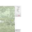
A 1:25000 scale map of the Antonine Wall was published by RCAHMS in 2008. The map shows the course of the Antonine Wall on a modern map base, including areas where the Wall is in public ownership or care and can be visited. The data had been collated as part of the project to prepare maps for the World Heritage Site nomination bid.

