
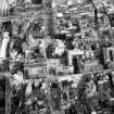
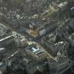
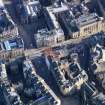
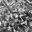
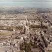
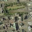
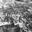
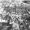
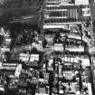
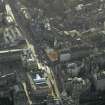
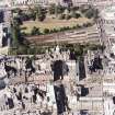
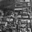
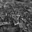
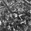
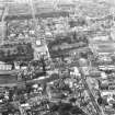
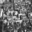
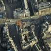
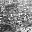
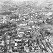
Edinburgh, 413-431 Lawnmarket, Former Sheriff Court House


Court House (20th Century)
Site Name Edinburgh, 413-431 Lawnmarket, Former Sheriff Court House
Classification Court House (20th Century)
Alternative Name(s) Bank Street; High Street; St Giles' Street; High Court Of Justiciary
Canmore ID 74115
Site Number NT27SE 482
NGR NT 25629 73632
Datum OSGB36 - NGR
Permalink http://canmore.org.uk/site/74115


- Council Edinburgh, City Of
- Parish Edinburgh (Edinburgh, City Of)
- Former Region Lothian
- Former District City Of Edinburgh
- Former County Midlothian
NT27SE 482 25629 73632
High Court of Justiciary [NAT]
OS (GIS) MasterMap, April 2010.
See also NT27SE 451.
ARCHITECT: A J Pitcher OBE (HM Officer of Works)
Alexander Carrick, sculptor of Statue of Justice
Non-Guardianship Sites Plan Collection, DC23611, 1935.
(Undated) information in NMRS.
Project (1997)
The Public Monuments and Sculpture Association (http://www.pmsa.org.uk/) set up a National Recording Project in 1997 with the aim of making a survey of public monuments and sculpture in Britain ranging from medieval monuments to the most contemporary works. Information from the Edinburgh project was added to the RCAHMS database in October 2010 and again in 2012.
The PMSA (Public Monuments and Sculpture Association) Edinburgh Sculpture Project has been supported by Eastern Photocolour, Edinburgh College of Art, the Edinburgh World Heritage Trust, Historic Scotland, the Hope Scott Trust, The Old Edinburgh Club, the Pilgrim Trust, the RCAHMS, and the Scottish Archive Network.
Field Visit (24 September 2002)
Enthroned helmeted and draped female figure of Justice, sits with her hands positioned centrally on her sword, which points downwards between her knees, and on scales which hang above her knees.
The building was designed by A. J. Pitcher, with J. Wilson Paterson as Associate Architect. Both were employed by H.M. Office of Works. The exterior walls on all frontages are faced with Darney stone.
Inspected By : D. King
Inscriptions : None Visible
Signatures : None Visible
Design period : 1934-1937
Information from Public Monuments and Sculpture Association (PMSA Work Ref : EDIN0846)
Watching Brief (10 June 2008 - 12 June 2008)
NT 2562 7363 A watching brief was undertaken, 10–12 June 2008, in the basement of the High Court during groundbreaking works associated with the creation of lift access. A 0.6m deep layer of mortar, set into natural bedrock and believed to be part of the building’s wall foundations was recorded.
Archive: RCAHMS
Funder: Morris and Spottiswood
Sarah Lynchehaun (AOC Archaeology Group), 2008

