
Following the launch of trove.scot in February 2025 we are now planning the retiral of some of our webservices. Canmore will be switched off on 24th June 2025. Information about the closure can be found on the HES website: Retiral of HES web services | Historic Environment Scotland
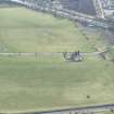
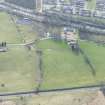
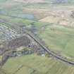
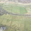
Antonine Wall, Auchendavie - Kirkintilloch


Frontier Defence (Roman)
Site Name Antonine Wall, Auchendavie - Kirkintilloch
Classification Frontier Defence (Roman)
Canmore ID 73919
Site Number NS67SE 42
NGR NS 66603 74572
NGR Description From NS 6503 7390 to NS 6765 7500
Datum OSGB36 - NGR
Permalink http://canmore.org.uk/site/73919


- Council East Dunbartonshire
- Parish Kirkintilloch (Strathkelvin)
- Former Region Strathclyde
- Former District Strathkelvin
- Former County Dunbartonshire
NS67SE 42.00 From 6503 7390 to 6765 7500
NS67SE 42.01 NS 6615 7428 Antonine Wall, 81 Hillhead Road, Kirkintilloch Trial excavation
NS67SE 42.02 NS 662 743 Antonine Wall, St Flannan's Church, Hillhead Road, Kirkintilloch Trial excavation
NS67SE 42.03 NS 653 741 Antonine Wall, Cowgate, Kirkintilloch Watching Brief
NS67SE 42.04 From NS c.660 742 to NS c.6971 7573 Antonine Wall; Military Way
NS 659 742 Construction work at 25 Hillhead Road on the presumed Wall line revealed a compact mass of cobbling, reasonably identified as part of the rubble core of the Wall base.
L J F Keppie 1975; R Goodburn 1976.
NS 675 749 The stone base of the Wall and the N lip of its ditch were located during the laying of a sewage pipe. The base was 4.3m wide and the ditch and berm together were 15.5m, suggesting that the ditch itself was well below the norm of 14.3m.
L J F Keppie 1978; R Goodburn 1979.
NS 6503 7390 to NS 6507 7400 The published course (OS 50 inch 1966) was resurveyed. Apart from the preserved and displayed portion of the Wall base at NS 6506 7398 there are no extant remains through private grounds. The revised line is based entirely on the excavation plans from NS 6506 7396.
Just S of NS 6503 7390 the line should turn sharply W in order to maintain reasonable ground and to link with the next known portion further W (see NS67SW 45.00 : NS 6424 7366 to NS 6439 7370). However it is not possible to assume or survey this turn with accuracy.
NS 6506 7396 The line of the Wall and Ditch was determined by excavation in 1953 and 1958 (Robertson 1966).
NS 6507 7400 to NS 6582 7421 E of the Peel no remains of the line have been recorded and it is not possible to speculate a large scale survey of the likeliest route.
It would seen that Macdonald's suggestion at NS 6516 7400 is negated by the evidence at NS 6507 7400 and the negative results at NS 6522 7405, NS 6525 7405, and NS 6532 7408, and that the course is likely to run E-W, under or just N of the old parish church as suggested at by Robertson (1966).
NS 6507 7400 Continuation of the Ditch (from NS 6506 7396) was located by excavations from 1953-61 (Robertson 1966).
NS 6516 7402 Peel fort (NS67SE 15) lies on the N side of the Wall. (?) (OSA 1792).
NS 6516 7400 The southern part of the Peel moat (at Peel fort NS67SE 15) represents the Ditch (Macdonald 1934).
NS 6523 7407 The Wall passed 'behind' the parish church (NSA 1845).
NS 6522 7405, NS 6525 7405, and NS 6532 7408 Search excavations E of Peel Park in 1952 and 1959 proved entirely negative, but the line must lie beneath or N of the church (Robertson 1966).
NS 6582 7421 to NS 6600 7425 The published course (OS 50 inch 1966) was resurveyed. There is no visible trace across developed area. The modified line is based on the revised OS survey of 1957 which corrected Macdonald's (1934) course, the re-examination of the partially extant on the 2nd edition of the OS 2 and a half inch (Stirlingshire 1898, sheet 33/2) and the evidence at NS 6590 7422.
W of NS 6522 7405, there is no positive or negative evidence for the course had been found, and the variable topography precludes any survey at large scale. The line is next located on NS 6644 7441 and NS 6624 7431.
NS 6590 7422 During construction work at 25 Hillhead Road in 1975, cobbling probably from the core of the Wall was exposed (Keppie 1975; Goodburn 1976).
NS 6595 7425 In 1958 the line of the Ditch was established by the then Ministry of Public Building Works, 300yds (270m) W of Cleddans (see NS 6624 7431) (Robertson 1979).
NS 6600 7425 to NS 6622 7431 The published course (OS 50 inch 1963) was resurveyed. Apart from an amorphous dip against the hedge line W of Grahamsdyke Road, there are no remains across developed land. It was noted on post-1957 surveys by OS investigators that Macdonald's (1934) line W of Cleddans ignored the extant OS survey on the 2nd edition of the OS 2 and a half inch (Stirlingshire 1898, sheet 33/2) and the local topography. The revised line is based on the re-examination of the 1898 survey and subsequent OS findings (see record sheet) in conjunction with excavation evidence further W (see NS 6595 7425).
NS 6609 7427 About 100yds W of Cleddans?the Roman engineers seemed to have turned a little to the right, so that for the next 350yds the barrier has run immediately below the crest.. (Macdonald 1934).
NS 6622 7431 to NS 6650 7445 The published course (OS 50 inch 1963) was resurveyed. There is no trace across the wasteland and partially landscaped grounds. Revised course based on the evidence of NS 6644 7441 and the survey on the 2nd edition of the OS 2 and a half inch (Stirlingshire 1898, sheet 33/2); the one almost exactly agrees with the other. The evidence at NS 6624 7431 has been respected.
NS 6624 7431 An excellent section of the Rampart Base was exposed in the stackyard of Cleddans farm in 1909 (Macdonald 1934).
In 1958 the line of the Ditch was established by the then Ministry of Public Building Works at Cleddans (Robertson 1979).
NS 6630 7434 to NS 6655 7450 Excavations in 1980 in advance of earthmoving operations determined the course of the Wall and Ditch for a length of some 300m (Keppie and Breeze 1982).
NS 6650 7445 to NS 6655 7450 The published course (OS 50 inch 1971) was resurveyed. There are no surface remains across the boggy wasteland; but a distinct vegetation mark of the Ditch crosses most of this portion. The 2nd edition of the OS 2 and a half inch (Stirlingshire 1898, sheet 33/2) shows the extant course of the Ditch and the Outer Mound, and the excavation evidence between NS 6630 7434 and NS 6655 7450 coincides almost exactly with this detail.
NS 6655 7450 to NS 6700 7482 The course of the Ditch is visible in this sector (Macdonald 1934)
The published course (OS 50 inch 1967) was resurveyed. No ground remains across scrub and wasteland, apart from a vague vegetation mark of the Ditch line just NE of NS 6655 7450. Two old trial pits, probably in search of the Wall base, are visible at NS 6661 7457 but nothing significant shows and they are not recorded.
The revised course with its repositioned alignment angles is based entirely on a re-examination of the 2nd edition of the OS 2 and a half inch (Stirlingshire 1898, sheet 33/2) survey, which shows the extant line of the Ditch and Outer Mound. No Rampart detail is discernible. The faint depression of the Ditch was visible as late as 1957 (Information from OS 1957).
NS 6700 7482 to NS 6730 7486 The published course (OS 50 inch 1970) was resurveyed. There is no known record of an extant large scale survey for this portion, the entire length being destroyed by Canal construction. The revised course could only be determined by assuming the probable continuation of the one-time extant portions either side of this sector and relating Roy's 1793 survey to the topography.
NS 6730 7486 to NS 6750 7496 The published course (OS 50 inch 1970) was resurveyed. No trace across rough grass. The 2nd edition of the OS 2 and a half inch (Stirlingshire 1898, sheet 33/2) shows a fairly extant survey of the Ditch and Outer Mound, the Ditch still being observed as a 'broad shallow depression' as late as 1957 by an OS field investigator. Revised line with the repositioned alignment angle was based on re-examination of the 1898 survey. The revised line does coincide with the published line in the area of the excavated remains at NS 6741 7492.
NS 6741 7492 The Wall base and N lip of the Ditch were located in a pipe trench in 1978. It is located on the OS published line (Goodburn 1979).
This was in farmland at Bridgend, at a point 300m W of Auchendavy Fort (NS67SE 12). The stone base was found 0.6m below the modern surface and was 4.3m wide. The N lip was located 15.5m from the N kerb of the stone base, but the S lip was not discovered. The ditch here was probably only about 9.5m, not its full width of 12m, and the berm was c.6m (Keppie and Breeze 1982).
NS 6750 7496 to NS 6765 7500 An occasional dip of the Ditch is seen in fields at Auchendavy (Macdonald 1934).
The published course (OS 50 inch 1967) was resurveyed. The only coherent remains are the spread profiles of the Ditch and Outer Mound preserved at the hedge lines between NS 6750 7496 and NS 6765 7500. Otherwise long grass and crop show nothing significant. The 2nd edition of the OS 25 inch map (Dumbartonshire 1898, sheet 33/3) has fairly extant detail of the Wall, and the revised line with its two deduced alignment angles is based on the re-examination of this survey and the ground topography.
Information from OS 1980
R Goodburn 1976, 1979; L J F Keppie and D J Breeze 1982; Keppie 1975, 1978; Macdonald 1934; NSA 1845; OSA 1792; A S Robertson 1966, 1979; W Roy 1793
NS 663 743 to NS 666 745 Excavation proved that the Wall lies slightly north of the position shown on the OS maps. The stone base had a width of 4.3m and as separated by a berm of 6m from a ditch 9m to 9.1m wide.
L J F Keppie 1980; F O Grew 1981.
NS 662 742 Excavation at selected points on the N side of Hillhead Road from 9 to 14 June 1958, was necessitated by the imminent redevelopment as a housing estate of an area which the Antonine Wall was known to traverse, but where its exact course had never been determined. The line of the Antonine Ditch was established at two points, which also corresponds to that inferred by the Ordnance Survey Officers from surface indications. The line suggested by Sir George Macdonald (1934) is now manifestly erroneous.
In trench 1, both lips of the Ditch were defined. The ditch seems to conform to the 6.15m standard recorded at Duntocher, rather than the 12.3m width hitherto regarded as the norm. A feature nowhere previously reported was the stepping of the edge of the ditch, visibly especially at the southern lip.
J Barber 1981
L J F Keppie and D J Breeze 1982.
NS 684 452 The stone base of the Wall was disturbed during the laying of field-drains, and observed in section, on the alignment shown on OS maps.
L J F Keppie and J J Walker 1982
NS 652 739 Two days of machine excavation on behalf of Strathclyde Regional Council in advance of development revealed the continuation of a Roman ditch first identified in 1797 by R Stevenson and associated with the southern defences of the Antonine Wall.
The V-sectioned ditch was 4.8, wide and 1.8m deep and was filled with humic-rich silts. A number of rough sandstone blocks were found in the basal silts on the S side of the ditch. This ditch was found to turn N across Union Street, approximately 80m W of the junction with Cowgate. This, coupled with previous information about the size of the fort suggests that its dimensions are in excess of 100m by 100m. A second, irregular but contemporaneous ditch measuring 1.25m in width and 0.35m in depth was found running parallel to the first on the S side. The centre lines of the ditches were 5.75m apart.
A third ditch of apparently Roman date was found in 1988, 30m to the S, during work on the site of 12 Regent Street. It is possible that the fort had a S annex.
During trenching operations on the site, three pits were found and excavated by hand. No datable material was recovered, but the stratigraphy suggested a medieval date.
Sponsors: SUAT, Strathclyde Regional Council.
SUAT 1990
A faint hollow passing the N side of Auchendavy Fort (NS67SE 12) is the only sign of the Antonine Ditch in this particular section, although there is also a trace of a possible causeway leading to the N gate of the fort.
During excavations in 1999 preceding the laying of a sewer about 250 metres to the NW of the fort, the Wall and Ditch were investigated.
There is little visible trace of the Wall and Ditch between Auchendavy and the centre of Kirkintilloch.
A S Robertson 2001
NS 6742 7491 In May 1999 Headland Archaeology Ltd carried out an archaeological watching brief during the construction of the Kelvin Valley Sewer. A possible Roman enclosure was discovered NW of the Antonine Wall at Auchendavy. This section of the sewer ran along the foot of the slope below Auchendavy Farm, 100m N of the Antonine Wall and adjacent to the River Kelvin. Access to this section of the sewer required the creation of two temporary roads over the line of the Antonine Wall and the opportunity was taken to confirm its precise position at these points (At NS 6742 7492 and at NS 6817 7516 (see NS67NE 21.00)) Monitoring during the stripping of the way-leave for the pipe trench identified archaeological features over a 150m section. The majority of features uncovered appeared to form part of a medieval or later field enclosure system. Three stratigraphically earlier ditches contained only Roman artefacts and their close proximity to the Antonine Wall and Roman fort (see NS67SE 12) at Auchendavy suggested that they might be contemporary with the frontier wall.
A machine-excavated trench was opened along the length of the proposed route for both access roads along the Antonine Wall; both were stripped of topsoil and hand-cleaned in order to confirm the position of the Rampart and Ditch so that they could be protected during construction of the access roads. Both the Rampart base and Ditch were revealed in Access Road 16 (At NS 6817 9516) just N of the B8023 road, confirming the assumed location of the Antonine Wall. Preservation of the Rampart base was extremely poor with only a small number of stones remaining. Only the Ditch (see NS67SE 42.00 at NS 6742 7491) was uncovered at Access Road 14 (at NS 6742 7516). It was recorded further S than expected and this indicates that the Wall curves to the SW.
M Hastie 2002
A Dunwell, G Bailey, A Leslie, A Smith 2002.
The excavation of two trenches within a housebuilding plot was undertaken by GUARD in June 1994. The work was carried out where the proposed building work overlay the line of the Antonine Wall. The trenches revealed sections of the wall base, berm and ditch of the wall. A full report has been lodged with the NMRS.
Sponsors: Historic Scotland, Mr & Mrs Docherty and Strathclyde Regional Council.
J A Atkinson 1994; NMRS MS/725/78.
Excavation in advance of house-building indicated that stonework forming the Wall base had been almost totally removed, but pinpointed the S lip of the accompanying ditch at two points.
L J F Keppie 1995.
At NS 6624 7429 and NS 6628 74733 Two trenches were opened by GUARD in June 1994, a little to the W of St. Flannan's Church, ahead of construction of a house, where the development impinged upon the line of the Antonine Wall. Both trenches successfully located three principal Antonine Wall elements: Rampart base, Berm and Ditch. The brief for the work specifically excluded full excavation of the Ditch and neither trench extended far enough S to encompass the full width of the Rampart base. The Berm was measured in Trench 1 at c7.5m to 8m wide and in Trench 2 at 6.5m to 7m wide. Sections revealed that the Ditch had a step-cut profile, in common with evidence obtained elsewhere (Keppie and Breeze 1981).
The effects of many years of ploughing appear to have removed most traces of the Rampart and its base, including kerb-stones. The dimensions of the Berm and the characteristics if the Ditch, insofar as the latter was examined, were broadly consistent with the testimony of other excavators.
J A Atkinson 2002
A Dunwell, G Bailey, A Leslie, A Smith 2002; L J F Keppie and D J Breeze 1981.
Three trenches were excavated by GUARD in December 1994 in advance of proposed development. Sections of the Antonine Wall base were revealed.
NMRS MS/725/83.
NS 662 743 Archaeological assessment in advance of proposed development in the grounds of the church, resulted in five trenches being opened by GUARD. Three of these straddled the wall line, the other two being positioned immediately to the S of the wall to test for the existence of any fortlet at this point (Fig 33, p91).
Trenches A, D and E: No surviving archaeological features were recorded.
Trench B: A sparse spread of stones, much disturbed, signified the ephemeral remains of the wall base.
Trench C: A well-preserved stretch of the wall was exposed, surviving to a height of 0.55m. Individual turves were recorded in plan and section, overlying the undisturbed cobble base and kerbing. The berm and part of the ditch were also exposed, although these two elements were disturbed in places by the later farm buildings on the site.
The excellent preservation of the wall in trench C only is due to the sealing of this area by the cobbled yard of Cleddans Farm.
Sponsor: Angle Property and Construction Co.
K Speller 1995.
NS 6625 7432 and NS 6628 7433 Excavations were conducted W of the church (at NS 662 742) in 1958 by James Barber (Keppie and Breeze 1981), when the Ditch was found to be only 6.15m wide with a stepped cut, and no trace was found of the Rampart base. In 1980, Lawrence Keppie recorded rather different dimensions some 300m to the E of the church (NS 6630 7434- NS 6655 7450), where the average width of the ditch was found to be 9.2m lip to lip. (Keppie and Breeze 1981), although here again almost all traces of the Rampart base had been ploughed away. The suggestion had been made that this discrepancy in dimensions may have arisen from this area being a point on the Rampart's line where two work parties met (Hanson and Maxwell 1986).
In December 1994 and February 1995, five trenches were opened by GUARD around St. Flannan's Church, three along the line of the Wall and two behind it. The work was conducted in advance of a proposed housing development.
The ephemeral remains of the base of the Rampart were represented by a sparse spread of rounded stones lying on and slightly within the natural subsoil were found in Trench B.
Trench C revealed the relatively well persevered remains of the Antonine Wall. The Rampart base of rounded and angular stones was clearly defined to the N and S by a kerb line of large, rectangular limestone blocks, giving a base width of 4.3m to 4.4m. Above the basal stones, successive layers of turf were recorded, many of which still displayed their original subrectangular block shapes, the whole standing to a maximum height of 0.55m. The old Roman ground surface may be identified as a highly leached layer and presumably formed the Berm. Although only patches survived, the full width of the Berm (from the kerb stones marking the front of the Wall to the southern lip of the ditch) appears to have been around 7m. At the northern limit of the Berm the S lip of the Ditch was encountered. Full dimensions of the Ditch were unable to be established due to unforeseen events. The Rampart base, as established in Trench C, falls within, but at the narrow end of, the range of previously recorded dimensions (Hanson and Maxwell 1986), although its width is consistent with dimensions previously recorded in the Kirkintilloch area (Keppie 1974).
K Speller and A Leslie 2002
A Dunwell, G Bailey, A Leslie, A Smith 2002; W S Hanson and G S Maxwell 1986; L J F Keppie 1974; L J F Keppie and D J Breeze 1981.
NS67SE 42.01 6615 7428.
The excavation of two trenches within a housebuilding plot was undertaken by GUARD in June 1994. The work was carried out where the proposed building work overlay the line of the Antonine Wall. The trenches revealed sections of the wall base, berm and ditch of the wall. A full report has been lodged with the NMRS.
Sponsors: Historic Scotland, Mr & Mrs Docherty and Strathclyde Regional Council.
J A Atkinson 1994; NMRS MS/725/78.
Excavation in advance of house-building indicated that stonework forming the Wall base had been almost totally removed, but pinpointed the S lip of the accompanying ditch at two points.
L J F Keppie 1995.
At NS 6624 7429 and NS 6628 74733 Two trenches were opened by GUARD in June 1994, a little to the W of St. Flannan's Church, ahead of construction of a house, where the development impinged upon the line of the Antonine Wall. Both trenches successfully located three principal Antonine Wall elements: Rampart base, Berm and Ditch. The brief for the work specifically excluded full excavation of the Ditch and neither trench extended far enough S to encompass the full width of the Rampart base. The Berm was measured in Trench 1 at c7.5m to 8m wide and in Trench 2 at 6.5m to 7m wide. Sections revealed that the Ditch had a step-cut profile, in common with evidence obtained elsewhere (Keppie and Breeze 1981).
The effects of many years of ploughing appear to have removed most traces of the Rampart and its base, including kerb-stones. The dimensions of the Berm and the characteristics if the Ditch, insofar as the latter was examined, were broadly consistent with the testimony of other excavators.
J A Atkinson 2002
NS67SE 42.02 662 743.
Three trenches were excavated by GUARD in December 1994 in advance of proposed development. Sections of the Antonine Wall base were revealed.
NMRS MS/725/83. NS 662 743 Archaeological assessment in advance of proposed development in the grounds of the church, resulted in five trenches being opened by GUARD. Three of these straddled the wall line, the other two being positioned immediately to the S of the wall to test for the existence of any fortlet at this point (Fig 33, p91).
Trenches A, D and E: No surviving archaeological features were recorded.
Trench B: A sparse spread of stones, much disturbed, signified the ephemeral remains of the wall base.
Trench C: A well-preserved stretch of the wall was exposed, surviving to a height of 0.55m. Individual turves were recorded in plan and section, overlying the undisturbed cobble base and kerbing. The berm and part of the ditch were also exposed, although these two elements were disturbed in places by the later farm buildings on the site.
The excellent preservation of the wall in trench C only is due to the sealing of this area by the cobbled yard of Cleddans Farm.
Sponsor: Angle Property and Construction Co.
K Speller 1995.
NS 6625 7432 and NS 6628 7433 Excavations were conducted W of the church (at NS 662 742) in 1958 by James Barber (Keppie and Breeze 1981), when the Ditch was found to be only 6.15m wide with a stepped cut, and no trace was found of the Rampart base. In 1980, Lawrence Keppie recorded rather different dimensions some 300m to the E of the church (NS 6630 7434- NS 6655 7450), where the average width of the ditch was found to be 9.2m lip to lip. (Keppie and Breeze 1981), although here again almost all traces of the Rampart base had been ploughed away. The suggestion had been made that this discrepancy in dimensions may have arisen from this area being a point on the Rampart's line where two work parties met (Hanson and Maxwell 1986).
In December 1994 and February 1995, five trenches were opened by GUARD around St. Flannan's Church, three along the line of the Wall and two behind it. The work was conducted in advance of a proposed housing development.
The ephemeral remains of the base of the Rampart were represented by a sparse spread of rounded stones lying on and slightly within the natural subsoil were found in Trench B.
Trench C revealed the relatively well persevered remains of the Antonine Wall. The Rampart base of rounded and angular stones was clearly defined to the N and S by a kerb line of large, rectangular limestone blocks, giving a base width of 4.3m to 4.4m. Above the basal stones, successive layers of turf were recorded, many of which still displayed their original subrectangular block shapes, the whole standing to a maximum height of 0.55m. The old Roman ground surface may be identified as a highly leached layer and presumably formed the Berm. Although only patches survived, the full width of the Berm (from the kerb stones marking the front of the Wall to the southern lip of the ditch) appears to have been around 7m. At the northern limit of the Berm the S lip of the Ditch was encountered. Full dimensions of the Ditch were unable to be established due to unforeseen events. The Rampart base, as established in Trench C, falls within, but at the narrow end of, the range of previously recorded dimensions (Hanson and Maxwell 1986), although its width is consistent with dimensions previously recorded in the Kirkintilloch area (Keppie 1974).
K Speller and A Leslie 2002
A Dunwell, G Bailey, A Leslie, A Smith 2002; W S Hanson and G S Maxwell 1986; L J F Keppie 1974; L J F Keppie and D J Breeze 1981.
NS67SE 42.03 653 741
NS 653 742 The presumed line of the Roman frontier has been crossed by the NS Kirkintilloch Relief Road, c100m E of the Cowgate. The only feature observed, on the W side of the cut, was a triangular feature, perhaps the truncated remnant of a ditch, 1.7m wide and 0.7m deep. This was in line with the project alignment of the Antonine Ditch hereabouts; but there was no means of dating the feature observed in 1989.
Sponsor: Scottish Development Department HBM.
L J F Keppie 1989
A watching brief was carried out during construction work across the presumed line of the Antonine Wall, in 1988. A shallow V-shaped feature, 1,7m wide and 0.7m deep, was visible in section, 50m S of the High Street. Neither its date nor purpose could be determined.
L J F Keppie et al 1995
Antiquarian Observation (1792)
NS 6516 7402 Peel fort (NS67SE 15) lies on the N side of the Wall. (?) (OSA 1792).
Antiquarian Observation (1845)
NS 6523 7407 The Wall passed 'behind' the parish church (NSA 1845).
Salvage Record (1909)
NS 6624 7431 An excellent section of the Rampart Base was exposed in the stackyard of Cleddans farm in 1909 (Macdonald 1934).
Field Visit (1934)
NS 6516 7400 The southern part of the Peel moat (at Peel fort NS67SE 15) represents the Ditch (Macdonald 1934).
Field Visit (1934)
NS 6750 7496 to NS 6765 7500 An occasional dip of the Ditch is seen in fields at Auchendavy (Macdonald 1934).
Field Visit (1934)
NS 6655 7450 to NS 6700 7482 The course of the Ditch is visible in this sector (Macdonald 1934)
Field Visit (1934)
NS 6609 7427 About 100yds W of Cleddans?the Roman engineers seemed to have turned a little to the right, so that for the next 350yds the barrier has run immediately below the crest.. (Macdonald 1934).
Excavation (1952 - 1959)
NS 6522 7405, NS 6525 7405, and NS 6532 7408 Search excavations E of Peel Park in 1952 and 1959 proved entirely negative, but the line must lie beneath or N of the church (Robertson 1966).
Excavation (1953 - 1961)
In the years between 1953 and 1961 trenches cut under the auspices of the Hunterian Museum revealed the stone base of the Antonine Wall and the Antonine Ditch, while inside the park there were found to the S of the Antonine Wall remains of streets, gutters and several rows of postholes, belonging to narrow wooden buildings, besides a great quantity of Antonine Pottery. These remains indicate the presence of a fort, or a fort-annexe, and their disturbed condition at the same time suggests that much of the fort has been destroyed by the construction of the medieval peel and its associated structures, and by the laying out and terracing of the Park in more recent times.
A S Robertson 1973
Excavation (1953 - 1961)
NS 6507 7400 Continuation of the Ditch (from NS 6506 7396) was located by excavations from 1953-61 (Robertson 1966).
Excavation (1953)
NS 6506 7396 The line of the Wall and Ditch was determined by excavation in 1953 and 1958 (Robertson 1966).
Aerial Photography (31 July 1957)
Field Visit (1957)
NS 6655 7450 to NS 6700 7482 The faint depression of the Ditch was visible as late as 1957 (Information from OS 1957).
Excavation (9 June 1958 - 14 June 1958)
NS 662 742 Excavation at selected points on the N side of Hillhead Road from 9 to 14 June 1958, was necessitated by the imminent redevelopment as a housing estate of an area which the Antonine Wall was known to traverse, but where its exact course had never been determined. The line of the Antonine Ditch was established at two points, which also corresponds to that inferred by the Ordnance Survey Officers from surface indications. The line suggested by Sir George Macdonald (1934) is now manifestly erroneous.
In trench 1, both lips of the Ditch were defined. The ditch seems to conform to the 6.15m standard recorded at Duntocher, rather than the 12.3m width hitherto regarded as the norm. A feature nowhere previously reported was the stepping of the edge of the ditch, visibly especially at the southern lip.
J Barber 1981
L J F Keppie and D J Breeze 1982.
Excavation (1958)
NS 6595 7425 In 1958 the line of the Ditch was established by the then Ministry of Public Building Works, 300yds (270m) W of Cleddans (see NS 6624 7431) (Robertson 1979).
Excavation (1958)
NS 6624 7431 In 1958 the line of the Ditch was established by the then Ministry of Public Building Works at Cleddans (Robertson 1979).
Excavation (1958)
NS 6506 7396 The line of the Wall and Ditch was determined by excavation in 1953 and 1958 (Robertson 1966).
Excavation (1959)
NS 6522 7405, NS 6525 7405, and NS 6532 7408 Search excavations E of Peel Park in 1952 and 1959 proved entirely negative, but the line must lie beneath or N of the church (Robertson 1966).
Salvage Record (1975)
During the cutting of foundation trenches for a housing development at 50 Union Street (NS 6509 7390), to the SW of the Peel Park, the lip of a ditch was observed in section, and dark silty soil like ditch-fill was noted at several points, sufficient to suggest a roughly NW-SE alignment. Green-glazed ware was recovered from above the silt. If of Roman rather than medieval date, the ditch could mark the W limit of Kirkintilloch fort or of an annexe.
L J F Keppie 1975.
Salvage Record (1975)
NS 6590 7422 During construction work at 25 Hillhead Road in 1975, cobbling probably from the core of the Wall was exposed (Keppie 1975; Goodburn 1976).
Salvage Record (1975)
NS 659 742 Construction work at 25 Hillhead Road on the presumed Wall line revealed a compact mass of cobbling, reasonably identified as part of the rubble core of the Wall base.
L J F Keppie 1975; R Goodburn 1976.
Aerial Photography (21 July 1977)
Excavation (1978 - 1979)
Excavations in the car park to the S of Peel Park during 1978-9 exposed parts of two ditches which met at right angles and presumably formed the corner of an enclosure. They measured approximately 3.0 m wide, 1.5 m deep, and had a V-shaped profile. They were partly cut into deposits containing Antonine pottery and they contained plentiful deposits of similar pottery as well as Roman leather sandals, a pilum head and worked sandstone blocks.
It is not clear what the ditches enclosed but it is unlikely that they belonged to a fort or annexe; however, perhaps they were part of a civil settlement.
R D Stevenson 1980.
Salvage Record (1978)
NS 6741 7492 The Wall base and N lip of the Ditch were located in a pipe trench in 1978. It is located on the OS published line (Goodburn 1979).
This was in farmland at Bridgend, at a point 300m W of Auchendavy Fort (NS67SE 12). The stone base was found 0.6m below the modern surface and was 4.3m wide. The N lip was located 15.5m from the N kerb of the stone base, but the S lip was not discovered. The ditch here was probably only about 9.5m, not its full width of 12m, and the berm was c.6m (Keppie and Breeze 1982).
Salvage Record (1978)
NS 675 749 The stone base of the Wall and the N lip of its ditch were located during the laying of a sewage pipe. The base was 4.3m wide and the ditch and berm together were 15.5m, suggesting that the ditch itself was well below the norm of 14.3m.
L J F Keppie 1978; R Goodburn 1979.
Excavation (June 1980)
NS 6630 7434 to NS 6655 7450 Excavations in 1980 in advance of earthmoving operations determined the course of the Wall and Ditch for a length of some 300m (Keppie and Breeze 1982).
NS 663 743 to NS 666 745 Excavation proved that the Wall lies slightly north of the position shown on the OS maps. The stone base had a width of 4.3m and as separated by a berm of 6m from a ditch 9m to 9.1m wide.
L J F Keppie 1980; F O Grew 1981.
Field Visit (1980)
NS 6582 7421 to NS 6600 7425 The published course (OS 50 inch 1966) was resurveyed. There is no visible trace across developed area. The modified line is based on the revised OS survey of 1957 which corrected Macdonald's (1934) course, the re-examination of the partially extant on the 2nd edition of the OS 2 and a half inch (Stirlingshire 1898, sheet 33/2) and the evidence at NS 6590 7422.
Information from OS 1980
Field Visit (1980)
NS 6750 7496 to NS 6765 7500 The published course (OS 50 inch 1967) was resurveyed. The only coherent remains are the spread profiles of the Ditch and Outer Mound preserved at the hedge lines between NS 6750 7496 and NS 6765 7500. Otherwise long grass and crop show nothing significant. The 2nd edition of the OS 25 inch map (Dumbartonshire 1898, sheet 33/3) has fairly extant detail of the Wall, and the revised line with its two deduced alignment angles is based on the re-examination of this survey and the ground topography.
Information from OS 1980
Field Visit (1980)
NS 6730 7486 to NS 6750 7496 The published course (OS 50 inch 1970) was resurveyed. No trace across rough grass. The 2nd edition of the OS 2 and a half inch (Stirlingshire 1898, sheet 33/2) shows a fairly extant survey of the Ditch and Outer Mound, the Ditch still being observed as a 'broad shallow depression' as late as 1957 by an OS field investigator. Revised line with the repositioned alignment angle was based on re-examination of the 1898 survey. The revised line does coincide with the published line in the area of the excavated remains at NS 6741 7492.
Information from OS 1980
Field Visit (1980)
NS 6700 7482 to NS 6730 7486 The published course (OS 50 inch 1970) was resurveyed. There is no known record of an extant large scale survey for this portion, the entire length being destroyed by Canal construction. The revised course could only be determined by assuming the probable continuation of the one-time extant portions either side of this sector and relating Roy's 1793 survey to the topography.
Information from OS 1980
Field Visit (1980)
NS 6655 7450 to NS 6700 7482 The revised course with its repositioned alignment angles is based entirely on a re-examination of the 2nd edition of the OS 2 and a half inch (Stirlingshire 1898, sheet 33/2) survey, which shows the extant line of the Ditch and Outer Mound. No Rampart detail is discernible. The faint depression of the Ditch was visible as late as 1957 (Information from OS 1957).
Information from OS 1980
Field Visit (1980)
NS 6655 7450 to NS 6700 7482 The published course (OS 50 inch 1967) was resurveyed. No ground remains across scrub and wasteland, apart from a vague vegetation mark of the Ditch line just NE of NS 6655 7450. Two old trial pits, probably in search of the Wall base, are visible at NS 6661 7457 but nothing significant shows and they are not recorded.
Information from OS 1980
Field Visit (1980)
NS 6650 7445 to NS 6655 7450 The published course (OS 50 inch 1971) was resurveyed. There are no surface remains across the boggy wasteland; but a distinct vegetation mark of the Ditch crosses most of this portion. The 2nd edition of the OS 2 and a half inch (Stirlingshire 1898, sheet 33/2) shows the extant course of the Ditch and the Outer Mound, and the excavation evidence between NS 6630 7434 and NS 6655 7450 coincides almost exactly with this detail.
Information from OS 1980
Field Visit (1980)
It would seen that Macdonald's suggestion at NS 6516 7400 is negated by the evidence at NS 6507 7400 and the negative results at NS 6522 7405, NS 6525 7405, and NS 6532 7408, and that the course is likely to run E-W, under or just N of the old parish church as suggested at by Robertson (1966).
Information from OS 1980
Field Visit (1980)
NS 6507 7400 to NS 6582 7421 E of the Peel no remains of the line have been recorded and it is not possible to speculate a large scale survey of the likeliest route.
Information from OS 1980
Field Visit (1980)
Just S of NS 6503 7390 the line should turn sharply W in order to maintain reasonable ground and to link with the next known portion further W (see NS67SW 45.00 : NS 6424 7366 to NS 6439 7370). However it is not possible to assume or survey this turn with accuracy.
Information from OS 1980
Field Visit (1980)
NS 6503 7390 to NS 6507 7400 The published course (OS 50 inch 1966) was resurveyed. Apart from the preserved and displayed portion of the Wall base at NS 6506 7398 there are no extant remains through private grounds. The revised line is based entirely on the excavation plans from NS 6506 7396.
Information from OS 1980
Field Visit (1980)
NS 6600 7425 to NS 6622 7431 The published course (OS 50 inch 1963) was resurveyed. Apart from an amorphous dip against the hedge line W of Grahamsdyke Road, there are no remains across developed land. It was noted on post-1957 surveys by OS investigators that Macdonald's (1934) line W of Cleddans ignored the extant OS survey on the 2nd edition of the OS 2 and a half inch (Stirlingshire 1898, sheet 33/2) and the local topography. The revised line is based on the re-examination of the 1898 survey and subsequent OS findings (see record sheet) in conjunction with excavation evidence further W (see NS 6595 7425).
Information from OS 1980
Field Visit (1980)
W of NS 6522 7405, there is no positive or negative evidence for the course had been found, and the variable topography precludes any survey at large scale. The line is next located on NS 6644 7441 and NS 6624 7431.
Information from OS 1980
Salvage Record (1982)
NS 684 452 The stone base of the Wall was disturbed during the laying of field-drains, and observed in section, on the alignment shown on OS maps.
L J F Keppie and J J Walker 1982
Watching Brief (1 December 1988)
A watching brief was carried out during construction work across the presumed line of the Antonine Wall, in 1988. A shallow V-shaped feature, 1,7m wide and 0.7m deep, was visible in section, 50m S of the High Street. Neither its date nor purpose could be determined.
L J F Keppie et al 1995
Excavation (1988)
Excavations by SUAT in 1988 on the site of 12 Regent Street (NS 652 739), E of the site of the 1978-9 trenches, uncovered a Roman ditch running parallel to the alignment of that uncovered in 1978-9, but seperated from it by 30m. Trenches were extended 20m towards Union Street but no other Roman features were encountered.
L J F Keppie et al 1995
Watching Brief (1989)
NS67SE 42.03 653 741
NS 653 742 The presumed line of the Roman frontier has been crossed by the NS Kirkintilloch Relief Road, c100m E of the Cowgate. The only feature observed, on the W side of the cut, was a triangular feature, perhaps the truncated remnant of a ditch, 1.7m wide and 0.7m deep. This was in line with the project alignment of the Antonine Ditch hereabouts; but there was no means of dating the feature observed in 1989.
Sponsor: Scottish Development Department HBM.
L J F Keppie 1989
Watching Brief (1990)
NS 652 739 Two days of machine excavation on behalf of Strathclyde Regional Council in advance of development revealed the continuation of a Roman ditch first identified in 1797 by R Stevenson and associated with the southern defences of the Antonine Wall.
The V-sectioned ditch was 4.8, wide and 1.8m deep and was filled with humic-rich silts. A number of rough sandstone blocks were found in the basal silts on the S side of the ditch. This ditch was found to turn N across Union Street, approximately 80m W of the junction with Cowgate. This, coupled with previous information about the size of the fort suggests that its dimensions are in excess of 100m by 100m. A second, irregular but contemporaneous ditch measuring 1.25m in width and 0.35m in depth was found running parallel to the first on the S side. The centre lines of the ditches were 5.75m apart.
A third ditch of apparently Roman date was found in 1988, 30m to the S, during work on the site of 12 Regent Street. It is possible that the fort had a S annex.
During trenching operations on the site, three pits were found and excavated by hand. No datable material was recovered, but the stratigraphy suggested a medieval date.
Sponsors: SUAT, Strathclyde Regional Council.
SUAT 1990
Excavation (December 1994 - February 1995)
NMRS MS/725/83. NS 662 743 Archaeological assessment in advance of proposed development in the grounds of the church, resulted in five trenches being opened by GUARD. Three of these straddled the wall line, the other two being positioned immediately to the S of the wall to test for the existence of any fortlet at this point (Fig 33, p91).
Trenches A, D and E: No surviving archaeological features were recorded.
Trench B: A sparse spread of stones, much disturbed, signified the ephemeral remains of the wall base.
Trench C: A well-preserved stretch of the wall was exposed, surviving to a height of 0.55m. Individual turves were recorded in plan and section, overlying the undisturbed cobble base and kerbing. The berm and part of the ditch were also exposed, although these two elements were disturbed in places by the later farm buildings on the site.
The excellent preservation of the wall in trench C only is due to the sealing of this area by the cobbled yard of Cleddans Farm.
Sponsor: Angle Property and Construction Co.
K Speller 1995.
Excavation (1 June 1994 - 30 June 1994)
The excavation of two trenches within a housebuilding plot was undertaken by GUARD in June 1994. The work was carried out where the proposed building work overlay the line of the Antonine Wall. The trenches revealed sections of the wall base, berm and ditch of the wall. A full report has been lodged with the NMRS.
Sponsors: Historic Scotland, Mr & Mrs Docherty and Strathclyde Regional Council.
J A Atkinson 1994; NMRS MS/725/78.
Three trenches were excavated by GUARD in December 1994 in advance of proposed development. Sections of the Antonine Wall base were revealed.
Publication Account (1 June 1995)
Excavation in advance of house-building indicated that stonework forming the Wall base had been almost totally removed, but pinpointed the S lip of the accompanying ditch at two points.
L J F Keppie 1995.
NS67SE 42.01 6615 7428.
Field Visit (1998)
NS67SE 53 centred 655 743
NS 655 743; NS 603 735 (NS67SW 60); NS 619 737 (NS67SW 61); NS 630 774 (NS67 NW 33) (centres) A walkover survey was conducted prior to the implementation of a flood prevention scheme. The areas encompassed lands around the River Kelvin, the Luggie Water, the Glazert Water, the Park Burn and the Tower Burn. Much of the land appears always to have been marshy and prone to flooding, and for this reason little settlement archaeology was observed, the only example being a rectangular structure base and midden on slightly higher ground at Balmore (NS 603 735). A substantial boundary bank and ditch was observed to the NE of Hayston (NS 646 741). The course of the Antonine Wall runs through the area in Kirkintilloch (NS 655 745) but no remains are visible on the ground.
Many of the features observed were water management features. There is evidence that the course of the River Kelvin has been straightened (NS 665 749), possibly in the late 18th century. A lade was observed on the Glazert Water in Lennoxtown, and a further possible example on the Luggie Water in Kirkintilloch, just N of the aqueduct. Well-established embankments exist at many points on the banks of the watercourses, as a flood prevention measure, most notably on the banks of the Park Burn (NS 641 737).
Sponsor: Halcrow Crouch.
N Battley 1998
Watching Brief (May 1999)
NS 6742 7491 In May 1999 Headland Archaeology Ltd carried out an archaeological watching brief during the construction of the Kelvin Valley Sewer. A possible Roman enclosure was discovered NW of the Antonine Wall at Auchendavy. This section of the sewer ran along the foot of the slope below Auchendavy Farm, 100m N of the Antonine Wall and adjacent to the River Kelvin. Access to this section of the sewer required the creation of two temporary roads over the line of the Antonine Wall and the opportunity was taken to confirm its precise position at these points (At NS 6742 7492 and at NS 6817 7516 (see NS67NE 21.00)) Monitoring during the stripping of the way-leave for the pipe trench identified archaeological features over a 150m section. The majority of features uncovered appeared to form part of a medieval or later field enclosure system. Three stratigraphically earlier ditches contained only Roman artefacts and their close proximity to the Antonine Wall and Roman fort (see NS67SE 12) at Auchendavy suggested that they might be contemporary with the frontier wall.
A machine-excavated trench was opened along the length of the proposed route for both access roads along the Antonine Wall; both were stripped of topsoil and hand-cleaned in order to confirm the position of the Rampart and Ditch so that they could be protected during construction of the access roads. Both the Rampart base and Ditch were revealed in Access Road 16 (At NS 6817 9516) just N of the B8023 road, confirming the assumed location of the Antonine Wall. Preservation of the Rampart base was extremely poor with only a small number of stones remaining. Only the Ditch (see NS67SE 42.00 at NS 6742 7491) was uncovered at Access Road 14 (at NS 6742 7516). It was recorded further S than expected and this indicates that the Wall curves to the SW.
M Hastie 2002
A Dunwell, G Bailey, A Leslie, A Smith 2002.
During excavations in 1999 preceding the laying of a sewer about 250 metres to the NW of the fort, the Wall and Ditch were investigated. A S Robertson 2001
Field Visit (2001)
A faint hollow passing the N side of Auchendavy Fort (NS67SE 12) is the only sign of the Antonine Ditch in this particular section, although there is also a trace of a possible causeway leading to the N gate of the fort. A S Robertson 2001
Field Visit (2001)
There is little visible trace of the Wall and Ditch between Auchendavy and the centre of Kirkintilloch.
A S Robertson 2001
Publication Account (2002)
At NS 6624 7429 and NS 6628 74733 Two trenches were opened by GUARD in June 1994, a little to the W of St. Flannan's Church, ahead of construction of a house, where the development impinged upon the line of the Antonine Wall. Both trenches successfully located three principal Antonine Wall elements: Rampart base, Berm and Ditch. The brief for the work specifically excluded full excavation of the Ditch and neither trench extended far enough S to encompass the full width of the Rampart base. The Berm was measured in Trench 1 at c7.5m to 8m wide and in Trench 2 at 6.5m to 7m wide. Sections revealed that the Ditch had a step-cut profile, in common with evidence obtained elsewhere (Keppie and Breeze 1981).
The effects of many years of ploughing appear to have removed most traces of the Rampart and its base, including kerb-stones. The dimensions of the Berm and the characteristics if the Ditch, insofar as the latter was examined, were broadly consistent with the testimony of other excavators.
J A Atkinson 2002
A Dunwell, G Bailey, A Leslie, A Smith 2002; L J F Keppie and D J Breeze 1981.
Publication Account (2002)
Three trenches were excavated by GUARD in December 1994 in advance of proposed development. Sections of the Antonine Wall base were revealed.
NMRS MS/725/83.
NS 6625 7432 and NS 6628 7433 Excavations were conducted W of the church (at NS 662 742) in 1958 by James Barber (Keppie and Breeze 1981), when the Ditch was found to be only 6.15m wide with a stepped cut, and no trace was found of the Rampart base. In 1980, Lawrence Keppie recorded rather different dimensions some 300m to the E of the church (NS 6630 7434- NS 6655 7450), where the average width of the ditch was found to be 9.2m lip to lip. (Keppie and Breeze 1981), although here again almost all traces of the Rampart base had been ploughed away. The suggestion had been made that this discrepancy in dimensions may have arisen from this area being a point on the Rampart's line where two work parties met (Hanson and Maxwell 1986).
In December 1994 and February 1995, five trenches were opened by GUARD around St. Flannan's Church, three along the line of the Wall and two behind it. The work was conducted in advance of a proposed housing development.
The ephemeral remains of the base of the Rampart were represented by a sparse spread of rounded stones lying on and slightly within the natural subsoil were found in Trench B.
Trench C revealed the relatively well persevered remains of the Antonine Wall. The Rampart base of rounded and angular stones was clearly defined to the N and S by a kerb line of large, rectangular limestone blocks, giving a base width of 4.3m to 4.4m. Above the basal stones, successive layers of turf were recorded, many of which still displayed their original subrectangular block shapes, the whole standing to a maximum height of 0.55m. The old Roman ground surface may be identified as a highly leached layer and presumably formed the Berm. Although only patches survived, the full width of the Berm (from the kerb stones marking the front of the Wall to the southern lip of the ditch) appears to have been around 7m. At the northern limit of the Berm the S lip of the Ditch was encountered. Full dimensions of the Ditch were unable to be established due to unforeseen events. The Rampart base, as established in Trench C, falls within, but at the narrow end of, the range of previously recorded dimensions (Hanson and Maxwell 1986), although its width is consistent with dimensions previously recorded in the Kirkintilloch area (Keppie 1974).
K Speller and A Leslie 2002
A Dunwell, G Bailey, A Leslie, A Smith 2002; W S Hanson and G S Maxwell 1986; L J F Keppie 1974; L J F Keppie and D J Breeze 1981.
Excavation (2002)
Three trenches were excavated by GUARD in December 1994 in advance of proposed development. Sections of the Antonine Wall base were revealed.
NMRS MS/725/83.
NS 6625 7432 and NS 6628 7433 Excavations were conducted W of the church (at NS 662 742) in 1958 by James Barber (Keppie and Breeze 1981), when the Ditch was found to be only 6.15m wide with a stepped cut, and no trace was found of the Rampart base. In 1980, Lawrence Keppie recorded rather different dimensions some 300m to the E of the church (NS 6630 7434- NS 6655 7450), where the average width of the ditch was found to be 9.2m lip to lip. (Keppie and Breeze 1981), although here again almost all traces of the Rampart base had been ploughed away. The suggestion had been made that this discrepancy in dimensions may have arisen from this area being a point on the Rampart's line where two work parties met (Hanson and Maxwell 1986).
In December 1994 and February 1995, five trenches were opened by GUARD around St. Flannan's Church, three along the line of the Wall and two behind it. The work was conducted in advance of a proposed housing development.
The ephemeral remains of the base of the Rampart were represented by a sparse spread of rounded stones lying on and slightly within the natural subsoil were found in Trench B.
Trench C revealed the relatively well persevered remains of the Antonine Wall. The Rampart base of rounded and angular stones was clearly defined to the N and S by a kerb line of large, rectangular limestone blocks, giving a base width of 4.3m to 4.4m. Above the basal stones, successive layers of turf were recorded, many of which still displayed their original subrectangular block shapes, the whole standing to a maximum height of 0.55m. The old Roman ground surface may be identified as a highly leached layer and presumably formed the Berm. Although only patches survived, the full width of the Berm (from the kerb stones marking the front of the Wall to the southern lip of the ditch) appears to have been around 7m. At the northern limit of the Berm the S lip of the Ditch was encountered. Full dimensions of the Ditch were unable to be established due to unforeseen events. The Rampart base, as established in Trench C, falls within, but at the narrow end of, the range of previously recorded dimensions (Hanson and Maxwell 1986), although its width is consistent with dimensions previously recorded in the Kirkintilloch area (Keppie 1974).
K Speller and A Leslie 2002
A Dunwell, G Bailey, A Leslie, A Smith 2002; W S Hanson and G S Maxwell 1986; L J F Keppie 1974; L J F Keppie and D J Breeze 1981.
NMRS MS/725/83. NS 662 743 Archaeological assessment in advance of proposed development in the grounds of the church, resulted in five trenches being opened by GUARD. Three of these straddled the wall line, the other two being positioned immediately to the S of the wall to test for the existence of any fortlet at this point (Fig 33, p91).
Trenches A, D and E: No surviving archaeological features were recorded.
Trench B: A sparse spread of stones, much disturbed, signified the ephemeral remains of the wall base.
Trench C: A well-preserved stretch of the wall was exposed, surviving to a height of 0.55m. Individual turves were recorded in plan and section, overlying the undisturbed cobble base and kerbing. The berm and part of the ditch were also exposed, although these two elements were disturbed in places by the later farm buildings on the site.
The excellent preservation of the wall in trench C only is due to the sealing of this area by the cobbled yard of Cleddans Farm.
Sponsor: Angle Property and Construction Co.
K Speller 1995.
Earth Resistance Survey (16 February 2006 - 24 February 2006)
NS 6513 7396 GUARD conducted a geophysical survey on behalf of Historic Scotland in Peel Park, Kirkintilloch, in February 2006 to try to determine the precise character of the Roman remains known to be present there and, more generally, to assess the condition of any other archaeological remains within the scheduled area. Although the survey was unable definitively to determine the character of the Roman remains, it did produce some intriguing anomalies. The survey also recorded the remains of the SW corner of a large earthwork, assumed to be part of the medieval castle of Kirkintilloch, as well as a number of other anomalies which may prove to be of archaeological significance.
Archive to be deposited in the NMRS. Reports lodged with Historic Scotland and the NMRS.
Sponsor: Historic Scotland.
C Rennie, 2006.
Magnetometry (16 February 2006 - 16 February 2006)
NS 6513 7396 GUARD conducted a geophysical survey on behalf of Historic Scotland in Peel Park, Kirkintilloch, in February 2006 to try to determine the precise character of the Roman remains known to be present there and, more generally, to assess the condition of any other archaeological remains within the scheduled area. Although the survey was unable definitively to determine the character of the Roman remains, it did produce some intriguing anomalies. The survey also recorded the remains of the SW corner of a large earthwork, assumed to be part of the medieval castle of Kirkintilloch, as well as a number of other anomalies which may prove to be of archaeological significance.
Archive to be deposited in the NMRS. Reports lodged with Historic Scotland and the NMRS.
Sponsor: Historic Scotland.
C Rennie, 2006.
Watching Brief (15 October 2018 - 22 October 2018)
NS 66642 74662
An archaeological evaluation and watching brief was carried out by GUARD Archaeology Ltd at the proposed site for the installation of upsized sewer pipelines and a Combined Storm Overflow chamber at Ailsa Drive, Kirkintilloch, East Dunbartonshire. A total of seven machine excavated test pits and one cable percussion drill location were excavated on the site under archaeological supervision outwith the scheduled monuments. During the work, three trenches were hand excavated along the route of the proposed pipeline with only trench one revealing any archaeological deposits, the possible stone base of the Antonine Wall rampart/military way.
Information from K Green - GUARD Archaeology Ltd
OASIS ID: guardarc1-332048
DES Vol 20

