
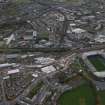
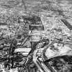
Edinburgh, Roseburn Street, Murrayfield Stadium


Stadium (20th Century), War Memorial (20th Century)
Site Name Edinburgh, Roseburn Street, Murrayfield Stadium
Classification Stadium (20th Century), War Memorial (20th Century)
Alternative Name(s) Riversdale Crescent; Scottish Rugby Union; Sru; Murrayfield Rugby Football Ground; War Memorial; Scottish Rugby Union War Memroial
Canmore ID 73600
Site Number NT27SW 176
NGR NT 22590 72830
Datum OSGB36 - NGR
Permalink http://canmore.org.uk/site/73600


First 100 images shown. See the Collections panel (below) for a link to all digital images.
- Council Edinburgh, City Of
- Parish Edinburgh (Edinburgh, City Of)
- Former Region Lothian
- Former District City Of Edinburgh
- Former County Midlothian
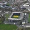
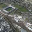
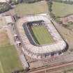
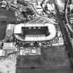
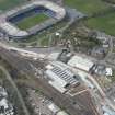
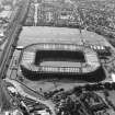
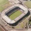
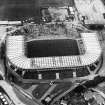
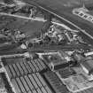
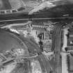
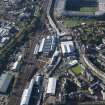
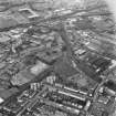
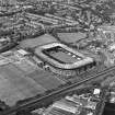
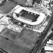
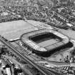
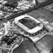
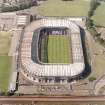
In 1911 the Scottish Rugby Union purchased land at Murrayfield for use by the national team. It is now the largest stadium in Scotland with an all-seated capacity of 67,500, considerably less than the record attendance of 104,000 for a match against Wales in 1975 before the removal of standing areas.
Information from RCAHMS (SC) 30 July 2007
Johnson, B 1995
NT27SW 176.00 22590 72830
Murrayfield
Rugby Football Ground [NAT]
OS (GIS) MasterMap, October 2009.
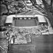
NT27SW 176.01 NT 22700 72849 Clock Tower (removed to Roseburn Street)
NT27SW 176.02 NT 22715 72750 Gateway (War Memorial)
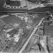
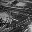
For adjacent ice rink, see NT27SW 177.
NMRS Reference.
Edinburgh, Scottish Rugby Union War Memorial.
Architect: A.F. Balfour Paul.
Possibly the clock tower (?).
(Undated) information in NMRS.
Two-phase redevelopment by The Miller Partnership, Glasgow, March 1992-1994.
Now an all-seated covered Bowl stadium with capacity of 67,500. Cost: £39m.
RIAS 1992.

