Following the launch of trove.scot in February 2025 we are now planning the retiral of some of our webservices. Canmore will be switched off on 24th June 2025. Information about the closure can be found on the HES website: Retiral of HES web services | Historic Environment Scotland
Birsay, Brough Road
Cairn (Period Unassigned), Cist (Period Unassigned), Human Remains (Period Unassigned)
Site Name Birsay, Brough Road
Classification Cairn (Period Unassigned), Cist (Period Unassigned), Human Remains (Period Unassigned)
Canmore ID 73552
Site Number HY22NW 61
NGR HY 2467 2806
Datum OSGB36 - NGR
Permalink http://canmore.org.uk/site/73552
- Council Orkney Islands
- Parish Birsay And Harray
- Former Region Orkney Islands Area
- Former District Orkney
- Former County Orkney
HY22NW 61 2467 2806
See also HY22NW 62
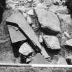
Located in 1976 below turf and in dune sand, when Mrs M Hughes of the Orkney Field Centre, Links House, Birsay, noted human bone projecting from the cliff section. Small scale excavations then revealed a long cist grave containing parts of two skeletons lying roughly N-S, separated by a flagstone. The lower skeleton had a number of beach pebbles around it (Cutting 1). Further excavations in 1978 showed the cist probably to be associated with an eroded cairn, on top of which was a later skeleton, aligned roughly E-W (Area 1).
Radiocarbon dates of 1640+/-70bp (GU-1550) were obtained from skeleton 1 in the cist; 1600+/-70bp (GU-1551) from skeleton 2; and 1040+/-60bp (GU-1552) from the skeleton on top of the cairn. Small finds are in Tankerness House Museum, Kirkwall; biological material in RMS, Edinburgh.
C D Morris 1978a, 1979h, 1979i, 1989.
Excavation (1976)
Located in 1976 below turf and in dune sand, when Mrs M Hughes of the Orkney Field Centre, Links House, Birsay, noted human bone projecting from the cliff section. Small scale excavations then revealed a long cist grave containing parts of two skeletons lying roughly N-S, separated by a flagstone. The lower skeleton had a number of beach pebbles around it (Cutting 1). Further excavations in 1978 showed the cist probably to be associated with an eroded cairn, on top of which was a later skeleton, aligned roughly E-W (Area 1).
Radiocarbon dates of 1640+/-70bp (GU-1550) were obtained from skeleton 1 in the cist; 1600+/-70bp (GU-1551) from skeleton 2; and 1040+/-60bp (GU-1552) from the skeleton on top of the cairn. Small finds are in Tankerness House Museum, Kirkwall; biological material in RMS, Edinburgh.
C D Morris 1978a, 1979h, 1979i, 1989.


