
Learable


Field System (Prehistoric), Hut (Period Unknown)(Possible)
Site Name Learable
Classification Field System (Prehistoric), Hut (Period Unknown)(Possible)
Canmore ID 72407
Site Number NC82SE 20.10
NGR NC 896 239
Datum OSGB36 - NGR
Permalink http://canmore.org.uk/site/72407


- Council Highland
- Parish Kildonan
- Former Region Highland
- Former District Sutherland
- Former County Sutherland
Field Visit (5 June 1991)
NC82SE 20.10 896 239.
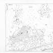
The remains of what is probably a prehistoric field-system can be seen on either side of the ring dyke to the N of the township, extending over a distance of some 350m from NW to SE by 150m transversely. One portion lies in the deciduous woodland below the cultivated ground of the township, with fragments of the system surviving within the area of rig, while the other can be seen in rough pasture to the N of the ring-dyke. It comprises stony banks and lynchets, defining rectilinear plots.
Most extensive is that found in the woodland: three cross-contour banks, some 60m and 120m apart respectively, were identified which were interconnected by contour dykes. This partially enclosed at least two plots; the more northerly contained a hut-circle (NC82SE 20.04) and was cut in two places by the ring-dyke of the township, whilst the more southerly, lower down the hillside, was defined at its E side by a substantial terrace or lynchet, some 50m from the railway-line.
The second system, which occupies the heather-covered ground to the N of the ring-dyke, comprises three sides of a plot, whose SE side runs off the NE of a cairn (NC82SE 3), and measures 80m from WNW to ESE by at least 45m transversely. Another stony bank describes an irregular course downhill for 110m from the E corner of this second field-system. What may be a hut is situated in the deciduous woodland on the S side of one of the cross-contour banks of the field-system at NC 8963 2395; it comprises a sub-rectangular platform, which measures 5.5m from N to S by 3.5m in breadth within a stony perimeter spread to 1.1m in thickness and 0.3m in height.
(KILD91 207)
Visited by RCAHMS (PJD) 5 June 1991.

