Pricing Change
New pricing for orders of material from this site will come into place shortly. Charges for supply of digital images, digitisation on demand, prints and licensing will be altered.
Learable
Burnt Mound (Prehistoric)
Site Name Learable
Classification Burnt Mound (Prehistoric)
Canmore ID 72397
Site Number NC82SE 20.07
NGR NC 8949 2337
Datum OSGB36 - NGR
Permalink http://canmore.org.uk/site/72397
- Council Highland
- Parish Kildonan
- Former Region Highland
- Former District Sutherland
- Former County Sutherland
Field Visit (6 May 1991)
NC82SE 20.07 8949 2337.
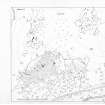
This U-shaped burnt mound is set against a natural bank in heather-covered peat terrain, some 50m SW of the ring-dyke of the township; it measures 7m from NE to SW by 5.5m transversely and up to 0.4m in height with its mouth to the NW. A bank runs off from its SW arm.
(KILD91 297)
Visited by RCAHMS (PJD) 6 May 1991.


