
Holywood


Enclosure (Period Unassigned)(Possible)
Site Name Holywood
Classification Enclosure (Period Unassigned)(Possible)
Canmore ID 69934
Site Number NX97NW 44
NGR NX 94925 79530
Datum OSGB36 - NGR
Permalink http://canmore.org.uk/site/69934


- Council Dumfries And Galloway
- Parish Holywood
- Former Region Dumfries And Galloway
- Former District Nithsdale
- Former County Dumfries-shire
NX97NW 44 94925 79530
See also NX97NW 23.
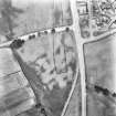
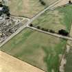
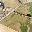
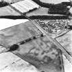
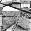
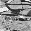
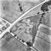
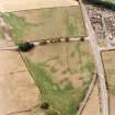
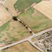
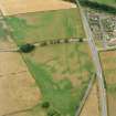
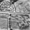
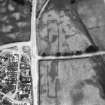
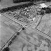
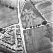
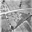
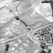
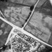
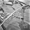
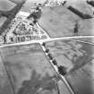
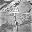
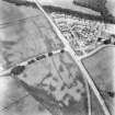
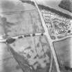
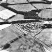
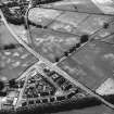
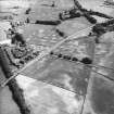
Cropmarks have revealed a circular enclosure containing at least two pits within the SW corner of the S terminal of the cursus monument (see NX97NW 23); it measures about 20m in diameter within a very narrow mark which has the proportion of the wall trenches sometimes observed in the cropmarks of timber round-houses.
Information from RCAHMS (ARG), 15 April 1998
Aerial photography has revealed the cropmark of a possible enclosure within the southern terminal area of Holywood 1 cursus (NX97NW 23), 180m SSW of Holywood church hall. An arc of ditch possibly represents the W half of a circular enclosure measuring approximately 34m in diameter, with at least two internal pit features. A slightly smaller ring-ditch (NX97NW 38) has been recorded as a cropmark in the northern terminal of the cursus, and both these features lie near the cursus ditch (where the bank would probably run) and a causeway.
Information from RCAHMS (KB) 6 May 1999
Aerial Photographic Transcription (15 January 1990 - 12 December 1990)
An aerial transcription was produced from oblique aerial photographs. Information from Historic Environment Scotland (BM) 31 March 2017.
Aerial Photographic Transcription (1991)
Aerial Photographic Transcription (1991)

