
Pricing Change
New pricing for orders of material from this site will come into place shortly. Charges for supply of digital images, digitisation on demand, prints and licensing will be altered.
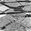
Holywood


Ring Ditch (Period Unassigned)
Site Name Holywood
Classification Ring Ditch (Period Unassigned)
Canmore ID 69933
Site Number NX97NW 45
NGR NX 94881 79561
Datum OSGB36 - NGR
Permalink http://canmore.org.uk/site/69933


- Council Dumfries And Galloway
- Parish Holywood
- Former Region Dumfries And Galloway
- Former District Nithsdale
- Former County Dumfries-shire
NX97NW 45 94881 79561
See also NX97NW 23.
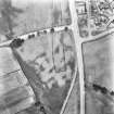
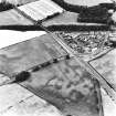
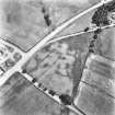
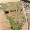
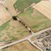
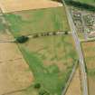
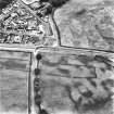
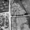
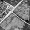
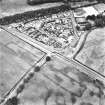
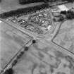
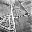
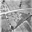
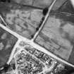
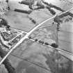
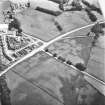
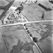
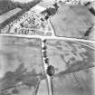
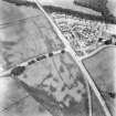
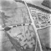
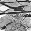
What may be a ring of elongated pits has been revealed by cropmarks immediately W of the cursus monument NX97NW 23 opposite the more northerly of the two breaks in the ditch forming this side. The ring measures about 15m in diameter, but it is not clear whether it is a pit-circle or the remains of a heavily degraded ring-ditch.
Information from RCAHMS (ARG), 15 April 1998
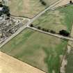
Aerial Photographic Transcription (15 January 1990 - 12 December 1990)
An aerial transcription was produced from oblique aerial photographs. Information from Historic Environment Scotland (BM) 31 March 2017.
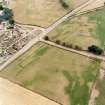
Aerial Photographic Transcription (1991)
Aerial Photographic Transcription (1991)

