Following the launch of trove.scot in February 2025 we are now planning the retiral of some of our webservices. Canmore will be switched off on 24th June 2025. Information about the closure can be found on the HES website: Retiral of HES web services | Historic Environment Scotland
Tongland Power Station
Hydroelectric Power Station (Modern)
Site Name Tongland Power Station
Classification Hydroelectric Power Station (Modern)
Alternative Name(s) Galloway Hydroelectric Scheme; Galloway Hydros Visitor Centre
Canmore ID 69356
Site Number NX65SE 86
NGR NX 69488 53563
NGR Description centred
Datum OSGB36 - NGR
Permalink http://canmore.org.uk/site/69356
- Council Dumfries And Galloway
- Parish Tongland
- Former Region Dumfries And Galloway
- Former District Stewartry
- Former County Kirkcudbrightshire
NX65SE 86.00 69488 53563
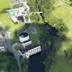
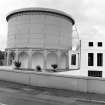
NX65SE 86.01 NX 69540 53605 Surge tower
NX65SE 86.02 NX 69479 53669 Transformer Station
For (associated) Tongland Dam and Tongland Tunnel (aqueduct), see NX75SW 37 and NX75SW 43 respectively.
Power Station [NAT]
OS 1:10,000 map, 1990.
Power Station [NAT]
OS 1:50,000 map, 1996.
Tongland Power Station: 1st stage of project
Average net head: 102ft (31.9m)
Catchment area: 396 sq miles (121 sq km)
Max. load: 33,000 kW [58% of 1st stage total: 33% of grand total]
Units per annum: 68 million [63% of 1st stage total: 37% of grand total]
No. of main turbines: 3
Tongland power station, surge tower etc: Wm. Taylor and Son (Glasgow) Ltd.
Tongland, rack cleaning machine: Blakeborough and Co. Ltd.
This power station has three 11,000kW vertical Francis turbines. The tailrace extends about 300ft (91.5m) below the powerhouse, and has been formed by the excavation of the rock in the bed of the river, which is tidal up to a point beyond the power station. The average net head available is 102ft (31.1m).
Anon. 1934 ['Galloway Water Power Scheme'].
(Detailed description of power generation equipment and switchgear).
English Electric Company Limited [post-1936].
Tongland Power Station
Catchment area: 395 sq mi (1023 sq km)
Average net head: 106 ft (32.3m)
Water consumption on full load at average head: 4250 cusec
Number and size of units: 3x11000kW, 1x250kW
Gross volume of turbine room (incl. loading bay), above main floor level = total: 420,000 cu ft (11893.3 cu m)
Gross volume of turbine room (incl. loading bay), above main floor level = per kW: 12.6 cu ft (0.36 cu m)
Range of net heads: 95-114ft (29-34.8m)
No. of rating of generator sets installed: 3x11,000 kW
Turbine output: 15,500 hp
Specific speed: 84 rpm
Normal speed: 214.3 rpm
Runaway speed: 418 rpm
Water consumption per turbine on full load at average head: 1414 cusecs
Diameter of runner: 8ft 8ins (2.64m)
Auxiliary set: 250kW, water consumption 35 cusecs
This power station is intended for manned operation, and is also the remote control station for Glenlochar Barrage (NX76SW 40). It houses the memorial plaque to William McLellan (1874-1934), who conceived the scheme.
Anon. 1938 ['Galloway Hydro-Electric Development'].
[Constructed] by Sir Alexander Gibb and Partners, 1934, as part of the Galloway hydro-electric scheme.
J Gifford 1996.
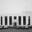
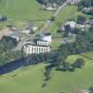
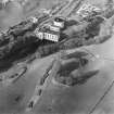
Tongland Power Station was built in 1936 by Merz and McLellan, and Sir Alexander Gibb and Partners, engineers, and is the lowest and largest such station in the Galloway Hydro-Electric Scheme. The concrete building is in the art deco style, and is complemented by a surge tower of rivetted steel construction on reinforced concrete arches. Water is supplied from a reservoir impounded by a concrete arch and granite dam with monumental flood gates.
J R Hume 2000.
This power station is open to the public as a visitor attraction under the title 'Galloway Hydros Visitor Centre'.
Source: 'Harnessing the Power of Nature' [Scottish Power information leaflet, 2006].
Publication Account (1934)
Tongland Power Station: 1st stage of project
Average net head: 102ft (31.9m)
Catchment area: 396 sq miles (121 sq km)
Max. load: 33,000 kW [58% of 1st stage total: 33% of grand total]
Units per annum: 68 million [63% of 1st stage total: 37% of grand total]
No. of main turbines: 3
Tongland power station, surge tower etc: Wm. Taylor and Son (Glasgow) Ltd.
Tongland, rack cleaning machine: Blakeborough and Co. Ltd.
This power station has three 11,000kW vertical Francis turbines. The tailrace extends about 300ft (91.5m) below the powerhouse, and has been formed by the excavation of the rock in the bed of the river, which is tidal up to a point beyond the power station. The average net head available is 102ft (31.1m).
Anon. 1934 ['Galloway Water Power Scheme'].
Field Visit (2010)
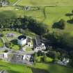
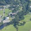
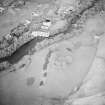
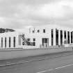
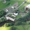
This is the most southerly of the powerhouses on the Galloway scheme and generates prior to the water going out to sea. Water going through the turbines in Tongland PowerStation will already have been used four times previously to generate electricity. The powerhouse site also houses the surge tower which protects both penstocks and turbines from sudden fluctuations in water level. Tongland is the largest station on the Galloway scheme (making use of all available water). This complex of buildings is an outstanding example of the application of early modernist design principles to an industrial setting, with a functionalist classical design scheme. The architectural treatment of the building is high quality with the original form and glazing pattern broadly retained. Many original interior features, such as panelling, are also retained. The landscape contribution is significant with the powerhouse set prominently against a busy A road.
Project (1 February 2014 - 24 February 2014)
An archaeological evaluation has been carried out by CFA Archaeology Ltd (CFA) using information provided by the Dumfries and Galloway Historic Environment Record (HER). A desk-based study was undertaken in order to assess the archaeological potential of the proposed development area. No intrusive site investigation work was undertaken during the assessment. A desk-based study was undertaken in order to assess the archaeological potential of the proposed development area. No intrusive site investigation work was undertaken during the assessment. Fifteen cultural heritage features have been identified within the study area. The construction works will involve the extension of the substation. No known cultural heritage features will be directly impacted by the proposed development works.
Information from Hannah Tweedie, CFA Archaeology Ltd., February 2014
Watching Brief (1 February 2014 - 24 February 2014)
Tongland Power Station is Category A Listed (Official name: Galloway Electric Power Scheme, Tongland Power Station, Surge Tower and Valve House, including Boundary Walls (Index No. 17126). It dates from the 1930s.
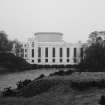
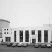
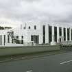
Sir Alexander Gibb consulting engineer, Merz and McLellan Electrical engineers, Payler and Son (Glasgow) construction engineers; dated 1934. Large symmetrical roughly T-plan Classical Modern power station with detached surge tower and valve-house to N. Painted reinforced concrete. POWER STATION: 2 storeys, 7 bays. Recessed eaves and blocking course and full-height pilasters. Central lugged doorway with 2-leaf timber doors inscribed above with TONGLAND POWER STATION, 1934. Flanked by pair of bi-partite rectangular small-pane windows. Single narrow round arched windows to outer bays, flanked by lower terminating bays with bipartite windows with pilastered transom.N (SIDE) ELEVATION: 10 bays with 3-bay return to right (W) with arcaded ground floor to terminal bays at right (S). Slightly advanced porch in re-entrant angle to right (W); large timber door with rectangular top-lights. Continuous run of bi-partite rectangular small-pane windows to centre and left (E) separated by pilasters. E (END) ELEVATION: 2 bays with deep basement. Windows similar to those to N elevation with two additional rectangular windows to basement. S (REAR) ELEVATION: similar to that at N with additional tower advanced to left (W) and lower 2-bay block to far left (W). Rectangular small-pane windows to tower (bipartite to 2nd floor). Flat roof. Cast-iron rainwater goods integrated behind blocking course to roof. INTERIOR: plain interior to power station with double height space and large travelling crane on steel gantry. Some oak panelling to former administrative areas and entrance hall. Some wooden blockwork flooring. VALVE-HOUSE AND SURGE TOWER: large steel water tank on continuous arcade of concrete arches to N of power station. Integrated valve-house to S (6 bays by 2 bays). Pilastered ground floor with banded base course above. Rectangular small-pane windows at ground floor with louvered rectangular openings above. BOUNDARY WALLS: integrated with structure to front (W) elevation. Low painted concrete walls with shallow curved profile to top.
Tongland power station is a key component of the highly influential Galloway scheme, forming the control station for the whole scheme on its completion. The power station is prominently sited next to the A711 road and adjacent to the River Dee. The Galloway scheme was a significant technological achievement and the first example of run of the river technology to be successfully utilised on a large scale in Scotland, going to influence future developments throughout the country. Tongland power station is at the bottom of the scheme and receives water which has already been used by all of the other stations (see separate listings) to generate electricity. The Galloway scheme was a significant technological achievement and the first example of run of the river technology to be successfully utilised on a large scale in Scotland. The architectural design of Tongland is a fusion of the necessary engineering requirements of a large commercial power station and a finely detailed Modernist classical design. The stark roofline and rhythmic articulation of the façade characterise the modern, dynamic attitude with which hydroelectricity was viewed in this period. The development of the Galloway Hydroelectric Scheme predates the 1943 Hydroelectric (Scotland) Act which formalised the development of Hydroelectricity in Scotland and led to the founding of the North of Scotland Hydroelectric Board. Those developments which predated the 1943 act were developed by individual companies as a response to particular market and topographic conditions. The completion of a number of schemes (including Galloway, Grampian and those associated with aluminium smelting (see separate listings) without a national strategic policy framework is groundbreaking as is the consistency of high quality aesthetic and engineering design across all of the schemes. The Galloway scheme was influential on the future development of hydropower in Scotland. After initial opposition to the parliamentary act granting powers for the completion of the scheme it was approved with a number of safeguards on the landscape and amenity of the area. This necessitated the high quality design of both power stations and dams which characterises the Galloway scheme. This condition also proved influential during the drafting of the Hydroelectric (Scotland) Act of 1943 where the visual impact of future schemes was a primary concern. Sir Alexander Gibb and Partners was a pioneering engineering company, responsible for a number of high profile works in Scotland, including the Kincardine Bridge (see separate listing). The company was founded by Alexander Gibb in 1921 and quickly became the UK's largest firm of consulting engineers with numerous international clients. Gibb was personally involved in the design and construction of the Galloway scheme, and the pioneering nature of the Galloway development is due, in large part, to his abilities as an engineer. Merz and McLellan were pioneering British electrical engineers and developed a high profile practice, working on a number of power stations across Britain, including Dunstan B, as well as completing hydroelectric work in Italy in the 1980s.
Information from Hannah Tweedie, CFA Archaeology Ltd., February 2014


