Accessibility

Font Size

100% 150% 200%

Background Colour

Default Contrast
Close Reset

White Caterthun

Pillow Mound (Post Medieval)

Site Name White Caterthun

Classification Pillow Mound (Post Medieval)

Canmore ID 68681

Site Number NO56NW 18.05

NGR NO 5395 6601

Datum OSGB36 - NGR

Permalink http://canmore.org.uk/site/68681

Ordnance Survey licence number AC0000807262. All rights reserved.
Canmore Disclaimer. © Bluesky International Limited 2025. Public Sector Viewing Terms

Toggle Aerial | View on large map

Digital Images

Plan of both forts and a field-system with cairns and hut-circles adjacent to the White Caterthun (photographic copy).
Plan of both forts and a field-system with cairns and hut-circles adjacent to the White Caterthun (photographic copy).Oblique aerial view centred on the remains of ring ditches, cairnfield and field system at White Caterthun, looking to the NE.

Administrative Areas

  • Council Angus
  • Parish Menmuir
  • Former Region Tayside
  • Former District Angus
  • Former County Angus

Activities

Field Visit (14 September 1989)

NO56NW 18.05 5395 6601.

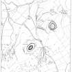
What may be a pillow mound is located on a gentle slope above an un-named burn on the NW side of the field-system (NO56NW 18.4). It measures 7m from NE to SW by 3.5m transversely and 0.4m in maximum height. The NE end and the sides of the mound are flanked by a shallow ditch from 1.25m to 1.5m broad.

Visited by RCAHMS (DCC) 14 September 1989.

References

MyCanmore Image Contributions


Contribute an Image

MyCanmore Text Contributions