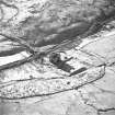
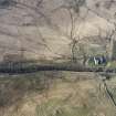
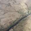
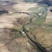
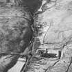
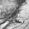
Hermitage, Chapel And Graveyard
Boundary Dyke (Medieval), Chapel (Medieval), Gravestone(S) (Medieval), Moated Site (Medieval)
Site Name Hermitage, Chapel And Graveyard
Classification Boundary Dyke (Medieval), Chapel (Medieval), Gravestone(S) (Medieval), Moated Site (Medieval)
Alternative Name(s) Cout O'kielder's Grave
Canmore ID 67914
Site Number NY49NE 4
NGR NY 49321 95995
Datum OSGB36 - NGR
Permalink http://canmore.org.uk/site/67914
- Council Scottish Borders, The
- Parish Castleton
- Former Region Borders
- Former District Roxburgh
- Former County Roxburghshire
NY49NE 4 49321 95995
(NY 4932 9599) CHAPEL (NR) (Remains of)
(NY 4933 9597) COUT O' KIELDER'S GRAVE (NR)
OS 6" map (1916-49)
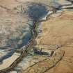
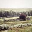
Chapel and Earthwork, Hermitage. Of the chapel of Hermitage, situated on the left bank of Hermitage Water about 400 yds. W of Hermitage Castle (RCAHMS 1956 no. 63 ), very little was visible when, in 1926, HM Office of Works began to excavate it; but the outline of the structure has now been exposed and its remains have been secured against further decay.
It stands within a graveyard which overlies and is enclosed by the E part of an earthwork obviously of earlier date, and is oblong on plan, measuring 18 ft. 3 in. from N to S by 45 ft. 6 in. from E to W within walls 3 ft. thick.
The side walls, which stand to a maximum height of 5 ft. at the NW corner, are divided into five bays of buttresses, each gable having a similar buttress at either end. There is no structural division between nave and chancel, but the E end, for a length of 11 ft. 3 in. is three steps higher than the remainder of the chamber. The masonry is ashlar, fairly cubical, built in courses 11 in. high; a chamfered base-course with a projection of 5 in. runs round the building, returning round each buttress. The entrance, now represented by a gap in the S wall in the second bay from the W, is the only opening traceable; but a number of window-rybats, chamfered outside, splayed back on the inner side and grooved for fixed glazing, were recovered during the excavation, and some of these evidently formed part of a large E window. Their detail, when considered with the plan, suggests a 14th-century date for the building.
The foiled head of a niche for a piscina, together with two sections of bold dog-tooth enrichment, all presumed to have come from the chapel, have been inserted above the entrance to the coach-house of the modern mansion of Hermitage.
TOMBSTONES. To the 14th century may also be attributed the upper part of a mediaeval tombstone found in the chapel and now transferred to Hermitage Castle. This has a present length of 1 ft. 7 in. and is 13 in. wide at the top and 12 in. at the bottom; the margin is chamfered. It has borne a cross with a small sword on the sinister side, and enough of the cross-shaft is left to show a bulbous necking a little below the cross-head. The cross-head includes four impinging pennanular rings with lobated ends, each pair being linked at thir junction by a cross-bar, a spear- or leaf-shaped member closing the re-entrants.
Between the S wall of the graveyard and the river bank lies "Cout o' Kielder's Grave", a low mound running N and S and measuring 11 ft. 9 in. in length and 3 ft. in breadth. A fragment of a mediaeval tombstone marks one end and part of a later tombstone the other. This may be the grave of Sir Richard Knout (Knut), of Kielder in Tynedale, Sheriff of Northumberland, who died between 1289 and 1291. (J Bain 1884)
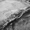
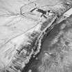
EARTHWORKS. The earthworks, which comprise two divisions, rest their S side on the river bank. To the N of them lie some enclosed fields and hollow tracks.
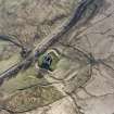
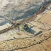
The E division of the earthworks is roughly square, and only a little larger than the graveyard that it now encloses. Its innermost defence consists of a bank which runs all round the site, and on the side towards the river this forms the only protection. Along the other three sides, however, outside this, there runs a wide ditch with another bank outside it, and on N and W a narrower ditch outside this bank again.
To the W, with its E side flanking this narrower ditch, lies the other main division, an oblong enclosure defined on W, N, and E by a bank, but with its S side open. The N and W banks have borrow-ditches. The area of this enclosure is rather less than one acre, and it contains some indefinite mounds such as might cover the ruins of buildings.
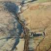
The bank that rises beyond the narrow ditch on the N of the fortified site is probably a boundary dyke forming part of the field enclosures of which mention has been made above; at its E end it turns N and defines, with another parallel bank, a hollow way which runs for some 60 yds. from the NE corner of the defences to join an old roadway - itself hollowed in this part to resemble a ditch - which flanks the N side of the enclosed ground. This old road can be observed descending the left bank of the river some 350 yds. to the W, swinging uphill to avoid the earthworks and enclosed fields, and running on towards the E until obliterated in the improved land surrounding Hermitage Castle.
It is tempting, in view of the obviously defensive character of the E division of the earthworks, to interpret this as the Hermitage Castle of 1244 (RCAHMS 1956 p.82) with the W one as its dependence or outer bailey; on the other hand, its defences seem altogether too slight for an important castle of this period. Alternatively, the E division, taken by itself, bears a close resemblance to a "homestead moat" (RCAHMS 1956 p.47), a form of construction for which a central date of 1200 has been established in the south of England. The road and the field-system both appear to be associated with a later occupation of the W division of the earthworks, in which there is some evidence of alteration.
RCAHMS 1956, visited 1931 and 1945
The architecture of the church belongs to the Early Pointed Period (1189-1272) indicating a date for the present building of about 1220, although charters of 1180 and 1204 mention a chapel here. No trace could be found to indicate any rebuilding after the Early Pointed Period.
J P Alison 1901
As described above.
Visited by OS (JLD) 27 September 1960
Possible Early Medieval Ring-work.
Information from E J Talbot TS. 'Mottes'.
This site is listed in an Atlas of Scottish History (McNeill and MacQueen 1996) as a moated site.
Information from RCAHMS (DE) September 1997
NMRS REFERENCE:
Inventory to Hawick Museum Drawings - typescript
Field Visit (1996 - 2003)
Russell Coleman managed an Historic Scotland funded project to record medieval moated sites in Scotland. Gazetteers were produced for each regional council area between 1996 and 2002 with an uncompleted overall review in 2002-03. The results of the first year of the project were published in Tayside and Fife Archaeological Journal, Volume 3 (1997).
Measured Survey (6 March 1998)
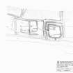
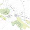
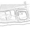
RCAHMS surveyed Hermitage chapel and moated site on 6 March 1998 with EDM, producing a pencil plan at a scale of 1:500. The plan was subsequently redrawn in ink.
Field Visit (6 March 1998)
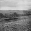
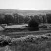
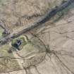
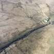
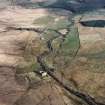
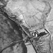
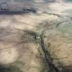
A chapel, a moated enclosure and adjacent settlement enclosure and several phases of boundary dyke are situated on the haughland on the N of the Hermitage Water. The chapel was mapped but not recorded in any detail on the date of visit.
The moated enclosure (LID96 268) is subsquare on plan and measures 32.8m from E to W by 31m transversely within two banks and a medial ditch. Both stand up to 0.75m in height and are spread to about 4.5m in thickness, while the medial ditch varies from about 2m to 6m in breadth. An outer ditch is visible on the E, W, and N, and on the latter it is accompanied by traces of an upcast outer bank. The entrance is on the W where there is a dip in the crest of the inner bank and a low bank returning around the terminal of the ditch on the N side of the causeway. This return is obliquely aligned on the offset gap in the bank of the neighbouring enclosure on the W, suggesting that this was an intentional entrance arrangement, if not necessarily original. There is no evidence for an entrance in the E of the enclosure, which strongly suggests that in its conception the moated enclosure did not look to the castle. The chapel occupies the NW corner of the enclosure, and has a small burial aisle between it and the 19th century stone wall that encloses the chapel. This wall incorporates a number of architectural fragments from the chapel. Cout o' Keilder's grave is situated on the S edge of the moated enclosure outside the stone wall and comprises a low mound about 3.5m in length from N to S with a flat stone leaning against either end. The orientation, the long mound and the ill-set stones all militate against the likelihood that this is a monument of any great antiquity.
The settlement enclosure on the W of the moated site. It is defined by a stony bank with an external ditch on the N and W, and a less well-defined bank on the E, but there is little sign of any boundary along the river bank on the S side of the enclosure. Internally it measures about 76m from E to W by 38m transversely, and the banks on the N and W are spread to about 4m in thickness and up to 0.7m in height. Some facing-stones are visible in places, suggesting that the banks on the N and W are the remains of a wall. It is divided into two parts by a bank that extends S from the N side and returns to the E just short of the edge of the river bank. Within this eastern compartment there are the partly robbed remains of a stone building, which measures 13.9m from E to W by 4.8m transversely within faced-rubble walls 0.9m in thickness and up to 0.5m in height (LID96 269). In the W compartment there is the remains of a substantial structure with mortared walls, two large fragments of which are visible on its W. The E end has been demolished, but may have been incorporated into the dividing bank between the two compartments. The structure measures at least 20m in length by 11m in breadth overall. This would make a substantial building, such as a barn. Parallels for this type of site are with manorial and moated enclosures, such as those at Muirhouselaw (NT62NW 1) or Timpendean (NT62SW 10), both near Jedburgh.
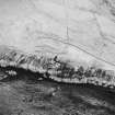
Four boundary dykes run up to the enclosures, two at the NE of the moated enclosure and two at the NW corner of the settlement. The two at the NE corner approach from the N on a parallel course about 1.5m to 2m apart, each comprising a bank and a ditch. About 55m to the N, the westerly of the two turns E along the bank of the park pale, which leads from the NW corner of the settlement enclosure (NY49NE 3) to Hermitage Castle (NY49NE 5), increasing its height along this sector to almost 1m in height. That to the E stops immediately short of the park pale. The pale approaches the settlement enclosure at a point 15m E of the NW corner, and may well be earlier in date. A second bank, with its ditch on the uphill side, extends W from the same point along the foot of the steep hillside, and encloses an area of about 1ha on the haughland to the W of the settlement. This boundary dyke is cut at its W end by a later ditch (NY 4906 9598).
(LID96 268-9)
Visited by RCAHMS (PJD) 6 March 1998.
Sbc Note
Visibility: This is an upstanding earthwork or monument.
Information from Scottish Borders Council


