|
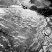
Photographs and Off-line Digital Images |
A 28096 |
RCAHMS Aerial Photography |
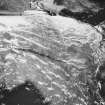
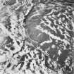
Oblique aerial view. |
1986 |
Item Level |
|
|
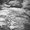
Photographs and Off-line Digital Images |
A 28097 |
RCAHMS Aerial Photography |
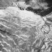
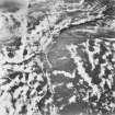
Oblique aerial view. |
1986 |
Item Level |
|
|
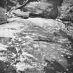
Photographs and Off-line Digital Images |
A 28098 |
RCAHMS Aerial Photography |
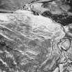
Oblique aerial view. |
1986 |
Item Level |
|
|
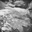
Photographs and Off-line Digital Images |
B 46901 |
RCAHMS Aerial Photography |
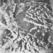
Oblique aerial view. |
1991 |
Item Level |
|
|
Photographs and Off-line Digital Images |
B 46902 |
RCAHMS Aerial Photography |
Oblique aerial view. |
1991 |
Item Level |
|
|
Photographs and Off-line Digital Images |
B 46903 |
RCAHMS Aerial Photography |
Oblique aerial view. |
1991 |
Item Level |
|
|
Photographs and Off-line Digital Images |
A 28099 |
RCAHMS Aerial Photography |
Oblique aerial view. |
1986 |
Item Level |
|
|
Photographs and Off-line Digital Images |
A 28100 |
RCAHMS Aerial Photography |
Oblique aerial view. |
1986 |
Item Level |
|
|
Photographs and Off-line Digital Images |
A 28101 |
RCAHMS Aerial Photography |
Oblique aerial view. |
1986 |
Item Level |
|
|
Prints and Drawings |
DC 32331 |
Records of the Royal Commission on the Ancient and Historical Monuments of Scotland (RCAHMS), Edinbu |
Survey drawing; Plan of Rain Sike farmstead, indicating cultivation remains and topographical features. |
16/6/1992 |
Item Level |
|
|
Prints and Drawings |
DC 32291 |
Records of the Royal Commission on the Ancient and Historical Monuments of Scotland (RCAHMS), Edinbu |
Publication drawing; Plan of Rain Sike farmstead. |
1996 |
Item Level |
|
 |
On-line Digital Images |
SC 382787 |
Records of the Royal Commission on the Ancient and Historical Monuments of Scotland (RCAHMS), Edinbu |
Publication drawing; Plan of Rain Sike farmstead. |
1996 |
Item Level |
|
 |
On-line Digital Images |
SC 383457 |
RCAHMS Aerial Photography |
Oblique aerial view. |
1986 |
Item Level |
|
 |
On-line Digital Images |
SC 1346113 |
Records of the Royal Commission on the Ancient and Historical Monuments of Scotland (RCAHMS), Edinbu |
Survey drawing; Plan of Rain Sike farmstead. |
16/6/1992 |
Item Level |
|
 |
On-line Digital Images |
SC 1761226 |
RCAHMS Aerial Photography |
Oblique aerial view. |
1986 |
Item Level |
|
 |
On-line Digital Images |
SC 1761227 |
RCAHMS Aerial Photography |
Oblique aerial view. |
1986 |
Item Level |
|
 |
On-line Digital Images |
SC 1761228 |
RCAHMS Aerial Photography |
Oblique aerial view. |
1986 |
Item Level |
|
 |
On-line Digital Images |
SC 1761229 |
RCAHMS Aerial Photography |
Oblique aerial view. |
1986 |
Item Level |
|
 |
On-line Digital Images |
SC 1761230 |
RCAHMS Aerial Photography |
Oblique aerial view. |
1986 |
Item Level |
|
 |
On-line Digital Images |
SC 1761231 |
RCAHMS Aerial Photography |
Oblique aerial view. |
1986 |
Item Level |
|
 |
On-line Digital Images |
SC 1761244 |
RCAHMS Aerial Photography |
Oblique aerial view. |
1991 |
Item Level |
|
 |
On-line Digital Images |
SC 1761245 |
RCAHMS Aerial Photography |
Oblique aerial view. |
1991 |
Item Level |
|
 |
On-line Digital Images |
SC 1761246 |
RCAHMS Aerial Photography |
Oblique aerial view. |
1991 |
Item Level |
|
 |
On-line Digital Images |
SC 2472781 |
Records of the Ordnance Survey, Southampton, Hampshire, England |
Rain Sike, NY38SW 30, Ordnance Survey index card, Recto |
c. 1958 |
Item Level |
|


