
Rain Sike


Farmstead (Medieval) - (Post Medieval)
Site Name Rain Sike
Classification Farmstead (Medieval) - (Post Medieval)
Alternative Name(s) Gibb's Hill
Canmore ID 67735
Site Number NY38SW 30
NGR NY 3117 8423
Datum OSGB36 - NGR
Permalink http://canmore.org.uk/site/67735


- Council Dumfries And Galloway
- Parish Langholm
- Former Region Dumfries And Galloway
- Former District Annandale And Eskdale
- Former County Dumfries-shire
Field Visit (March 1981)
Rain Sike NY 311 842 NY38SW
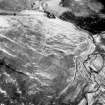
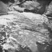
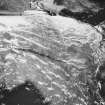
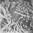
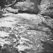
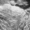
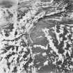
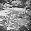
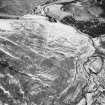
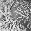
On the steep E-facing slope of Gibb's Hill immediately S of Rain Sike there are two platform-buildings, their platforms measuring 10.6m by 4.7m and 7.9m by 5.5m respectively. The larger building is constructed on two levels, its lower portion measuring 7m in length.
RCAHMS 1981, visited March 1981
Measured Survey (16 June 1992)
RCAHMS surveyed the farmstead at Rain Sike on 16 June 1992 with plane-table and self-reducing alidade at a scale of 1:250. This plan was redrawn in ink for publication at a scale of 1:1000 (RCAHMS 1997, Fig. 257).
Note (1997)
NY 3117 8423 NY38SW 30
Listed as farmstead.
RCAHMS 1997.

