|
Prints and Drawings |
DC 32228 |
Records of the Royal Commission on the Ancient and Historical Monuments of Scotland (RCAHMS), Edinbu |
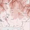
This map shows the distribution of timber and stone castles in Eastern Dumfriesshire and the neighbouring parts of Nithsdale and northern England. Published in Eastern Dumfriesshire: an archaeological landscape. |
1996 |
Item Level |
|
|
Digital Files (Non-image) |
GV 007464 |
Records of the Royal Commission on the Ancient and Historical Monuments of Scotland (RCAHMS), Edinbu |
Map showing the distribution of timber and stone castles in Eastern Dumfriesshire and the neighbouring parts of Nithsdale and northern England. Published in Eastern Dumfriesshire: an archaeological landscape. |
1996 |
Item Level |
|
 |
On-line Digital Images |
SC 1917782 |
Records of the Royal Commission on the Ancient and Historical Monuments of Scotland (RCAHMS), Edinbu |
Map showing the distribution of timber and stone castles in Eastern Dumfriesshire and the neighbouring parts of Nithsdale and northern England. Published in Eastern Dumfriesshire: an archaeological landscape. |
1996 |
Item Level |
|
 |
On-line Digital Images |
SC 2472320 |
Records of the Ordnance Survey, Southampton, Hampshire, England |
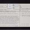
Gilnockie Castle, NY37NE 4, Ordnance Survey index card, page number 1, Recto |
c. 1958 |
Item Level |
|
 |
On-line Digital Images |
SC 2472321 |
Records of the Ordnance Survey, Southampton, Hampshire, England |
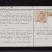
Gilnockie Castle, NY37NE 4, Ordnance Survey index card, page number 2, Verso |
c. 1958 |
Item Level |
|
|
All Other |
551 166/1/1 |
Records of the Ordnance Survey, Southampton, Hampshire, England |
Archaeological site card index ('495' cards) |
1947 |
Sub-Group Level |
|