|
Prints and Drawings |
DC 32346 |
Records of the Royal Commission on the Ancient and Historical Monuments of Scotland (RCAHMS), Edinbu |
Survey drawing; Plan of (S end of) Neolithic bank barrow at Tom's Knowe, Raeburnfoot, indicating modern features. |
10/9/1992 |
Item Level |
|
|
Prints and Drawings |
DC 32347 |
Records of the Royal Commission on the Ancient and Historical Monuments of Scotland (RCAHMS), Edinbu |
(Unfinished outline) field survey plan of (S end of) Neolithic bank barrow at Tom's Knowe. |
10/9/1992 |
Item Level |
|
|
Prints and Drawings |
DC 32573 |
Records of the Royal Commission on the Ancient and Historical Monuments of Scotland (RCAHMS), Edinbu |
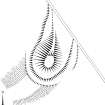
Publication drawing; Plan of (S end of) Neolithic bank barrow at Tom's Knowe (Raeburnfoot). |
1996 |
Item Level |
|
|
Prints and Drawings |
DC 32574 |
Records of the Royal Commission on the Ancient and Historical Monuments of Scotland (RCAHMS), Edinbu |
Computer-generated three-dimensional view of (S end of) Neolithic bank barrow at Tom's Knowe, Raeburnfoot [from SW], generated in SDRMAP software from computer file LAMBSKN3D.TIF. Unattributed, [1996]. |
1996 |
Item Level |
|
|
Prints and Drawings |
DC 32172 |
Records of the Royal Commission on the Ancient and Historical Monuments of Scotland (RCAHMS), Edinbu |
Upper Eskdale landscape case-study area: map showing the prehistoric monuments, with windows for maps of Bailiehill and Raeburnfoot. Published in Eastern Dumfriesshire: an archaeological landscape. |
11/1996 |
Item Level |
|
|
Prints and Drawings |
DC 32190 |
Records of the Royal Commission on the Ancient and Historical Monuments of Scotland (RCAHMS), Edinbu |
Map showing the distribution of stone axes and Neolithic monuments (long cairns, bank barrow, standing stones, cursus, stone circles, henges and pitted enclosures) in Annandale and Eskdale. Published in Eastern Dumfriesshire: an archaeological landscape. |
1996 |
Item Level |
|
|
Prints and Drawings |
DC 32195 |
Records of the Royal Commission on the Ancient and Historical Monuments of Scotland (RCAHMS), Edinbu |
Map showing the position of the bank barrow spanning the valley of the Esk between Lamb Knowe and Tom's Knowe (Raeburnfoot, Eskdalemuir): publication drawing for Inventory of Eastern Dumfriesshire, generated from computer file 10LAMBKN.ai. Unattributed, [1996]. |
1996 |
Item Level |
|
|
Prints and Drawings |
DC 32196 |
Records of the Royal Commission on the Ancient and Historical Monuments of Scotland (RCAHMS), Edinbu |
Plans of the terminals of the bank barrow on Lamb Knowe and Tom's Knowe (Raeburnfoot, Eskdalemuir): publication drawing for Inventory of Eastern Dumfriesshire. Unattributed, [1996]. |
1996 |
Item Level |
|
|
Prints and Drawings |
DC 32756 |
Records of the Royal Commission on the Ancient and Historical Monuments of Scotland (RCAHMS), Edinbu |
Map showing the distribution of Neolithic monuments in southern Scotland; cursus monuments, bank barrows, pitted avenues, large ritual enclosures, possible mortuary enclosures and interrupted-ditch enclosures in Annandale and Eskdale. Published in Eastern Dumfriesshire: an archaeological landscape. |
1996 |
Item Level |
|
|
Photographs and Off-line Digital Images |
D 85987 S |
|
Site location map and plans DC 32575 and DC 32573. |
1996 |
Item Level |
|
 |
On-line Digital Images |
SC 381997 |
Records of the Royal Commission on the Ancient and Historical Monuments of Scotland (RCAHMS), Edinbu |
Publication drawing; Plan of (S end of) Neolithic bank barrow at Tom's Knowe (Raeburnfoot). |
1996 |
Item Level |
|
|
Photographs and Off-line Digital Images |
C 55682 |
RCAHMS Aerial Photography |
Tom's Knowe, oblique aerial view, taken from the E, centred on the snowmarks of a bank barrow. |
22/2/1996 |
Item Level |
|
|
Photographs and Off-line Digital Images |
C 55683 |
RCAHMS Aerial Photography |
Tom's Knowe, oblique aerial view, taken from the NE, centred on the snowmarks of a bank barrow. |
22/2/1996 |
Item Level |
|
|
Photographs and Off-line Digital Images |
C 55686 |
RCAHMS Aerial Photography |
Tom's Knowe, oblique aerial view, taken from the NW, centred on the snowmarks of a bank barrow. |
22/2/1996 |
Item Level |
|
|
Photographs and Off-line Digital Images |
C 55933 CN |
RCAHMS Aerial Photography |
Tom's Knowe, oblique aerial view, taken from the ESE, centred on the snowmark of a bank barrow. |
22/2/1996 |
Item Level |
|
|
Photographs and Off-line Digital Images |
C 55934 CN |
RCAHMS Aerial Photography |
Tom's Knowe, oblique aerial view, taken from the SE, centred on the snowmark of a bank barrow. |
22/2/1996 |
Item Level |
|
|
Photographs and Off-line Digital Images |
C 55935 CN |
RCAHMS Aerial Photography |
Tom's Knowe, oblique aerial view, taken from the NE, centred on the snowmark of a bank barrow. |
22/2/1996 |
Item Level |
|
 |
On-line Digital Images |
SC 624166 |
RCAHMS Aerial Photography |
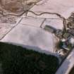
Tom's Knowe, oblique aerial view, taken from the ESE, centred on the snowmark of a bank barrow. |
22/2/1996 |
Item Level |
|
|
Photographs and Off-line Digital Images |
C 55684 |
RCAHMS Aerial Photography |
Oblique aerial view taken from the NE, centred on the snowmarks of a bank barrow. |
22/2/1996 |
Item Level |
|
 |
On-line Digital Images |
SC 842719 |
RCAHMS Aerial Photography |
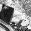
Oblique aerial view taken from the NE, centred on the snowmarks of a bank barrow. |
22/2/1996 |
Item Level |
|
|
Photographs and Off-line Digital Images |
G 83580 CS |
|
Copy of location plan (DC 32196) of terminals of bank barrow |
1996 |
Item Level |
|
|
Photographs and Off-line Digital Images |
G 83581 CS |
|
Copy of page 109 from Eastern Dumfriesshire (RCAHMS 1996), showing (top) a three dimensional contour plan of the northern terminal of the bank barrow |
|
Item Level |
|
 |
On-line Digital Images |
SC 1346147 |
Records of the Royal Commission on the Ancient and Historical Monuments of Scotland (RCAHMS), Edinbu |
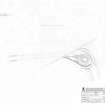
Survey drawing; Plan of Tom's Knowe bank barrow. |
10/9/1992 |
Item Level |
|
 |
On-line Digital Images |
SC 1760994 |
RCAHMS Aerial Photography |
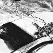
Tom's Knowe, oblique aerial view, taken from the E, centred on the snowmarks of a bank barrow. |
22/2/1996 |
Item Level |
|


