Scheduled Maintenance
Please be advised that this website will undergo scheduled maintenance on the following dates: •
Tuesday 3rd December 11:00-15:00
During these times, some services may be temporarily unavailable. We apologise for any inconvenience this may cause.
Tom's Knowe
Bank Barrow (Neolithic)
Site Name Tom's Knowe
Classification Bank Barrow (Neolithic)
Alternative Name(s) Holm; Tom's Knowe Cairn; Eskdalemuir
Canmore ID 67284
Site Number NY29NE 102
NGR NY 2501 9798
NGR Description NY 2501 9798 to NY 2501 9823
Datum OSGB36 - NGR
Permalink http://canmore.org.uk/site/67284
- Council Dumfries And Galloway
- Parish Eskdalemuir
- Former Region Dumfries And Galloway
- Former District Annandale And Eskdale
- Former County Dumfries-shire
NY29NE 102 2501 9798 to 2501 9823
For N end of bank barrow or cursiform earthwork at Lamb Knowe, Raeburnfoot (NY 2501 9935 to 2519 9997), see NY29NE 75.
(NY 2501 9798) Cairn (NR)
OS 6" map (1965)
Situated on the summit of Tom's Knowe is a circular, turf- covered, earth-and-stone cairn. It measures 14.0 m in diameter and has been slightly mutilated on the N side.
Visited by OS (WDJ) 5 September 1962 and (IA) 5 October 1973.
No change to the previous field report.
Visited by OS (MJF) 30 August 1978.
The previous authorities are describing the same mound however the dimensions differ because OS (IA) has included the whole 1.6m high feature whereas RCAHMS 1980 apparently identifies only the upper part as a possible cairn. The position of the apparently fragmentary ditch, which is a very tenuous feature, is unusual in that it encircles the whole mound rather than the cairn itself.
Visited by OS (MJF) 30 August 1981.
(Named Tom's Knowe Cairn and location cited as NY 250 979). Situated on a prominent rocky knoll commanding good general views, especially to the S and E, the monument comprises a conical mound of earth and stones measuring 16m from E to W by 15.4m transversely and 1.8m in height. Some of this height is clearly due to a natural rock formation and the whole site could indeed be natural, but on balance it seems acceptable, if only because of the tradition of the name.
M J Yates 1984.
Field Visit (June 1980)
Tom's Knowe, Eskdalemuir NY 250 979 NY29NE 8
A mound, possibly a prehistoric burial-cairn measuring about 8m in diameter and 0. 7m in height, is situated on a low knoll on Tom's Knowe; around the base of the knoll on the SW, SE and E there is a ditch up to 2.4m in breadth and 0.2m in depth.
RCAHMS 1980, visited June 1980
Measured Survey (10 September 1992)
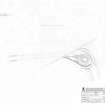
RCAHMS surveyed the bank barrow at Tom’s Knowe on 10 September 1992 with plane-table and self-reducing alidade at a scale of 1:250. The plan was redrawn in ink and published at a scale of 1:500 (RCAHMS 1997, Fig. 99).
Field Visit (10 September 1992)
NY2501 9798 to 2501 9823
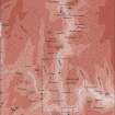
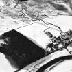
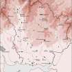
NY29NE 8 This earthwork, previously identified as a cairn, extends down the N slope of Tom's Knowe from the summit, and comprises a central mound, measuring up to 5.5m in thickness and 0.5m in height, flanked by shallow ditches up to 3.5m broad. The ditches are separated from the central mound by a flattish berm, measuring up to 3.5m in width, but they are only visible at the S end, returning around a barrow-like mound to form a hairpin terminal. Although the earthwork has been mutilated by cultivation and latterly by afforestation, the mound can be traced for about 255m down to the flat ground some 60m S of Holm steading (NY29NE 81). The barrow-like terminal is roughly oval on plan and measures about 10.5m from N to S by 9m and 1.5m in height. As with a similar earthwork (NY29NE 75) on Lamb Knowe, on the opposite side of the valley, the linear element of the mound appears to ride up the side of the barrow-like terminal without actually reaching the crest of its flat top. Indeed, such are the similarities between the two monuments that it is probable that they are in fact the two ends of one monument some 2km long, of which the the central section has been destroyed.
Visited by RCAHMS (JRS) 10 September 1992.
Listed among 'cursus monuments and bank barrows; name cited as Toms's Knowe, Holm at NY 2501 9798 to 2501 9823.
RCAHMS 1997.


![Computer-generated three-dimensional view of (S end of) Neolithic bank barrow at Tom's Knowe, Raeburnfoot [from SW], generated in SDRMAP software from computer file LAMBSKN3D.TIF. Unattributed, [1996].](http://i.rcahms.gov.uk/canmore/l/SC01918323.jpg)


![Computer-generated three-dimensional view of (S end of) Neolithic bank barrow at Tom's Knowe, Raeburnfoot [from SW], generated in SDRMAP software from computer file LAMBSKN3D.TIF. Unattributed, [1996].](http://i.rcahms.gov.uk/canmore/s/SC01918323.jpg)


