|
Photographs and Off-line Digital Images |
DF 1914 PO |
Cambridge University Collection for Aerial Photography |
Millhouse Bridge, Dinwoodie Green, enclosure: aerial view. |
29/7/1945 |
Item Level |
|
|
Photographs and Off-line Digital Images |
DF 2119 |
RCAHMS Aerial Photography |
Oblique aerial view. |
1977 |
Item Level |
|
|
Photographs and Off-line Digital Images |
DF 2120 |
RCAHMS Aerial Photography |
Oblique aerial view. |
1977 |
Item Level |
|
|
Prints and Drawings |
DC 31611 |
Records from the Department of Archaeology, University of Glasgow, Glasgow, Scotland |
Tracing of OS 1:10,000 map sheet NY18NW. (from excavation archive of NY18NW 17 - Fourmerkland Hill) |
1990 |
Item Level |
|
|
Prints and Drawings |
DC 32193 |
Records of the Royal Commission on the Ancient and Historical Monuments of Scotland (RCAHMS), Edinbu |
Map showing the distribution of Neolithic and Bronze Age funerary monuments (cists, round cairns, burials, ring-ditches and long cairns) in Annandale and Eskdale. Published in Eastern Dumfriesshire: an archaeological landscape. |
1996 |
Item Level |
|
 |
On-line Digital Images |
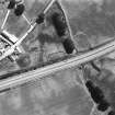
SC 1760112 |
RCAHMS Aerial Photography |
Oblique aerial view. |
1977 |
Item Level |
|
 |
On-line Digital Images |
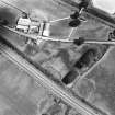
SC 1760113 |
RCAHMS Aerial Photography |
Oblique aerial view. |
1977 |
Item Level |
|
|
Photographs and Off-line Digital Images |
SC 1913440 |
Cambridge University Collection for Aerial Photography |
Millhouse Bridge, Dinwoodie Green, enclosure: aerial view. |
29/7/1945 |
Item Level |
|
|
Digital Files (Non-image) |
GV 007448 |
Records of the Royal Commission on the Ancient and Historical Monuments of Scotland (RCAHMS), Edinbu |
Map showing the distribution of Neolithic and Bronze Age funerary monuments (cists, round cairns, burials, ring-ditches and long cairns) in Annandale and Eskdale. Published in Eastern Dumfriesshire: an archaeological landscape. |
1996 |
Item Level |
|
 |
On-line Digital Images |
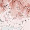
SC 1917621 |
Records of the Royal Commission on the Ancient and Historical Monuments of Scotland (RCAHMS), Edinbu |
Map showing the distribution of Neolithic and Bronze Age funerary monuments (cists, round cairns, burials, ring-ditches and long cairns) in Annandale and Eskdale. Published in Eastern Dumfriesshire: an archaeological landscape. |
1996 |
Item Level |
|
 |
On-line Digital Images |
SC 2470819 |
Records of the Ordnance Survey, Southampton, Hampshire, England |
Millhouse Bridge, Dinwoodie Green, NY18NW 5, Ordnance Survey index card, Recto |
c. 1958 |
Item Level |
|
 |
On-line Digital Images |
SC 2470820 |
Records of the Ordnance Survey, Southampton, Hampshire, England |
Millhouse Bridge, Dinwoodie Green, NY18NW 5, Ordnance Survey index card, page number 1, Recto |
c. 1958 |
Item Level |
|
 |
On-line Digital Images |
SC 2470821 |
Records of the Ordnance Survey, Southampton, Hampshire, England |
Millhouse Bridge, Dinwoodie Green, NY18NW 5, Ordnance Survey index card, page number 2, Verso |
c. 1958 |
Item Level |
|
 |
On-line Digital Images |
SC 2470822 |
Records of the Ordnance Survey, Southampton, Hampshire, England |
Millhouse Bridge, Dinwoodie Green, NY18NW 5, Ordnance Survey index card, Recto |
c. 1958 |
Item Level |
|
|
On-line Digital Images |
AT 003773 |
RCAHMS Aerial Transcription |
Imagery and Mapping Files for Aerial Photo Transcription. |
11/10/2012 |
Item Level |
|
|
Photographs and Off-line Digital Images |
AT 003772 |
RCAHMS Aerial Transcription |
Imagery and Mapping Files for Aerial Photo Transcription. |
12/10/2012 |
Item Level |
|
|
All Other |
551 166/1/1 |
Records of the Ordnance Survey, Southampton, Hampshire, England |
Archaeological site card index ('495' cards) |
1947 |
Sub-Group Level |
|
|
All Other |
551 227/37 |
Records of SUAT Ltd, archaeologists, Perth, Perth and Kinross, Scotland |
Archives from a survey of medieval moated sites in Scotland |
1996 |
Group Level |
|