
Following the launch of trove.scot in February 2025 we are now planning the retiral of some of our webservices. Canmore will be switched off on 24th June 2025. Information about the closure can be found on the HES website: Retiral of HES web services | Historic Environment Scotland
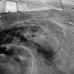
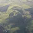
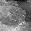
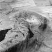
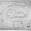
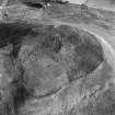
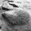
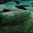
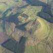
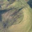
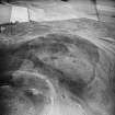
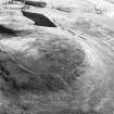
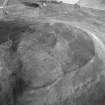
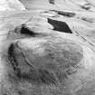
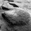
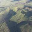
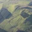
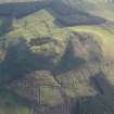
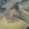
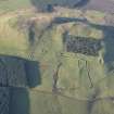
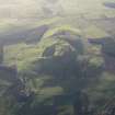
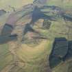
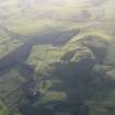
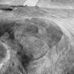
Burnswark


Earthwork (Post Medieval), Observation Post (Second World War), Redoubt (17th Century)(Possible), Triangulation Station (19th Century) (1847)
Site Name Burnswark
Classification Earthwork (Post Medieval), Observation Post (Second World War), Redoubt (17th Century)(Possible), Triangulation Station (19th Century) (1847)
Canmore ID 66628
Site Number NY17NE 2.07
NGR NY 1851 7860
Datum OSGB36 - NGR
Permalink http://canmore.org.uk/site/66628


- Council Dumfries And Galloway
- Parish Hoddom
- Former Region Dumfries And Galloway
- Former District Annandale And Eskdale
- Former County Dumfries-shire
Note (1997)
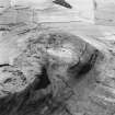
NY 1851 7860 NY17NE 2.7
Burnswark, listed as artillery fortification.
RCAHMS 1997.

