Archwood Hill
Fort (Prehistoric), Ring Ditch House(S) (Prehistoric)
Site Name Archwood Hill
Classification Fort (Prehistoric), Ring Ditch House(S) (Prehistoric)
Canmore ID 66231
Site Number NY08NE 21
NGR NY 09114 88380
Datum OSGB36 - NGR
Permalink http://canmore.org.uk/site/66231
- Council Dumfries And Galloway
- Parish Johnstone
- Former Region Dumfries And Galloway
- Former District Annandale And Eskdale
- Former County Dumfries-shire
Field Visit (8 September 1993 - 20 February 1996)
NY 090 883 NY08NE 21
This fort (which was discovered during aerial survey) is situated on a pronounced slope at the N end of the ridge known as Archwood Hill; it was under pasture on the date of visit. The only visible surface remains were those of a spread rampart or bank, measuring up to 6m in thickness and 0.2m in height, and a broad outer ditch which was too shallow and ill-defined to be measured. This bank and ditch is situated on the SW arc of the fort on the highest part of its circuit, from which access would have been easiest from along the ridge.
Visited by RCAHMS (JRS, IMS) 8 September 1993.
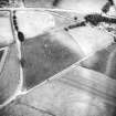
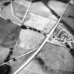
Air photography (John Dewar 1975; RCAHMSAP 1983, 1984, 1986, 1988 and 1989) has recorded the cropmarks of a multivallate fort on the sloping N flank of Archwood Hill, about 100m NW of Archwood steading (NY08NE 43.00). It measures about 75m in diameter within defences comprising four concentric ditches. There are traces of a concentric construction trench for a palisade or timber-laced rampart within the innermost ditch on the S. The entrance is on the E.
Information from RCAHMS (SPH), 20 February 1996.
Listed as fort and palisade.
RCAHMS 1997.
Aerial Photographic Transcription (26 July 2012)
An interpretative transcription, or mapping, of information on oblique aerial photographs was produced on 26 July 2012.
Note (23 May 2014 - 23 May 2016)
This fort is situated on the northern end of an elongated hillock on the W side of the River Annan. Faint traces of the outermost defences are visible on the SW, but otherwise the fort is only known from cropmarks, which reveal that it is circular on plan, measuring about 75m in diameter within a belt of four concentric ditches some 30m deep, though the breadths and spacing of the ditches suggest that the inner and outer pairs may belong to separate schemes of defence. While the inner pair are about 3m in breadth and set some 5m apart, on the S the the outer pair are between 4m and 5m in breadth and 8m apart. Around the S there are traces of another narrow line concentrically placed within the innermost ditch, either representing a palisade trench or the rear of the innermost rampart; allowing about 5m for the thickness of this rampart, the interior would have been in the order of 0.34ha in extent and there are traces of at least one round-house on its W side. However, if the outer pair represented a freestanding fortification, this would have measured about 100m in internal diameter and enclosed a much larger area of about 0.78ha. The entrance through both sets of defences is on the E.
Information from An Atlas of Hillforts of Great Britain and Ireland – 23 May 2016. Atlas of Hillforts SC0869


