Holmains Tower
House (17th Century), Tower House (Medieval)
Site Name Holmains Tower
Classification House (17th Century), Tower House (Medieval)
Alternative Name(s) Holmains House
Canmore ID 66131
Site Number NY07NE 7
NGR NY 0828 7652
Datum OSGB36 - NGR
Permalink http://canmore.org.uk/site/66131
- Council Dumfries And Galloway
- Parish Dalton
- Former Region Dumfries And Galloway
- Former District Annandale And Eskdale
- Former County Dumfries-shire
NY07NE 7 0828 7652.
(NY 0828 7652) Holmains Tower (NR) (Site of).
OS 6" map (1957)
Holmains Tower does not appear to have been a place of great strength, although described as 'a considerable stronghold before the union of the crowns'. Said to be in ruins in 1795 and 1835.
A stone 'on the mantlepiece' of Holmains Farm bears the escutcheon of the Carruthers family and the date 1665.
New Statistical Account (NSA) 1845 (T H Thomson); Name Book 1856-98; Statistical Account (OSA) 1795
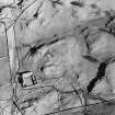
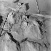
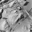
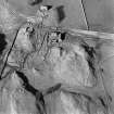
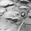
This tower was situated on top of a small rocky knoll, and appears to have been rectangular, measuring 6.2m N-S by 6.8m E-W. Traces of the outer wall face can be seen on the north and east sides, and there is some fallen masonry at the SW angle, but otherwise there are no remains. A courtyard possibly existed to the south of the tower.
Resurveyed at 1/2500.
Visited by OS (WDJ) 9 June 1966
No change to previous field report.
Visited by OS (DWR) 22 February 1973.
EXTERNAL REFERENCE:
Scottish Records Office
GD 207/164/5
Marriage stone in an old farmhouse at Holmains.
Moved to the farmhouse when the Border Tower was pulled down.
The Arms arethose of John Carruthers of Holmains and Helen Grierson. The carving is dated 1665.
Pen and wash sketch by A Clephane.
1877
GD 206/104/97
Mason work at the House of Holmains.
Receipted account for £26.2.8 and measurement of the work done by John Mein.
1732
GD 206/104/94
Slater work at the House of Holmains.
Receipt from John Thomson, slater.
1732
GD 207/104/168 and 189
GD 207/105/25
Wright work at the House of Holmains.
Measurement of work by John Rae and receipted accounts.
1732-1733
GD 207/119/42
Plan.
[Lay out of a garden.]
Drawn on the instructions of John Carruthers of Holmains
N.D.
Note (1997)
NY 0828 7652 NY07NE 7
Listed as tower.
RCAHMS 1997.


