Carzield
Fort Annexe (Roman), Roman Fort (Roman)
Site Name Carzield
Classification Fort Annexe (Roman), Roman Fort (Roman)
Canmore ID 65890
Site Number NX98SE 8
NGR NX 96865 81797
Datum OSGB36 - NGR
Permalink http://canmore.org.uk/site/65890
- Council Dumfries And Galloway
- Parish Kirkmahoe
- Former Region Dumfries And Galloway
- Former District Nithsdale
- Former County Dumfries-shire
NX98SE 8 968 818.
(NX 9687 8180) ROMAN FORT (R) (Site of)
OS 6" map (1948)
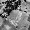
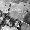
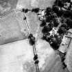
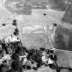
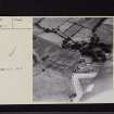
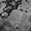
Excavations at Carzield in March 1939 revealed an Antonine cavalry fort measuring some 500 by 560' over the ramparts.
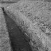
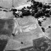
The defences are still visible at the SE angle (together with about 300' of each adjacent side), the NE angle, and a sector of the W side. The fort was surrounded by a turf rampart and a double ditch, with a third ditch on the S side, and there appears to have been a small annexe E of the fort.
E Birley and I A Richmond 1942; J K St Joseph 1951
The fort bath-house was located and planned in 1956, and the apparent location of the civilian annexe was found at NX 9697 8194, in 1952.
A E Truckell 1955, 1956
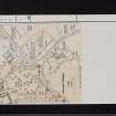
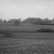
The only surveyable traces of this fort are the scarp of the ditch at the E angle and along the NE and SE sides, and the counterscarp of the ditch on the N angle. The outer edge of the ditch is also traceable on the NE and SE sides. Elsewhere traces are vague and obscured by undergrowth, etc. No visible traces of the civilian annexe were found. Surveyed at 1/2500.
Visited by OS (WDJ) 25 June 1964
Further excavations in 1967-8 among the rubbish spread located a large clay-lined rubbish-pit at NX 968 821. It measured 30' by 5 1/2'. Finds from the Carzield excavations are in Dumfries Museum.
J Williams 1968; A McCracken 1967
Further references to the continuing excavations at the Carzield rubbish pits, and the material found.
M Henig 1969; A E Truckell 1973; J Williams 1976-7
Watching Brief (25 October 2011 - 4 November 2011)
Approximately 90m of the water pipe trench was monitored under this
archaeological watching brief; a series of archaeological features were
recorded and subsequently removed during the course of this trench
excavation.
The archaeological features uncovered may correlate with the projected
layout of Carzield Roman Fort according to previous investigations, and are
therefore potentially Roman in date. These features included the remains
of four separate areas of cobbled surface, three of which coincide with the
position of a projected barrack block on the south-west edge of the main
Roman road through the fort. The most north-westerly of the surfaces lay
within what would have been the central area of the fort and appeared to
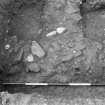
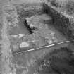
be more refined in its construction. Below the surfaces there were two ditch features extending north-west and south-east, and between the surfaces there were three cut features and a spread. A number of finds have been recovered for further analysis, these include numerous metal fragments (some of which may be hobnails), two possible pieces of tile, one large cast metal object and several pieces of burnt clay.
W Bailie (GUARD archaeology Ltd) November 2011
Watching Brief (3 September 2011 - 21 October 2011)
A watching brief of seven new poles together with the hand-excavation and recording of two trenches at Carzield Roman Fort was carried out by GUARD Archaeology Ltd under Scheduled Monument Consent on behalf of Scottish Power Energy Networks. The two trenches were excavated to facilitate the installation of power lines below ground at Carzield Farm, Carzield House and Glebe House, all within the scheduled area. Trench 1 revealed a nineteenth/twentieth century track as well as a number of possible earlier linear features including a 5 m wide ditch. Finds included nineteenth/twentieth century ceramics, glass and building materials as well as a number of unidentified metal objects, and most notably two sherds of Samian Ware, a common pottery type used by the Romans. In Trench 2 there were truncated built remains of probable Roman date underlying successive yard surfaces of eighteenth to twentieth century date.
Warren Bailie, GUARD Archaeology 2011 (OASIS ID: guardarc1-119325)
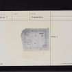
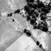
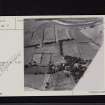
Aerial Photographic Transcription (7 June 2012)


