
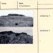
Carn Liath


Broch (Iron Age)
Site Name Carn Liath
Classification Broch (Iron Age)
Alternative Name(s) Dunrobin
Canmore ID 6546
Site Number NC80SE 4
NGR NC 8704 0137
Datum OSGB36 - NGR
Permalink http://canmore.org.uk/site/6546


First 100 images shown. See the Collections panel (below) for a link to all digital images.
- Council Highland
- Parish Golspie
- Former Region Highland
- Former District Sutherland
- Former County Sutherland
NC80SE 4.00 8704 0137.
NC80SE 4.01 NC 8704 0137 Incised Stone
NC80SE 4.02 NC 870 013 Worked Shale
(NC 8704 0137) Carn Liath (NAT) Broch (NR)
OS 6"map, (1964)
Carn Liath is an excavated broch, measuring 30ft internal diameter within a wall 18ft thick at the entrance in the E and 12ft average internal height. The entrance passage is 6ft high and roofed with flags and contains a door check with bar-holes either side with an entrance to a guard cell on the N side.
Within the broch an entrance in the SE arc leads to a mural stair of twenty-one steps. In the middle of the interior is a sunken chamber 8ft long, 6ft broad and 6ft deep; secondary walls encumber the internal area.
Outside the broch the entrance is approached from the S by a covered and flagged passage, 12ft long, 3ft wide and 4 1/2ft high. The outer lintel of this passage bears cup-marks on its upper face (RCAHMS 1911) It also displays linear markings which appear to be artificial (J M Joass 1873) Around the broch are the remains of encircling walls and outbuildings (RCAHMS 1911).
Finds from the broch include mortars and querns, discs of sandstone and shale, steatite cups, a long-handled comb, a whalebone, two bronze plates, a rusted iron blade and fragments of coarse native pottery. Outside the broch was found a cruciform-shaped silver brooch, 3ins long. It is clear that its design is strongly influenced by the Roman tradition, but conversely, the saltire decorating the arm tends to connect it with some of the silverware found at Norrie's Law, Fife (NO40NW 3), silverware dated 7th century. It is possible that the brooch offers a link between provincial Roman design and the symbols characterising the sculptured stones of N and E Scotland (J Anderson 1901 and J Curle 1932). Robertson states that the brooch may be of Roman or native manufacture, but it is not earlier than the 4th century. (A S Robertson 1970)
RCAHMS 1911, visited 1909; T A Wise 1881; J M Joass 1873; J Anderson 1883 and 1901; J Curle 1932; A S Robertson 1970.
Re-surveyed at 1:2500.
Visited by OS (E G C) 7 April 1962.
Carn Liath (name verified), a broch situated on a raised beach and approached by steep slopes on all sides; it is basically as described by the RCAHMS (RCAHMS 1911). There has however been some change since their report, due in the main, to deterioration and, in recent years, to tidying up by the DOE; the interior has been cleared out, the sunken chamber filled in and the floor levelled off; the entrance to the guard chamber has been walled up as has the immediate access to the mural stairway, whose approach passage has partially collapsed; the bar holes are no longer evident and the entrance is un-lintelled inward from the door-check; the approach passage from outside the broch is deroofed and the cup-marked lintel (the linear markings on this could suggest Ogham lettering) lies displaced nearby.
Internally, and only readily seen in the E half of the broch is a scarcement 2.2m above present floor level. A secondary wall 0.4m thick, lines inner face of broch wall to scarcement height in the S half; elsewhere, round the inner periphery, it is much reduced and shows signs of recent restoration.
Outside the broch in the NW quarter are remains possibly of an encircling defensive outwork but the general area is confused by later structures of a domestic type which abut onto the broch and clutter its immediate environs.
Visited by OS (J M) 20 November 1975.
Finds from the broch are in Dunrobin Museum (Accession nos: 1868.3-26) and the National Museum of Antiquities of Scotland (NMAS, Accession ns: FR486; GA 105-111)
Information in TS catalogue of Dunrobin museum and NMAS catalogue from A S Henshall.
During a short trial within the Guardianship area the 1972 spoil tip was removed from the E side of the broch and the easterly approach passage was partially cleared. In the latter a well-preserved stepped paving was revealed, flanked and partially overlain by a wall of drystone masonry edged with several courses of dressed blocks. The excavated area has since been consolidated.
P Love 1984.
Excavation prior to consolidation at this site examined outworks to the NW of the broch. Despite thorough Victorian disturbance, a tentative chronology was established for the site. The Bronze Age was represented by a beaker fragment and later cist with food vessel and shale washer necklace. Pre-broch settlement, shown by post holes, predated the construction of the broch and attendant ring wall, while later Iron Age activity included the division into outbuildings of the area between the broch and outer wall by the addition of cross walls. A previously unrecorded circuit wall was identified downslope of the main outworks, and the site produced evidence of shale and iron working.
P Love 1986.
Further excavation took place in 1987, in parallel with masonry consolidation. A semi-circular stake defined feature was found around the Bronze Age cist discovered in 1986. This was apparently originally a complete circle, but had been truncated during scarping of the mound prior to the construction of the Iron Age outer wall. The new wall discovered on the outer slope of the broch mound last year was followed round to the N, and was found to be of two-phase construction. The entrance passage of the broch was cleared to the original paved level, and the guard cell and outer 'dog kennel' at the entrance were cleared of their modern fill prior to consolidation for display.
P Love 1987.
Negatives for Corcoran's 1972 excavations were accessioned in May, 2001.
S Winlow 2001.
Excavation (1984 - 1987)
During a short trial within the Guardianship area the 1972 spoil tip was removed from the E side of the broch and the easterly approach passage was partially cleared. In the latter a well-preserved stepped paving was revealed, flanked and partially overlain by a wall of drystone masonry edged with several courses of dressed blocks. The excavated area has since been consolidated.
P Love 1984.
Excavation prior to consolidation at this site examined outworks to the NW of the broch. Despite thorough Victorian disturbance, a tentative chronology was established for the site. The Bronze Age was represented by a beaker fragment and later cist with food vessel and shale washer necklace. Pre-broch settlement, shown by post holes, predated the construction of the broch and attendant ring wall, while later Iron Age activity included the division into outbuildings of the area between the broch and outer wall by the addition of cross walls. A previously unrecorded circuit wall was identified downslope of the main outworks, and the site produced evidence of shale and iron working.
P Love 1986.
Further excavation took place in 1987, in parallel with masonry consolidation. A semi-circular stake defined feature was found around the Bronze Age cist discovered in 1986. This was apparently originally a complete circle, but had been truncated during scarping of the mound prior to the construction of the Iron Age outer wall. The new wall discovered on the outer slope of the broch mound last year was followed round to the N, and was found to be of two-phase construction. The entrance passage of the broch was cleared to the original paved level, and the guard cell and outer 'dog kennel' at the entrance were cleared of their modern fill prior to consolidation for display.
P Love 1987.
Publication Account (1995)
The broch is built on the edge of a terrace looking out over a fIat coastal strip to the sea. The knoll on which the broch stands may have been artificially steepened in places and is defended by a stone wall round its edge. Within this, and sometimes into this, a series of houses have been built and rebuilt, some perhaps contemporary with the broch, others certainly later. (The site was excavated in the late 19th century and the records are inadequate.)
The broch entrance is on the east and is approached by a stone-walled passage leading from the ourer wall. This passage was once Iintelled over and has checks for a wooden door. The broch entrance has its own set of door checks, here vertical slabs set at right angles to the passage wall, and a bar-hole, and beyond these a door to a chamber on the right. Inside the broch a doorway opposite the entrance opens onto the stairs, which can be climbed to the present top of the wall. This has been grassed over for its protection. A thick secondary facing, now of irregular height, hides much of the inner wall-face; it is the wall of a house constructed out of the broch remains after the highest part of the wall had fallen. In the top of the original wall-face there are traces of a scarcement ledge. Little can be seen of the galleries bur there are some traces high up near the entrance.
Sunk in the fIoor of the broch were three curious round 'chambers', apparently not water cisterns, perhaps storeholes, now filled in. Evidence for the manufacture of beads, rings and bangles from the local shale was found, also iron slag from ironworking. There are finds from the broch in Dunrobin Castle Museum.
Information from ‘Exploring Scotland’s Heritage: The Highlands’, (1995).
Watching Brief (23 January 2007 - 9 February 2007)
NC 870 013 A watching brief was maintained from 23 January–9 February 2007 while contractors excavated a trench along the outside of the existing fence around the perimeter of the guardianship area surrounding the broch. This trench was required to allow the installation of a rabbit-proof fence. The only potentially significant archaeological feature encountered was the stone-capped watercourse seen towards the SW corner of the excavation. This feature, or at least part of it, may be contemporary with the broch, but may be a sign of more recent work to improve drainage in the area S of the broch. It was not disturbed, and it was agreed with the contractors that the installation of the new fence could be carried out without any further excavation in the area. Since this feature was not fully excavated, it was not possible to determine its date. Apart from this structure, no finds or features of archaeological significance were encountered during these works.
Archive to be deposited with RCAHMS.
Funder: Historic Scotland.
OASIS Id: kirkdale1-249641
Publication Account (2007)
NC80 2 CARN LIATH 1 (‘Dunrobin’)
NC/871013 (8704 0137 – GPS).
This solid-based probable broch in Golspie, Sutherland, stands a short distance from the sea on an apparently flat-topped rock knoll which rises from flat ground; it stands on a fertile strip of raised beach which runs along the coast here for several miles. The site is immediately east of the main road and above the old shore line, now a bank nearer to the sea. The name means “the white” or “fair cairn”, a reference to the pile of pale stones that it was before excavation [9, pl. 5] (visited 8 and 22/7/63, in 1971, in 10/7/85 and 21/7/03).
Early descriptions
In 1769 the site was visited by Thomas Pennant when it was evidently much better preserved than it is now. He wrote –
"Not far from Dunrobin is a very entire piece of antiquity of the kind known in Scotland by the name of Pictish Castles, and called here 'Carn Lia' or a grey tower; that I saw was about 130 yards in circumference" (or 62ft in diameter) "round, and raised so high above the ground as to form a considerable mount; on the top was an extensive but shallow hollow; within were three low concentric galleries, at small distances from each other, covered with large stones; and the side walls were about four or five feet thick, rudely made."
Comments on these observations are made below under 'Structural analysis'.
Excavation in 1868
The broch and some of the surrounding outbuildings were cleared out by the third Duke of Sutherland, the owner of the land, in 1868 and, inevitably for that period of antiquarian research, the finds recovered were not related to any clear stratigraphy. A summary of the results was published by Rev. Joass [3]. The site is now under guardianship and the interior was further explored in 1972 by John X W P Corcoran whose untimely death not long afterwards prevented publication of his work. Further excavations were undertaken by Paula Love in 1986 and 1987 [9], mainly to improve the appearance of the visible features but also to establish exactly what the Duke of Suther-land and Corcoran had found (see below).
Much of the wall still stands up to 3.66m (12ft) high, though the faces are lower and it is lower overall at the entrance. Many traces of stone-walled buildings surround the broch and they appeared to be contained within a massive outer wall which has been only partly exposed.
When the author first visited this broch in 1963 it appeared to be much as it had been left after the 19th century explorations, apart from considerable dilapidation in the intervening century. Since that time extensive restoration and reconstruction work has been carried out by the Government agency now known as Historic Scotland and – as is the usual practice in this country – it is rarely possible for the visitor to tell which parts of the monument are original and which have been restored. To compare, for example, the state of the broch stairway in 1963 with its present state is to get a vivid impression of how the site has been altered. Restoration and stabilisation were of course essential; the broch is next to, and clearly visible from, the main road north (the A9), as well as from the nearby railway, and is visited by hundreds if not thousands of people every year.
The primary entrance passage is on the east side and 5.49m (18ft) in length, with several of the outermost lintels in position. Joass gave the height of the passage under the lintels as 2.14m (7ft) and its width is 91cm (3ft) [3, 103]. The door-frame is about 1.53m (5ft) from the exterior and now consists of one rebated check (faced with an upright slab) in the right wall; what looks like a broken-off projecting slab in the opposite wall, and what is presumably a sill stone, are marked on Joass' plan [3, pl. xiv] and both are visible in a photograph taken at about 1900 [4, 117, fig. 3]. In 1909 a bar-hole 69cm (2ft 3in) deep was behind the left check with a socket in the opposite wall [5], but these have now disappeared, having presumably been filled up.
The same early photograph of the inner end of the passage clearly shows its sides extending upwards above the lintels for about 1m, indicating that there was a chamber over the entrance – a characteristic feature of hollow-walled brochs. Indeed Joass' cross- sections through the entrance show this clearly [3, pl. xv, sections A-B and east-F]. No doubt this feature – not specifically mentioned in previous accounts of the site except, briefly, in that of Anderson [4] – was somewhat restored after the original excavations but there is no reason to doubt its existence. At about 1900 all the passage lintels seem to have been in position (again no doubt some had been replaced) and Anderson mentions gaps between them, through which intruders could be attacked from the chamber above.
The 1985 photograph shows just how much damage the restored inner part of the entrance passage has suffered in the intervening years (the large block at lower right in this picture, from which a huge flake has been removed, can be identified in the older photograph). Most of the lintels have gone and the chamber above the entrance is no longer traceable.
A guard cell opens off the right side of the passage, and is reached through a low lintelled doorway behind the main door-frame, by way of a step down into the interior [9]. It measures 3.0m (10ft) by 1.5m (5ft) by 2.4m (8ft) high and its roof was "flatly arches with flags" [3, 103]; in other words it had roof of lintels which were apparently stepped to form a shallow dome [4, pl. xv, section east-F]. These stepped lintels must have formed the floor of the Level 2 gallery which, we know from historical evidence, was once immediately above it. If the gallery joined the chamber over the entrance (which seems at first sight to be very unlikely, but see below) this shallow dome would have restricted access into its inner parts of the Level 2 gallery (there is a similar situation at Mousa: HU42 6).
In 1963 there was visible above the entrance a curious structural feature not specifically mentioned either by Joass or by the Royal Commission. This is a long, rectangular chamber on the present wallhead and crossing the entrance passage about half way down it and it extends to about 4.3m (14ft) on either side of it, following the curve of the wall. Only the lower courses are preserved and such a feature would normally be regarded as a length of the first floor gallery; however its built ends were clearly visible in 1963, suggesting that – unless these ends are the result of modern restoration – that it is not a gallery but some kind of long chamber. It crosses the entrance passage behind the door-checks and could only have been reached by way of the chamber above the passage, which opened into the interior, probably at the height of the scarcement.
However the 1901 photograph appears to show both sides of this upper chamber complete, with no lateral openings leading to this long wallhead feature [4]. It is difficult now to assess the precise nature of these first floor features. The author knows of no comparable closed chamber at other sites, although there are a few examples of first floor galleries connecting with the chamber over the entrance. Restoration work and the grassing-over of the wallhead since 1963 has obliterated most of this first floor feature which, all things considered, is perhaps most likely to be a length of the Level 2 (first floor) gallery to which – its nature being unclear because it had only been partly exposed – ends were added after the 19th century excavation.
At about 9 o'clock (10 o'clock on the 19th century plan) is the doorway to the mural stair, rising as usual to the right; there is no sign of a stair-foot guard cell. There were twenty-one steps preserved in 1909 [5] but about a third of these has since disappeared. Both the stair doorway and the stair itself, roofless in 1963, have since been restored and several stone lintels were replaced over them.
The inner wallface now stands up to 3.05 - 3.66m (10 -12ft) high in places and a well preserved ledge type scarcement, about 15cm (6in) wide, runs round the south-east sector of the wall at a height of about 2.44m (8ft) above the present floor. The Commission gives the height of the ledge as about 1.83m (6ft), and Joass as 1.53m (5ft), above the floor but they were probably referring to the much more obvious secondary wall (below). There do not seem to be any other openings in the interior wallface (although the stretch of secondary walling from about 6 to 9 o'clock might conceal the opening to a mural cell).
Joass discovered two large chambers sunk into the floor. That on the south is near the centre and was then thought to be 2.44m (8ft) deep, 3.36m (11ft) long by 2.14m (7ft) wide; it is built of large upright flags about 1.5m (5ft) high surmounted by dry walling, and it connects with a small subsidiary chamber on the east 91cm (3ft) deep. The positioning of this underground chamber or cellar is curious as one would normally expect a large paved hearth in the middle of a broch central court. There was a third sunken chamber on the north side of the court next to the wall; this was found to be 2.44m (8ft) long, 1.83m (6ft) deep and the same at maximum width. It was built in the same way – of upright slabs facing inwards and surmounted by drystone walling – and a narrow stone slab, 2.44m (8ft) high, stood on its floor at the north end, projecting from the wall into the interior.
Excavations in 1972
The re-excavation of the central chamber by Corcoran in 1972 [9, pl. 3] was described by Paula Love some years later [9]; she also re-exposed the chamber on the north [9, pl. 8]. This work showed that the structure of their walls was not as unequivocal as was suggested by Joass; upright slabs were visible at the base of the drystone walling but the bases of these appeared to be lower than the depth given by Joass. The Duke's diggers had evidently not reached the bottom.
Moreover the lower parts of the chamber proved to have been excavated out of the underlying sand layer (starting 1.20m below broch floor level) which rendered deep re-excavation hazardous. As a result, and because adequate shoring was not available, the work on both chambers was abandoned by Corcoran and the chambers were filled in permanently. Their precise nature thus remains somewhat obscure and the conditions in the central chamber "rendered the interpretation of the structure purely conjectural, save to say that it would have made an unlikely well or cistern (Young 1962, 182)." [9, 159]. Some tentative further suggestions are made below; all these pits in the central court may well be secondary.
Judging from the photograph Corcoran also started to explore the northern sunken chamber but presumably abandoned the work [9, pl. 2, lower]; as noted Love cleared it out properly. He also discovered a paved hearth on the north side of the central court, close to the secondary wall (Ibid.).
For Part 2 of this text see Event ID 1039113.
Publication Account (2007)
NC80 2 CARN LIATH 1 (‘Dunrobin’)
NC/871013 (8704 0137 – GPS).
(...continued from part 1 Event ID 586921)
Clear secondary constructions
These include the wall added around the interior – which was not identified on Joass’ plan – and a number of external buildings and features. The internal secondary wall is about 46cm (18in) thick and runs all the way round the court, with apparently original gaps in it in front of the two doors; after modern consolidation its width varies between about 0.6-1.5m (2.5ft). This was probably the “scarcement” referred to by Joass; 19th century broch excavators often used the same term to describe both a secondary wall and the ledge on the inner face of the primary wall. Extensive restoration has taken place at the stair doorway (which was blocked off in the early '70's [1]) and this has resulted in the primary and secondary masonry of the left side of the stair doorway now being continuous, the assumed straight joint having been obliterated. Likewise the lintels over this doorway have been replaced wrongly, with three superimposed, whereas there was almost certainly a void here; such a feature is suggested – though not absolutely clearly – by Joass’ cross section and is a standard feature of stair doors in other brochs.
Corcoran examined the secondary wall in 1972 and observed that its foundations rested at a higher level than the lips of the central underground chamber and on “a well defined layer of moist charcoal” [9, 159]; the date of this wall relative to the broch was thus confirmed.
He also discovered five previously un-recorded post-holes, on the south and south-west sides of the central court and fairly close to the secondary wall. Two more, much shallower, depressions which might have been post-holes were found in the north sector. These are assumed to be secondary features, apparently because they are “not of the proportions to have supported timber uprights for an upper floor or gallery” [9, 160] but no dimensions were published. Taking account of the thickness of the secondary wall four of the post-holes in the southern arc might have formed part of an irregular arc suitable for some kind of internal wooden roundhouse, though they are certainly not as regular, nor apparently so massive, as the ring of posts inside, for example, Leckie (NS69 2) and Dun an Rhiroy (NH19 3).
Outside the broch there are a number of wallfaces, approximately concentric with the tower, on the north-west arc and some polygonal chambers abutting against the broch wall on the north-east, immediately to the right (north) of the entrance.
An important feature, found at many other brochs, is the secondary passage – with door-frame included – which has been added against the outer end of the entrance [9, pl. 4, left and right]. This door-frame is evidently at the inner end of a long extension east of the main entrance most of which has now disappeared. At the junction with the broch wall another passage turns south from this passage and runs along the outer face of the tower. The usual explanation of such features is that the addition of this new door housing means that, at a later stage in the history of the broch, the primary door had become broken down and useless, probably after the upper works of the tower had been demolished (MacKie 1995). Some of these external features were examined by Love (below).
The recent excavations [9]
There was apparently some unauthorised clearance of the broch interior by a school party in 1971 and this led to fresh excavations by the late John Corcoran in 1972, the results of which have been alluded to above. Shortly afterwards the site was taken into state care. The early death of the excavator prevented him publishing his work although numerous photographs of the features he uncovered are in the National Monuments Record (Corcoran's Day Book (diary of the excavations) is also with the NMRS). New excavations took place in 1984 and 1986-87 in order to find out if any undisturbed deposits remained in and around the broch, and also to make the site more comprehensible to visitors; summaries of Corcoran's discoveries are given [9].
The only new work inside the broch took place in the guard cell, which had been blocked up in the late 1960s because of increasing dilapidation. This was re-exposed and consolidated, and a complete Iron Age pot base was found on the floor (not illustrated in the report). In addition the northern pit in the central court was cleared out [9, pl. 8].
Extensive new excavations were under-taken in the “outbuildings” surrounding the broch. However it was clear that the Victorian diggers had disrupted the stratified deposits over large areas and it was difficult to arrange the structures in their correct relative order [9, 10].
Rock carvings and calendar orientations
One of the several lintels which then roofed the secondary extension of the entrance passage was found to bear three cup-marks on its upper face [3, 104] (these stones cannot now be located). Assuming that this secondary doorway was originally more massive, these lintels would have been covered by masonry and would probably have been invisible before the ruination of the site. Thus it is difficult to be sure whether the later builders attached any importance to the cup carvings. There is some evidence that cup-marks, and even cup-and-rings, were still being carved in the late Bronze and early Iron Ages (Morris 1989, 58 ff.: MacKie and Davis 1989, 142 ff). Presumably this stone had been brought from elsewhere to form part of the roof.
A few years later other lines, presumably pecked, were observed on the same lintel [10]. One group of these consisted of two long, pointed ovals, joined end to end and about 9cm (3.5in) in length with a straight line 4.5cm (1.75in) long below this. When the lintel was still in situ the orientation of these lines was measured with a compass and it then appeared that the straight line pointed due north-south and the ovals north-west and south-east [10]. The discoverer, believing (for unstated reasons) that the broch builders were probably sun-worshippers, surmised that the long ovals indicated the directions of midsummer sunset (in the north-west) and midwinter sunrise. The carved lintel cannot now be located on the site and is doubtless buried.
Assuming that Wise's diagram was based on a rubbing and is therefore accurate, one can measure the angle of the supposed north-west/south-east line in relation to the assumed north/south marker. The angle is close to 312o/132o, presumably in relation to magnetic north. Making allowances for the difference between magnetic and true north in 1880 (when the former was 21o west of the latter) the actual azimuth should be about 3133o/153o. At the latitude of Golspie (almost exactly 58o north) the azimuth of the midwinter sunrise at altitude 0o is now about 141o. Sunrise on the first sixteenth of the solar year before and after the winter solstice (Thom 1967, Table 9.1) occurs here on an azimuth of about 133o, much closer to the position indicated by the carving. However whether one can assume such an intention with such evidence is another matter. A pointer to sunrise on the first eighth of the year before and after the winter solstice (Feb. 1st and Nov. 1st) would be more plausible and would have many more parallels in Neolithic monuments (MacKie 2002).
Of course there are no means of knowing whether Wises’s diagram does show magnetic or true north. The author has not yet had an opportunity to measure the Aberdeenshire horizon from Carn Liath, but such an exercise might prove fruitful and might show some plausible horizon markers for calendar dates.
Structural Analysis and Discussion
Pennant's 1769 description makes it clear that two hundred and thirty five years ago Carn Liath looked like the stump of a tower projecting above a heap of rubble. His description of the three “low concentric galleries … covered with large stones” can only refer to superimposed and still lintelled galleries between the outer and inner elements of the hollow wall, which were 4-5ft thick. Since Carn Liath is now known to be a solid-based broch all these galleries must have been upper ones, resting on the solid base. The discovery in about 1868 of a chamber over the broch entrance confirms the diagnosis.
Level 1: the ground level storey contains the entrance passage just north of east and the doorway to the stair (without a guard cell) at 10 o'clock, on the south-west. Simply from the available space it seems possible that there may be an undiscovered intra-mural cell somewhere but specific evidence is lacking.
Levels 2-4: the nature of the first floor (Level 2) gallery is complicated by the existence of what appears to be a long cell running across the entrance passage. If this was a primary feature it is difficult to understand the need for it unless it was designed as two sideways extensions for the chamber over the entrance, but such openings in the sides of the latter were not referred to by Joass. By the time the broch stairway came round from 10 to 6 o'clock it would have risen high above these potential obstructions. It is possible however that, after the upper levels of the broch were in ruins (and the entrance passage perhaps blocked), a long chamber was constructed on the low wallhead at this point. A small such chamber was built into the raised mural galleries, after ruination, at about 1 o'clock at Midhowe and at Gurness in Orkney (HY33 1 and HY32 2).
There were doubtless several tiers of galleries above Level 2 but nothing of these survives.
The central underground chambers: the curious sunken chambers or cellars inside the broch are such an unusual feature that they require some explanation, particularly as their situation would appear to interrupt the course of the ring of posts of any internal roundhouse and the positioning of the standard broch fireplace in the centre. As Joass observed [3, 103] the design of the sides of these chambers – flat orthostats with dry walling on top – strongly resembles some of the chambered tombs further north in Caithness. Unfortunately such a resemblance could not be confirmed from the modern re-excavations which were not completed due to safety considerations, but underground chambers inside brochs which are clearly not wells or cisterns (being cut into sand) are sufficiently unusual to require some kind of explanation.
From the discoveries at Howe in Orkney (HY21 6) we now know that, very occasionally, a broch or broch-like building could be deliberately sited on top of an ancient Neolithic chambered tomb and that a part of that tomb – in this case an underground chamber – was inside the building, open and accessible. The feeling that a succession of Iron Age buildings were put up on this unstable site for primarily religious reasons is very strong at Howe [11].
Much closer geographically to Carn Liath is the broch at Dunbeath (ND13 6), about 42km to the north-east, where there seems to be a very strong likelihood that one chamber of a Neolithic tomb was incorporated into the broch wall and used as an open chamber; if so the rest of the tomb must have been pulled down before the broch was put up, as could also have happened at Howe.
Could the two large underground chambers at Carn Liath therefore be the remains of the underground parts of a now vanished Neolithic tomb, and could this broch therefore have been primarily a religious site as Howe seems to have been? Despite the general similarities with some Caithness tombs – seen in the orthostatic walling surmounted by drystone masonry – it seems improbable for four reasons.
The first is that underground chambers seem to be extremely rare in Scottish Neolithic tombs, so there would surely hardly be two such in the assumed Carn Liath tomb. The second reason is that these particular chambers are not well built, being in part hollowed out of soft sand with single layers of stone revetment forming the sides. The stone-work of Neolithic chambered tombs is generally of extremely high quality (the slabs facing the passage and chambers usually having been freshly quarried) and any underground compartments would surely not have been any less well built, particularly as a jerry-built, below-ground part would surely have compromised the stability of the heavy tomb.
The third reason is that everything about Howe is unusual, especially the design of the 'broch' which was planted on unstable clay foundations and could never have been a high, hollow-walled tower (it had a wall core also partly of clay); there were several signs of wall collapse. Carn Liath by contrast is a classic solid-walled, stone tower broch of the standard kind and – again in contrast to Howe – there is no reason to single it out from all other such except for the underground chambers. The fourth reason follows on from this. In its primary state Carn Liath should have had in its central court a large stone hearth (in the middle) as well as a massive wooden roundhouse resting on a ring of posts (of which there may be some traces) and on the scarcement in the primary wall. The positioning of the underground chambers is incompatible with such a design and indeed an apparently secondary fireplace was found on the north side of the interior [9, pl. 2, upper].
For all these reasons it seems most likely to the author that the deep chambers at Carn Liath are secondary inserts. They may be simpler versions of the deep and elaborate underground, often rock-cut chambers found in many Orkney and Caithness brochs which are usually described as wells. However they are likely to have had a more complex function than water storage (below).
The secondary constructions: the presence of the secondary internal wallface and of the outward extension of the entrance passage implies – judging from analogies with many other sites – that at some stage the high, hollow wall of the broch was taken down (the debris presumably being used to construct the secondary wall which supported the new low roof). The entrance must also have been damaged at some stage since it needed a new door-frame in its outward extension. Since this secondary passage runs through some outbuildings these too may all be secondary, though one cannot be sure about this. Despite the recent excavations we still lack much insight into what these 'outbuildings' were used for.
If the underground chambers were added inside the reduced broch at this stage it is possible that the site then acquired a more ritual function, or that a previous primary such function was enhanced during the secondary occupation. A tiny clue to the nature of such ceremonial activity may be provided by the curious carving on one of the lintels of the secondary entrance passage which rather clearly suggests a concern with the solar calendar, particularly with midsummer and midwinter. Indeed one might conclude that this secondary carving also supports the allocation of the underground chambers to the later phase of occupation of the broch. The fact that Carn Liath is situated on the shore with clear views across the sea to the north coast of Aber-deenshire could confirm that the site was sometimes used as some kind of simple calendar observatory, with long alignments to the uneven, distant horizon to the south-east providing some useful calendar dates. More work needs to be done on this aspect of the site.
The excavations and the finds
Joass [3] describes the deposits inside the broch as consisting of 90cm (3ft) of "unctuous earth" and ash strata resting on the floor and surmounted by 3.05m (10ft) of stony debris. We must assume that much of this 3ft-deep occupation layer accumulated during the secondary occupation but unfortunately no-one thought to make a note of how this deposit related to the base of the secondary wall. The wall above these floor deposits was apparently fire-marked.
The finds [3, pl. xvl] are in the Dunrobin Castle museum and the most important included the following:
Bronze objects included 2 heavy plates with hammermarks on both faces (found near the floor).
Bone objects included 2 long-handled combs, 1 whalebone 'club' and much food refuse.
Stone objects included many hammer-stones, 2 long pestles (inside the broch), 3 mortars (outside), about 12 rotary querns (inside and out), pot lids (in and out), spindle whorls (in and out), 1 possible loom-weight, 1 sandstone slab with pecked concentric rings (on broch floor), 2 small steatite cups (one handled) (inside), many shale rings with diameters of 0.25-3.0in., in all stages of manufacture (inside and out).
Romano-British finds: there was also a silver fibula the ornament on the stem of which is thought to derive from 4th century Roman brooches [5, 392 and 337, fig. 36, nos. 5 and 6]; it may however be later and date to the 7th century [1]. It was found “outside the broch” [6, 392].
Finds made by Corcoran and Love in their excavations are not published in detail. As regards the latter they –
"…were relatively few and generally undistinguished, the more outstanding artifacts having been collected by the Third Duke in 1868. The majority of these are now in Dunrobin Castle Museum, although some have been misplaced. Unfortunately, disturbance on site has meant that few of the finds from recent excavations have been securely stratified. They can only therefore be regarded as representative of activities on site, domestic and industrial, rather than as useful chronological indicators tied into stratigraphy.
Domestic occupations were represented by a variety of artifacts – spindle whorls, bone needles, perforated weights or sinkers, and pottery, the latter predominantly undecorated Iron Age coarseware, with the notable exceptions of the Beaker fragment and Food Vessel. Shale objects were ubiquitous across the area excavated, occurring in such quantities as to indicate that jewellery manufacture was taking place on site. Various stages of production were represented from waste flakes through to roughed-out armlets complete with chisel marks, and finally to the end product, polished beads and rings. As evidenced by the small, undecorated, perforated disc washers from the cist burial, this medium enjoyed a protracted popularity, with local supplies of the raw material outcropping on the beach at Brora, a short distance up the coast.
Iron working was also represented in the form of crucible fragments and numerous lumps of iron slag from both outbuildings and midden. There were few personal objects found however, save for a couple of glass beads, one clear, the other spherical with a decorative whorl design, and the shale washer necklace associated with the Food Vessel burial" [9, 169].
Dimensions (taken by the author in 1963):
Ext. Diam. Internal Diam. Wall prop. %
6-12 o'clock 67.0ft 32.5ft 51.5%
9-3 o'clock 72.0ft 27.5ft 55.6%
Average 69.5ft 30.0ft 53.5%
A fresh survey of the shape of the central court was undertaken in 1971 and showed that the primary wall is almost exactly circular; the radius of the circle which fits it best is 5.10 +/- 0.09m, or 33ft 6in. The difference from the 1963 taped dimension from 9-3 o'clock was probably due to difficulties in distinguishing between the primary and secondary wallfaces at that time.
The wall proportion can now be estimated, using the average overall diameter, at 48.2%.
Sources: 1. NMRS site no. NC 80 SE 4.00: 2. Anderson 1883, 221: 3. Joass 1890: 4. Anderson 1901, 117, fig. 3: 5. RCAHMS 1911a, 91-2, no. 270: 6. Curle 1932, 337-38: 7. Young 1962, 182: 8. Robertson 1970, table 2: 9. Love 1991: 10. Wise 1881: 11. MacKie 1998: 12. Close-Brooks 1995, 12, 134 and 147: 13. Cowley 1999, 71: 14. Armit 2003, 14, 151 and pl. 11.
E W MacKie 2007
Desk Based Assessment (May 2014 - June 2015)
CFA Archaeology Ltd undertook an assessment of the effects on cultural heritage interests of the construction, operation and decommissioning of the Proposed Development, at Crakaig, Highland.
A total of 48 heritage assets have been identified within the Proposed Development site boundary.
Funder: Energised Environments Ltd.
CFA Archaeology
Note (7 February 2015 - 1 November 2016)
The broch known as Carn Liath stands roughly in the centre of a what no appears to be a flat-topped hillock, but the steep flanks between 4m and 5m high, which have been deliberately scarped, mask one enclosing wall extending round the rim of the hillock, otherwise only clearly visible on the NW, while excavations in 1986-7 revealed a second wall lower down the slope on the NE. The inner encloses an area measuring about 40m from NE to SW by about 35m transversely (0.11ha). The broch itself is relatively well-preserved, standing over 3m high and displaying numerous architectural features including the checked entrance with a guard cell on the E, a mural stair, a scarcement and an inserted internal skin of masonry. The area between the foot of the broch and the inner of the outer walls is evidently infilled with numerous structures and an extended entrance passage seems to have been added, leading from the broch outwards to the probable entrance through the outer wall on the ESE. The excavations recovered evidence of occupation and use pre-dating the construction of the broch and the outer walls (Love 1988). The relationship between the outer walls and the broch are unknown.
Information from An Atlas of Hillforts of Great Britain and Ireland – 01 November 2016. Atlas of Hillforts SC2796

