
Following the launch of trove.scot in February 2025 we are now planning the retiral of some of our webservices. Canmore will be switched off on 24th June 2025. Information about the closure can be found on the HES website: Retiral of HES web services | Historic Environment Scotland
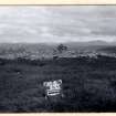
Loch Brora


Broch (Iron Age)(Possible)
Site Name Loch Brora
Classification Broch (Iron Age)(Possible)
Alternative Name(s) Killin
Canmore ID 6475
Site Number NC80NE 3
NGR NC 8673 0761
Datum OSGB36 - NGR
Permalink http://canmore.org.uk/site/6475


- Council Highland
- Parish Clyne
- Former Region Highland
- Former District Sutherland
- Former County Sutherland
NC80NE 3 8673 0761.
(NC 8673 0761) Broch (NR).
OS 6" map, (1964)
The ruins of a broch, now a structureless mass of stones. What was probably the entrance is exposed towards the WNW as is one side of the passage for about 10ft. At the inner end of the wall face, placed at right angles to its line of direction, is a slab standing 5ft 4ins above present level, and 3ft broad by 6ins to 8ins thick, which may have formed one of the jambs of the doorway. A very small portion of the wall is visible for a foot or two of its height on the N and a part of the outer wall of a chamber on the S.
The inner face of the broch wall is in no place exposed and without excavation it is not possible to obtain accurate measurements.
The massive rampart which protects the broch on the W, some 200 yards distant, appears to be of natural formation.
RCAHMS 1911, visited 1909.
The broch is generally as described above, reduced to a massive heap of stones, up to 1.0m in height.
Short portions of the outer face are visible around the periphery giving an overall diameter of 19.6m and a length of inner face is exposed in the ENE indicating a wall thickness of about 4.7m at this point. In the SW the outer wall of a chamber is visible. Connecting this chamber to the outside face of the broch is what appears to be a secondary entrance, 0.9m wide, which is partially exposed in the tumble, suggesting the broch was re-used at a later date.
The only evidence of outworks are two upright slabs on line on the level area W of the broch.
Re-surveyed at 1/10,560.
Visited by OS (E G C) 16 July 1961 and (J B) 11 November 1975.
Field Visit (24 August 1909)
26. Broch, Killin. About 1¼ m. SE. of Oldtown and ¼ m. back from the old road leading thence to Wester Clynekirkton, at an elevation of some 650' above the sea, are the ruins of a broch, now a structureless mass of stones. What was probably the entrance is exposed towards the WNW. by one side of the passage for a distance of about 10'. At the inner end of the wall face, placed at right angles to the line of its direction, is a remarkable slab standing 5' 4" above present level and 3' broad by 6" to 8" thick, which may have formed one of the jambs of the doorway. A very small portion of the outer wall is visible for a foot or two of its height on the N. and a part of the outer wall of a chamber on the S. The inner face of the broch wall is in no place exposed, and without excavation it is not possible to obtain accurate measurements. The massive rampart which protects the broch on the W., some 200 yards distant, appears to be of natural formation.
OS 6-inch map: Sutherland Sheet xcvii.
RCAHMS 1911, visited (AOC) 24th August 1909.
Publication Account (2007)
NC80 7 KILLIN (‘Loch Brora’)
NC/8673 0761
This probable broch stands about 198m (650ft) above the sea and was already a structureless mass of stones in 1909 [2]. The entrance is probably on the west side where one side of a passage is exposed for 3.05m (10ft) . A very large slab – at least 1.63m (5ft 4in) in height, 91cm (3ft) wide and 15 - 20cm (6 - 8in) thick – may be a door-check. Short lengths of the outer wallface are visible, suggesting that the overall diameter is 19.6m, and the wall of a mural cell can be seen on the south-west [1]. There seems to be a secondary doorway connecting this chamber to the exterior [1].
Sources: 1. NMRS site no. NC 80 NE 3: 2. RCAHMS 1911a, 9, no. 26.
E W MacKie 2007

