
Pricing Change
New pricing for orders of material from this site will come into place shortly. Charges for supply of digital images, digitisation on demand, prints and licensing will be altered.
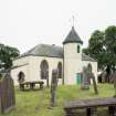
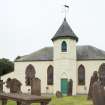
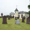
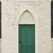
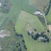
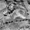
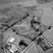
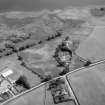
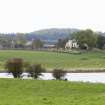
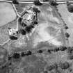
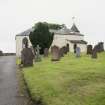
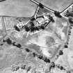
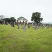
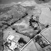
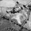
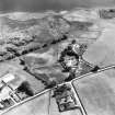
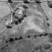
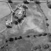
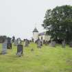
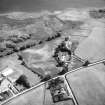
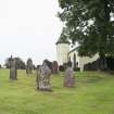
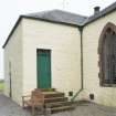
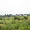
Balmaghie Parish Church And Churchyard


Burial Ground (18th Century), Church (18th Century), Churchyard (18th Century), War Memorial (20th Century)
Site Name Balmaghie Parish Church And Churchyard
Classification Burial Ground (18th Century), Church (18th Century), Churchyard (18th Century), War Memorial (20th Century)
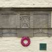
Alternative Name(s) War Memorial Plaque: Roll Of Honour
Canmore ID 64591
Site Number NX76NW 12
NGR NX 72277 66318
NGR Description NX 72277 66318
Datum OSGB36 - NGR
Permalink http://canmore.org.uk/site/64591


- Council Dumfries And Galloway
- Parish Balmaghie
- Former Region Dumfries And Galloway
- Former District Stewartry
- Former County Kirkcudbrightshire
NX76NW 12 72277 66318 and 7228 6629
(NX 7227 6631) Balmaghie Church (NAT)
OS 6" map (1958)
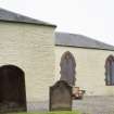
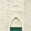
The church of Balmaghie was dedicated to St. Andrew. In early times it belonged to the Priory of Iona but at the Reformation it was in the possession of the Abbey of Holyrood. It was rebuilt in 1794 on the old site, only a small part of the east gable bearing an 18th Century monument, being preserved.
The earlier church was probably pre- Reformation, and to judge by the ground plan traceable in the turf, was probably only about 18 yds long by 12 yds broad.
H Scott 1917; H M B Reid 1895
Balmaghie Church (in normal use) was built in 1794 and bears an inscription to the effect that it was restored in 1894 and 1913. The only trace of the previous church, part of the east gate, a column of mortared masonry 1.0m x 1.3m x 3.5m high, is at NX 7228 6629.
Surveyed at 1/2500.
Visited by OS (WDJ) 13 August 1968
Excavation (August 2020 - October 2020)
NX 72158 66270 The unauthorised excavation of a trench to lay a septic tank outfall pipe within the Scheduled Ancient Monument (CanmoreID: 64591) required a remedial re-excavation to record the location of the trench and any archaeological evidence exposed in the trench sides. The trench was located running from the septic tank’s soakaway pit for 8.5m westwards to the W field boundary and the roadside ditch behind it. Its backfill was emptied to a depth of around 0.8m to the outfall pipe. The trench location was planned and both sections drawn, with the work taking place from August to October 2020. The sections revealed a natural soil profile for 2–3m adjacent to the field boundary, but otherwise a disturbed stratigraphy with a series of mixed layers sloping slightly to the E, and a cut for a 19th or early 20th-century field drain. At the lowest level of the sections, approximately 3m from the W field boundary, the pipe trench had cut through a large mass of apparent ferrous slag or metalworking debris, leaving a 0.4 x 0.2m block in the S section and a slightly smaller block in the N section. Smaller pieces of the same debris were observed in layers to the E as far as the cut for the soakaway pit. Samples of the larger mass were taken for further analysis. No associated dating evidence was found with it.
Archive: NRHE (intended)
David Devereux
(Source: DES Vol 21)
Note (13 March 2024)
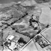
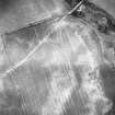
A church and burial ground is depicted on the 2nd edition of the OS 6-inch map (1895). A further enlarged modern burial ground digitised from orthoimagery provided by Bluesky International Ltd. OS 1km map square NX76NW flown on 3 April 2023.
Information from HES (D Watson) 13 March 2024

