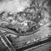
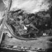
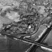
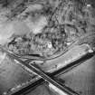
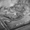
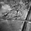
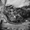
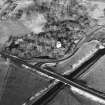
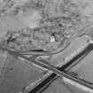
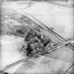
Fleet Canal
Canal (19th Century)
Site Name Fleet Canal
Classification Canal (19th Century)
Alternative Name(s) Gatehouse Of Fleet, Canal; Gatehouse-of-fleet; River Fleet; Fleet Bay; Boat Green; Hannay Street; Alder Pool; Port Mcadam
Canmore ID 63651
Site Number NX55NE 29
NGR NX 5933 5545
NGR Description NX 5953 5591 to NX 5896 5500
Datum OSGB36 - NGR
Permalink http://canmore.org.uk/site/63651
- Council Dumfries And Galloway
- Parish Girthon
- Former Region Dumfries And Galloway
- Former District Stewartry
- Former County Kirkcudbrightshire
NX55NE 29.00 5953 5591 to 5896 5500 LIN 28
The Canal [NAT] (centred NX 593 553)
OS 1:10,000 map, 1993.
NX55NE 29.01 NX 59071 55131 Cardoness Road Bridge (A75)
NX55NE 29.02 NX 5948 5572 Port McAdam
NX55NE 29.03 NX 59211 55315 Cardoness Swing Bridge
NX55SE 41.00 NX 5894 5499 to NX 5868 5464 (General)
NX55SE 41.01 NX 58730 54605 Fleet floodgates and sluice (Cally Bank)
See also:
NX55NE 36 NX c. 598 560 Gatehouse of Fleet, Harbour
NX65NW 23 Centred NX 6052 5649 Gatehouse of Fleet (general)
Extends onto map sheet NX55SE: see also NX55SE 41.00 (NX 5894 5499 to NX 5868 5464).
NMRS REFERENCE
This canal is clearly marked on the 1st edition of the OS 6-inch map (Kirkcudbrightshire 1854, sheet 43) and is still shown on the current edition of the OS 1:10000 map (1993).
(Undated) information in NMRS.
Although it had been possible to navigate the Water of Fleet from the sea up to Gatehouse prior to the canal era, nevertheless in 1824 a small scheme was undertaken to construct a canal. The purpose was to improve navigation as well as to achieve reclamation of land formerly covered over by the high tide. This new cut was carried out by men from Alexander Murray of Broughton's estates in Donegal who were in arrears of rent. He owned Cally Park which was situated on the E shore of the estuary. The waterway, which was 1,400 yards in length, was completed between 17 June and 3 October at a cost of £2,204.
J Lindsay 1968.
(Location cited as NX 59 55 and NX 59 56). Gatehouse-of-Fleet. Before the middle of the 18th century, Gatehouse was essentially a staging-post on the road from Dumfries to Portpatrick, and in consequence its river approaches were probably of little importance. Tucker, writing in 1655, alludes to 'one creek at the foot of the water of Fleet, not worth the nameing', though the presence of the Green Tower motte (NX55NE 13) and Cardoness Castle (NX55NE 11) close to tidewater at the head of Fleet Bay points to a landing-place here with a long history. It is true, however, that Murdoch Mackenzie's Maritime Survey of Ireland and West of Great Britain (1776) marks neither an anchorage in the bay nor the village (NX65NW 23) of Gatehouse itself; and it was only the industrial developments initiated or encouraged by James Murray of Broughton, between about 1760 and 1790, that called for improvement on the lowermost reached of the river. The remains of some of these still survive.
The port was originally at Boat Green (NX 598 560), above which navigation is stopped by a stretch of rapids. Here the river turns sharply from SSE to W, and a ditch which drained the ground W of the present Hannay Street may have helped to keep clear a larger pool than exists today among the reed-beds and saltings. Some 200yds to the W, at Alder Pool [name: NX 595 559], the river curves again, towards the S, and then continues SW for over a mile before debouching into the sands of Fleet Bay. In an unimproved state, the waterway must have been difficult for any but the smallest craft. Access to Boat Green, for example, was obstructed by a rocky shallow; about 120 yds [110m] below Alder Pool a tight meander turned off eastwards, re-entering some 170yds [155.5m] further downstream (NX 59 55 and NX 58 54) another series of meanders existed which are marked 'Track of old river' [name centred NX 88 544] on the OS map surveyed in 1853. To counter these drawbacks Murray effected some straightening and deepening of the channel, and it was no doubt at this time that the meander below Alder Pool was by-passed by the cut marked on the same map as 'Anciernt Canal. Course of old C' [name centred NX 596 558]; while in 1825 'the Canal', which begins about 300yds [274.4m] below its 'ancient' counterpart, was opened to five free passage right down to Fleet Bay. This latter works, 1400yds [1280.5m] and perfectly straight, was executed in the previous summer for Alexander Murray by his factor, Alexander Gray, using a force of some 200 men from the Murray estates in Donegal; the cost, originally estimated at £5000, was reduced to £2,240 by turning the river into a small guide-channel, previously dug, and causing the rush of the water to complete the cut. The canal was crossed near Cardoness Castle (NX 592 553) by a swing-bridge (NX55NE 29.03), of which the masonry abutments survive with the remains of an iron turntable. A final improvement came in 1836-7, with the construction of a quay (NX55NE 29.02) near the lower end of the 'ancient canal' by David McAdam, a shipbroker in Gatehouse who was also harbour-master in 1838; the channel was deepened by about 3ft [0.9m], and the quay accommodated craft too large to reach Boat Green. Port McAdam, as it was named, was last used commercially in the 1930's, and when it was visited little could be seen beyond a stretch of dilapidated quay-face on the right [W] bank, partly overgrown with bushes. It was of drystone construction, with tall frontal timbers attached to the stonework with iron clamps; a few timber bollards also survived. In 1975, however, the quay was repaired, and the site was redeveloped for use by pleasure-craft, by a local group led by Mr W A King-Webster.
In 1794, several vessels of 80 tons and under were owned in Gatehouse, trading chiefly with the W of Scotland and the N of England. At this date the port was accessible to craft of about 50 tons, but by 1844, thanks presumably to the construction of Port McAdam, the upper limit of tonnage had risen to 160 tons.
A Graham and A E Truckell 1977 (visited 1974).
The Fleet Canal extends across parts of 2 map sheets: and NX55SE.
Information from RCAHMS (LKFJ), April 2002.
Linear Account
Fleet Canal - Lin 28. From NX 5953 5591 to NX 5868 5464.
History.
Although it had been possible to navigate the Water of Fleet from the sea up to Gatehouse prior to the canal era, nevertheless in 1824 a small scheme was undertaken to construct a canal. The purpose was to improve navigation as well as to achieve reclamation of land formerly covered over by the high tide. This new cut was carried out by men from Alexander Murray of Broughton's estates in Donegal who were in arrears of rent. He owned Cally Park which was situated on the E shore of the estuary. The waterway, which was 1,400 yards in length, was completed between 17 June and 3 October at a cost of #2,204.
J Lindsay 1968.
Summary.
(See map sheets NX55NE and NX55SE).
This canal (NX55NE 29.00) starts on map sheet NX55NE just S of Gatehouse of Fleet and heads SW towards Fleet Bay. On the 1st edition of the OS 6-inch map (Kirkcudbrightshire) a draw bridge (NX55NE 151) is clearly marked crossing the canal and on the current edition of the OS 1:10000 map (1993) a road bridge (NX55NE 29.01) traverses the waterway shortly before it leaves the map sheet.
The canal (NX55SE 41.00) terminates in Fleet Bay on map sheet NX55SE, with floodgates/sluice (NX55SE 41.01) being clearly marked at its termination on the 1st edition map.


