Scheduled Maintenance
Please be advised that this website will undergo scheduled maintenance on the following dates: •
Tuesday 3rd December 11:00-15:00
During these times, some services may be temporarily unavailable. We apologise for any inconvenience this may cause.
Rutherford's Well
Well (Period Unassigned)
Site Name Rutherford's Well
Classification Well (Period Unassigned)
Canmore ID 63639
Site Number NX55NE 18
NGR NX 58389 56225
Datum OSGB36 - NGR
Permalink http://canmore.org.uk/site/63639
- Council Dumfries And Galloway
- Parish Anwoth
- Former Region Dumfries And Galloway
- Former District Stewartry
- Former County Kirkcudbrightshire
NX55NE 18 58389 56225.
(NX 5838 5622) Rutherfords' Well (NAT)
OS 6" map (1957)
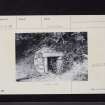
This is a modern stone structure, built over a probably holy well. It is called after Samuel Rutherford, minister of Anwoth 1627-39.
Name Book 1849; I F MacLeod 1969
A natural spring covered by a modern stone structure, feeding a cattle-trough outside. No information could be obtained regarding possible religious associations.
Visited by OS (WDJ) 7 July 1970
Field Visit (24 April 2012)
Although known as Rutherford’s Well, this feature is actually a small artificial pool that is fed by a spring that emanates from the foot of the adjacent W-facing slope and drains away via a trough that sits immediately to the W. The pool measures about 1m in diameter and is contained within a circular stone-walled well-house that has a domed roof (about 1.7m high externally) and a doorway on the S with a lintel and jambs formed from moulded window surrounds taken from elsewhere. The E jamb has been fitted with two simple door hinges; the W jamb has been fitted with a hoop to secure a lock.
The superstructure of the well-house gives every appearance of being relatively modern, perhaps the result of recent repairs, but it contains a partial lining of hand-made bricks very similar to those used in the construction of the walled garden (NS 58313 56104) about 100m to the SW. This garden is probably contemporary with the early 19th century former Anwoth parish manse (NX55NE 105) immediately SE.
Visited by RCAHMS (JRS) 24 April 2012.


