Accessibility

Font Size

100% 150% 200%

Background Colour

Default Contrast
Close Reset

Wigtown, General

Burgh (Medieval), Village (Period Unassigned)

Site Name Wigtown, General

Classification Burgh (Medieval), Village (Period Unassigned)

Canmore ID 63362

Site Number NX45NW 37

NGR NX 43298 55306

Datum OSGB36 - NGR

Permalink http://canmore.org.uk/site/63362

Ordnance Survey licence number AC0000807262. All rights reserved.
Canmore Disclaimer. © Bluesky International Limited 2025. Public Sector Viewing Terms

Toggle Aerial | View on large map

Digital Images

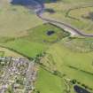
Oblique aerial view centred on Wigtown Parish Church, taken from the SE.
Oblique aerial view centred on Wigtown Parish Church, taken from the SE.Oblique aerial view centred on Wigtown Parish Church, taken from the ENE.Oblique aerial view centred on Wigtown Parish Church, taken from the WSW.Oblique aerial view centred on Wigtown County Buildings, taken from the NW.General oblique aerial view of Wigtown, taken from the SSE.View of North Main Street from SWView of Low Vennel from SView of Town Hall from SView of E end of South Main Street from NWWigtown, General, NX45NW 37, Ordnance Survey index card, RectoView of Low Vennel from SView of Town Hall from SOblique aerial view centred on Wigtown Parish Church, taken from the NW.Oblique aerial view of Wigtown County Buildings, taken from the SE.Oblique aerial view centred on Wigtown County Buildings, taken from the SSE.Oblique aerial view.View of E end of South Main Street from NWGeneral oblique aerial view centred on the village, taken from the SSE.General oblique aerial view of Wigtown, taken from the SE.Oblique aerial view centred on Wigtown Parish Church, taken from the N.Oblique aerial view centred on Wigtown County Buildings, taken from the WSW.View of North and South Main Street showing memorial from EView of North Main Street from EView of North and South Main Street showing memorial from EView of North Main Street from SWView of E end of South Main Street from NWDetail of Town Hall entranceOblique aerial view centred on the village, county building, court house, town hall and church, taken from the SW.Oblique aerial view centred on the village, county building, court house, town hall and church, taken from the SSW.General oblique aerial view of Wigtown, taken from the ESE.Oblique aerial view centred on Wigtown Parish Church, taken from the NNW.General oblique aerial view of Wigtown Harbour, taken from the SE.Oblique aerial view.View of North Main Street from EOblique aerial view centred on the village, county building, court house, town hall and church, taken from the WSW.General oblique aerial view of Wigtown, taken from the E.Oblique aerial view centred on Wigtown Parish Church, taken from the SSW.Oblique aerial view centred on Wigtown County Buildings, taken from the WNW.General oblique aerial view of Wigtown Harbour, taken from the ENE.View looking towards High Street from EView of South Main Street from WView of Town Hall from NWView looking towards High Street from EView of Bank Street from WOblique aerial view centred on the village, county building, court house, town hall and church, taken from the SW.General oblique aerial view of Wigtown, taken from the S.General oblique aerial view of Wigtown, taken from the NW.View of Town Hall from NWOblique aerial view centred on the village, county building, court house, town hall and church, taken from the W.General oblique aerial view centred on the village, taken from the W.General oblique aerial view of Wigtown, taken from the SW.General oblique aerial view of Wigtown, taken from the ENE.General oblique aerial view of Wigtown, taken from the NNE.Oblique aerial view centred on Wigtown Parish Church, taken from the SSE.General oblique aerial view of Wigtown and Bladnoch Golf Course, taken from the SSE.View of E end of South Main Street from NWDetail of Town Hall entranceGeneral oblique aerial view centred on the village, taken from the SE.Oblique aerial view centred on Wigtown County Buildings, taken from the ENE.General oblique aerial view of Wigtown Harbour, taken from the W.View of South Main Street from WView of Town Hall from SView of E end of South Main Street from NWView of Bank Street from W

Administrative Areas

  • Council Dumfries And Galloway
  • Parish Wigtown
  • Former Region Dumfries And Galloway
  • Former District Wigtown
  • Former County Wigtownshire

Archaeology Notes

NX45NW 37 43298 55306

NX45NW 44 429 555 Wigtown (Epiack or Epiacte, former location of settlement)

See Burgh Survey.

Architecture Notes

EXTERNAL REFERENCE

Wigtown Survey report of the Royal Burgh.

The centre of the Town is described as a square enclosed by buildings with an East and West Port. The County buildings erected in 1862 dominate the houses built in 18th century county style. Windows are often embellished and doorways may have columned porticos. The condition of houses, school and public halls is criticised.

20th century GD 138/2/172

References

MyCanmore Image Contributions


Contribute an Image

MyCanmore Text Contributions