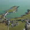
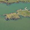
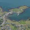
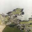
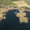
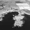
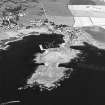
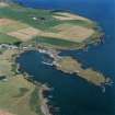
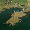
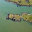
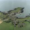
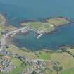
Isle Head
Promontory Fort (Period Unassigned)
Site Name Isle Head
Classification Promontory Fort (Period Unassigned)
Alternative Name(s) Isle Of Whithorn
Canmore ID 63098
Site Number NX43NE 8
NGR NX 4803 3605
Datum OSGB36 - NGR
Permalink http://canmore.org.uk/site/63098
- Council Dumfries And Galloway
- Parish Whithorn
- Former Region Dumfries And Galloway
- Former District Wigtown
- Former County Wigtownshire
NX43NE 8 4803 3605.
(NX 4803 3605) Promontory Fort (NR)
OS 6" map (1957)
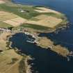
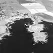
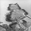
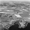
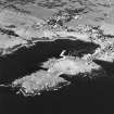
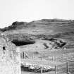
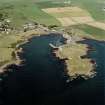
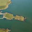
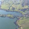
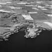
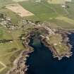
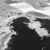
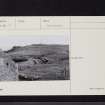
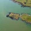
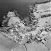
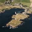
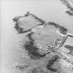
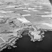
Fort, Isle of Whithorn: The head of the Isle of Whithorn is a rocky peninsula, the central portion of which is roughly triangular, rising 8'-10' above the grassy terrace separating it from the shore. There appears to have been a wall across its seaward end, following the line of a rocky outcop. 170' further on, and immediately in front of the scarp of the central plateau, are defences consisting of two ramparts between three ditches - Crawford, however, states "four lines of defence"- running across the peninsula. The inner ditch is 26' wide, the intermediate, 22' and the outer, 8'. The two inner ramparts measure 20' and 16' at base, and the outer one much less. The amount of stone lying at the bottom of the middle ditch suggests that the inner rampart was either faced with stone or topped by a parapet, while similar debris at the base of the inner scarp indicates a like feature. At the E side of the interior close by the rocks are the remains of a structure, and there are other indications of foundations on the plateau.
(Information from O G S Crawford, undated)
RCAHMS 1912, visited 1911
The seaward part of the promontory is crowned with a small pre-Roman fort with multiple defences on the land- ward side. From the outermost of these ramparts the slope runs down to a slight bank linking the two inlets. This bank is of uncertain date; it is too substantial to be a modern field bank, yet it does not appear to be part of the defences. Surface indications were held to indicate the existence of rectangular buildings on the hill above the chapel (NX43NE 6) (ie the plateau described by the RCAHMS). This area is crossed by natural stone dykes running NE- SW which give the appearance of buried walls. Occasionally these dykes are linked by slight cross banks. A trech 15' x 2'6" was cut across one of these cross banks and carried down to rock. This revealed an irregular spread of soil and rubble of 18" maximum thickness.
Mortar, identical with that used in the medieval masonry of the chapel, was still adhering to many of the stones.
Below this spread was a 12" thick layer of soil which had at one time been cultivated. This layer produced two sherds, one of c.1300 and the other of 15th century date. The soil lay on undisturbed clay which covered the native rock. The cross bank must be accepted as post-Reformation; it was probably formed to facilitate the removal of material from the chapel. The only other feature observed was a hollow quarried out of rock at one end of the trench. This was filled with soil and rubbish and sealed by the cultivation layer. It may have been one of the sources of the local stone used in building the chapel.
Truckell considers that a piece of Dark Age type clay mould, found by Radford when excavating at the Chapel, probably came from this promontory site.
C A R Radford 1957; A E Truckell 1963
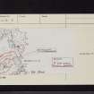
On the promontory at the head of the Isle of Whithorn is a multivallate fort measuring internally 72m NE to SW by 40m consisting of 3 ramparts and 2 medial ditches with a probable 4th rampart now reduced to a slight scarp. On the seaward side of the promontory are intermittent stretches of rubble linking and utilising natural outcrops of rock and in the SE corner inner and outer faces indicating the footings of a wall up to 3.1m wide. On the levelled summit area are slight indications of rubble walling and artificial scarping on the S and E sides and in the NE corner are the possible remains of a hut circle 6.0m in diameter. There no definite indications of an entrance, but the most likely access to the fort would be from the W side.
Resurveyd at 1/2500.
Visited by OS (IA) 17 January 1973
Field Visit (1 September 1951)
This site was included within the RCAHMS Marginal Land Survey (1950-1962), an unpublished rescue project. Site descriptions, organised by county, are available to view online - see the searchable PDF in 'Digital Items'. These vary from short notes, to lengthy and full descriptions. Contemporary plane-table surveys and inked drawings, where available, can be viewed online in most cases - see 'Digital Images'. The original typecripts, notebooks and drawings can also be viewed in the RCAHMS search room.
Information from RCAHMS (GFG) 19 July 2013.
Project (January 2008)
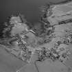
NX 4803 3605 A field survey was undertaken in January 2008 for research and in response to erosion of the ramparts. The work was required for long-term management planning and an assessment of settlement in the late 1st millennium BC and early 1st millennium AD. Isle Head fort appears anomalous among the group of promontory forts in SW Scotland.
A topographic survey was undertaken using a Leica 307 Total Station with Sunscreen computer using Penmap
software. Resistivity and magnetometry surveys were undertaken using a Geoscan Research RM15 earth resistance meter and a Geoscan FL256 Fluxgate Magnetometer.
Archive: University in Bradford (currently). HS and RCAHMS (intended)
Funder: Historic Scotland
Mike McCarthy (University of Bradford), 2008
Resistivity (January 2008)
NX 4803 3605 Resistivity survey (Geoscan Research RM15 earth resistance meter).
Archive: University in Bradford (currently). HS and RCAHMS (intended)
Funder: Historic Scotland
Mike McCarthy (University of Bradford), 2008
Magnetometry (January 2008)
NX 4803 3605 Magnetometry survey (Geoscan FL256 Fluxgate Magnetometer).
Archive: University in Bradford (currently). HS and RCAHMS (intended)
Funder: Historic Scotland
Mike McCarthy (University of Bradford), 2008
Note (20 December 2013 - 21 October 2016)
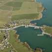
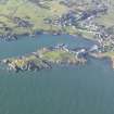
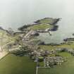
The southernmost tip of the Isle of Whithorn, which was still a tidal island at the beginning of the 19th century, is enclosed by an extensive set of fortifications, the outermost of which is a single wall, now reduced to a stony bank, cutting across on the seaward side of a narrow isthmus that divides the isle into two roughly equal portions. Resting on the outcrops that form this side of the isthmus, which on the SW rise into a cliff over 5m high, this is a natural position to place a rampart, which for a maximum of length of 95m cuts off an area of 1.6ha above the sea-washed rocks of the shoreline, and considerably more if these are included. The ground immediately behind this rampart forms an undulating terrace which has been cultivated in rigs, the plot measuring about 80m by 50m (0.3ha) and bounded by low lynchets on both the NE and the SW. The SE margin of this plot is marked by a 30m wide belt of three more ramparts, which isolate the flat-topped hillock that forms the seaward end of the promontory. The two outer ramparts and their external ditches cut across the promontory from shore to shore, apparently exploiting various ribs of outcrop and intervening gullies in an irregular but roughly concentric line; the central sector of the inner of these ditches is choked with loose stones. To the rear of them yet another ditch can be seen, which has been cut back into the flank of the hillock and seems to swing round its SW end inside the rocky boss known as the Watch Craig. Its central sector is also choked with loose stones, but in this case it seems to have partly collapsed from a rampart extending round the summit of the hillock. This rampart is seldom more than a stony scarp, but is a consistent feature all the way round the margin and encloses an area measuring about 80m from NE to SW by 30m transversely (0.23ha). A complete circuit of defences in a fort in this sort of position is unusual, but here there are also traces of rubble possibly belonging to the second rampart amongst the rocks at the foot of the slope on the southern, seaward, quarter. The position of the entrance is uncertain, one modern path approaching across the defences from the NW. A gap in the innermost rampart on the NE is more probably original, but it is not clear how an entrance way would have reached it through the outer defences.
Information from An Atlas of Hillforts of Great Britain and Ireland – 21 October 2016. Atlas of Hillforts SC0226


