|
Prints and Drawings |
DC 26570 |
Audrey S Henshall |
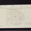
Plan of chambered cairn (KRK 10) on graph paper |
1962 |
Item Level |
|
 |
On-line Digital Images |
SC 2463702 |
Records of the Ordnance Survey, Southampton, Hampshire, England |
King's Cairn', Kirriemore, NX38NE 3, Ordnance Survey index card, page number 1, Recto |
c. 1958 |
Item Level |
|
 |
On-line Digital Images |
SC 2463703 |
Records of the Ordnance Survey, Southampton, Hampshire, England |
King's Cairn', Kirriemore, NX38NE 3, Ordnance Survey index card, page number 2, Verso |
c. 1958 |
Item Level |
|
 |
On-line Digital Images |
SC 2463704 |
Records of the Ordnance Survey, Southampton, Hampshire, England |
King's Cairn', Kirriemore, NX38NE 3, Ordnance Survey index card, Recto |
c. 1958 |
Item Level |
|
 |
On-line Digital Images |
SC 2463705 |
Records of the Ordnance Survey, Southampton, Hampshire, England |
King's Cairn', Kirriemore, NX38NE 3, Ordnance Survey index card, Recto |
c. 1958 |
Item Level |
|
 |
On-line Digital Images |
SC 2463706 |
Records of the Ordnance Survey, Southampton, Hampshire, England |
King's Cairn', Kirriemore, NX38NE 3, Ordnance Survey index card, Recto |
c. 1958 |
Item Level |
|
|
All Other |
551 166/1/1 |
Records of the Ordnance Survey, Southampton, Hampshire, England |
Archaeological site card index ('495' cards) |
1947 |
Sub-Group Level |
|


