|
Photographs and Off-line Digital Images |
DC 11726 P |
Records of North of Scotland Archaeological Services, Orkney, Scotland |
Lu Ness area plan, Burnt mounds I-III and houses I-IV fig 8 GAJ 11, 1984 |
1984 |
Item Level |
|
 |
On-line Digital Images |
SC 2337269 |
Records of the Ordnance Survey, Southampton, Hampshire, England |
West Burra, Luness, HU33NE 7, Ordnance Survey index card, Recto |
c. 1958 |
Item Level |
|
 |
On-line Digital Images |
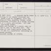
SC 2337270 |
Records of the Ordnance Survey, Southampton, Hampshire, England |
West Burra, Luness, HU33NE 7, Ordnance Survey index card, Recto |
c. 1958 |
Item Level |
|
 |
On-line Digital Images |
SC 2337271 |
Records of the Ordnance Survey, Southampton, Hampshire, England |
West Burra, Luness, HU33NE 7, Ordnance Survey index card, Recto |
c. 1958 |
Item Level |
|
 |
On-line Digital Images |
SC 2337272 |
Records of the Ordnance Survey, Southampton, Hampshire, England |
West Burra, Luness, HU33NE 7, Ordnance Survey index card, Recto |
c. 1958 |
Item Level |
|
|
All Other |
551 166/1/1 |
Records of the Ordnance Survey, Southampton, Hampshire, England |
Archaeological site card index ('495' cards) |
1947 |
Sub-Group Level |
|