Following the launch of trove.scot in February 2025 we are now planning the retiral of some of our webservices. Canmore will be switched off on 24th June 2025. Information about the closure can be found on the HES website: Retiral of HES web services | Historic Environment Scotland
Soulseat Abbey
Abbey (Medieval), Burial Ground (Post Medieval)
Site Name Soulseat Abbey
Classification Abbey (Medieval), Burial Ground (Post Medieval)
Alternative Name(s) Soulseat Abbey And Burial-ground, Mahaar
Canmore ID 61217
Site Number NX15NW 1
NGR NX 10060 58690
Datum OSGB36 - NGR
Permalink http://canmore.org.uk/site/61217
- Council Dumfries And Galloway
- Parish Inch
- Former Region Dumfries And Galloway
- Former District Wigtown
- Former County Wigtownshire
NX15NW 001 1006 5869.
(NX 1006 5869) Site of Soulseat Abbey (NR) (Premonstratensian)
OS 6" map (1957)
The origin and history of Soulseat Abbey are obscure. It may have been founded as a Cistercian house in 1148 but this foundation is uncertain. It was certainly founded for Premonstratensian canons 'somewhat later in the twelfth century', and was possibly the first Premonstratensian house in Scotland.
The last commendator was deposed in June 1572 and the abbey was annexed to the parsonage of Portpatrick in 1630 (D E Easson 1957).
It is said to have been burnt and the stones used in the building of Castle Kennedy (NX16SW 6).
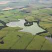
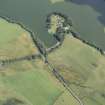
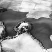
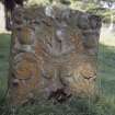
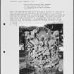
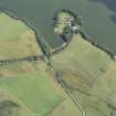
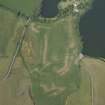
The only remains of the abbey are green mounds marking the foundations, some carved stones and unexcavated remains in a moat or trench which formerly isolated the peninsula on which the abbey stood.
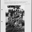
The rose garden of Inch manse occupies the site of the cloister garden (E M H M'Kerlie 1916), and a burial-ground formerly surrounded the abbey. Part of it still remained, and was occasionally used, in 1839, when the oldest inscription was dated 1616. Symson mentions a large stone at the manse, believed locally to have healing properties.
A Symson 1684; New Statistical Account (NSA) 1845; W Macfarlane 1907.
The outline of the cruciform church can still be traced.
C A R Radford 1963
The 'green mounds' mentioned by Easson are undoubtedly those at NX 1008 5871. Here are discernible the very faint outlines of a building, perhaps Radford's 'cruciform church' but considered by the minister at the nearby manse to be the chapter house.
The 'carved stones', 'unexcavated remains' and the moat or trench no longer survive. The burial-ground is no longer in use and the stone dated '1616' was not located. There is no trace of the stone mentioned by Symson and no local knowledge of it or of the dedication of the abbey.
Surveyed at 1/2500.
Visited by OS (RD) 28 February 1968
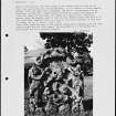
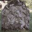
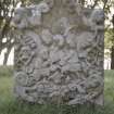
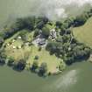
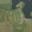
The Premonstratensian abbey of Soulseat was founded by Fergus, Lord of Galloway (died 1161), possibly on the site of a slightly earlier Cistercian foundation; it stood on the promontory projecting from the SW side of Soulseat Loch on the site now occupied by the 19th-century manse. To the E of the manse there are the turf-covered remains of a robbed rectangular building, aligned E-W and measuring about 20.8m by 13m overall, and about 12m to the S a small area of cobbling has been revealed by prospective excavation. On the S side of the building there are a 17th-century grave-slab and a number of 18th-century gravestones. Traces of a ditch (up to 6m broad and 0.2m deep) are visible across the neck of the promontory.
In 1386 the monastery was reputedly in a ruinous and collapsed condition on account of war. In 1630 the abbey lands were secularised, its emoluments were transferred to the new church at Portpatrick, and the parish of Soulseat was united with Inch.
RCAHMS 1987, visited March 1986.
NX 1004 5870 Inspection of the foundation trench for an extension at the northern end of the former manse showed a 0.3m deep deposit of topsoil resting directly on natural gravel. A stonesided feature with a mortar and re-used slate base was exposed towards the NE corner of the trench. This feature, which abutted a rich humic deposit and was sealed by topsoil, is probably an open drain or sunken path associated with an 18th- or 19th-century garden. No medieval deposits were noted.
J Pickin 2005
Measured Survey (20 November 1985)
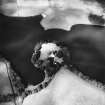
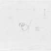
RCAHMS surveyed Soulseat Abbey on 20 November 1985 with plane-table and self-reducing alidade at a scale of 1:500. The plan was later redrawn in ink.
Note (9 March 2022)
The location, classification and period of this site have been reviewed.


