 |
On-line Digital Images |
DP 311543 |
Records of CFA Archaeology Ltd, archaeologists, Musselburgh, East Lothian, Scotland |
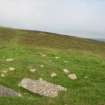
Field survey of planting areas and receptors, SM5520, Barbluie Cairn, looking towards E, from W, Glen App Wind Farm, South of Ballantrae, South Ayrsh |
6/6/2012 |
Item Level |
|
 |
On-line Digital Images |
DP 311544 |
Records of CFA Archaeology Ltd, archaeologists, Musselburgh, East Lothian, Scotland |
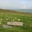
Field survey of planting areas and receptors, SM5520, Barbluie Cairn, looking towards PDA to SE, from NW, Glen App Wind Farm, South of Ballantrae, South Ayrsh |
6/6/2012 |
Item Level |
|
 |
On-line Digital Images |
DP 311545 |
Records of CFA Archaeology Ltd, archaeologists, Musselburgh, East Lothian, Scotland |
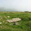
Field survey of planting areas and receptors, SM5520, Barbluie Cairn, looking towards S, from N, Glen App Wind Farm, South of Ballantrae, South Ayrsh |
6/6/2012 |
Item Level |
|
 |
On-line Digital Images |
DP 311546 |
Records of CFA Archaeology Ltd, archaeologists, Musselburgh, East Lothian, Scotland |
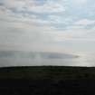
Field survey of planting areas and receptors, SM5520, Barbluie Cairn, looking towards S, from N, wider angle shot, Glen App Wind Farm, South of Ballantrae, South Ayrsh |
6/6/2012 |
Item Level |
|
 |
On-line Digital Images |
DP 311547 |
Records of CFA Archaeology Ltd, archaeologists, Musselburgh, East Lothian, Scotland |
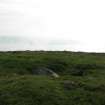
Field survey of planting areas and receptors, SM5520, Barbluie Cairn, looking towards W, from E, wider angle shot, Glen App Wind Farm, South of Ballantrae, South Ayrsh |
6/6/2012 |
Item Level |
|
 |
On-line Digital Images |
DP 311548 |
Records of CFA Archaeology Ltd, archaeologists, Musselburgh, East Lothian, Scotland |
Field survey of planting areas and receptors, SM5520, Barbluie Cairn, looking towards W, from E, close angle shot, Glen App Wind Farm, South of Ballantrae, South Ayrsh |
6/6/2012 |
Item Level |
|
|
Digital Files (Non-image) |
WP 006422 |
Records of CFA Archaeology Ltd, archaeologists, Musselburgh, East Lothian, Scotland |
Environmental Statement: 'Appendix 11.1 - 11.4', Glen App Wind Farm, South of Ballantrae, South Ayrshire |
8/2012 |
Item Level |
|
 |
On-line Digital Images |
SC 2459395 |
Records of the Ordnance Survey, Southampton, Hampshire, England |
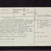
Finnarts Hill, NX07SE 7, Ordnance Survey index card, page number 1, Recto |
c. 1958 |
Item Level |
|
 |
On-line Digital Images |
SC 2459396 |
Records of the Ordnance Survey, Southampton, Hampshire, England |
Finnarts Hill, NX07SE 7, Ordnance Survey index card, page number 2, Verso |
c. 1958 |
Item Level |
|
 |
On-line Digital Images |
SC 2459397 |
Records of the Ordnance Survey, Southampton, Hampshire, England |
Finnarts Hill, NX07SE 7, Ordnance Survey index card, page number 1, Recto |
c. 1958 |
Item Level |
|
 |
On-line Digital Images |
SC 2459398 |
Records of the Ordnance Survey, Southampton, Hampshire, England |
Finnarts Hill, NX07SE 7, Ordnance Survey index card, page number 2, Verso |
c. 1958 |
Item Level |
|
|
All Other |
551 30/27/27/3 |
Records of CFA Archaeology Ltd, archaeologists, Musselburgh, East Lothian, Scotland |
Photographs and caption list of field survey of planting areas and receptors of Glen App Wind Farm, South of Ballantrae, South Ayrshire |
6/6/2012 |
Batch Level |
|
|
All Other |
551 166/1/1 |
Records of the Ordnance Survey, Southampton, Hampshire, England |
Archaeological site card index ('495' cards) |
1947 |
Sub-Group Level |
|
|
All Other |
551 30/27/27 |
Records of CFA Archaeology Ltd, archaeologists, Musselburgh, East Lothian, Scotland |
Archive from cultural heritage assessment of Glen App Wind Farm, South of Ballantrae, South Ayrshire |
11/2010 |
Sub-Group Level |
|