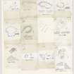
Harly Darlies
Settlement (Iron Age)
Site Name Harly Darlies
Classification Settlement (Iron Age)
Canmore ID 59825
Site Number NT86NW 30
NGR NT 8363 6941
Datum OSGB36 - NGR
Permalink http://canmore.org.uk/site/59825
- Council Scottish Borders, The
- Parish Cockburnspath
- Former Region Borders
- Former District Berwickshire
- Former County Berwickshire
NT86NW 30 8363 6941
(NT 8363 6941) Settlement (NR)
OS 1:10,000 map (1976).
This fort is situated among rock outcrops at an elevation of 743ft OD. It comprises an oval enclosure measuring 145ft by 102ft between the crests of a single earth-and- stone rampart, which is accompanied on the S, where the ground is level, by a ditch, 20ft wide. The rampart is low, except at one point in the NW, where it is about 4ft high. The whole area is covered with heather, and the entrance is uncertain.
RCAHMS 1915, visited 1908.
A settlement, generally as described by the RCAHMS; the entrance appears to be on the N. At least four 'cup- marks' on NW vertical rock faces on the NW of the settlement appear to be water-worn or pebble hollows. There are vague indications of hut platforms in the interior.
Resurveyed at 1:2500.
Visited by OS (CJP) 26 September 1956 and (RD) 8 February 1966.
This sub-rectangular settlement is bounded by a wall 1.6m in thickness), which links a number of rock outcrops, enclosing an area measuring 43m by 23m. It is accompanied by a ditch on three sides, and the entrance probably lay on the ENE. In the interior there are the sites of at least three circular houses.
RCAHMS 1980, visited 1979.
Field Visit (3 November 1908)
51. Fort, Harly Darlies.
On the spot so named at the north-west end of Dowlaw moss, and on the east side of the Dowlaw road, at an elevation of 743 feet above the sea, where the rock outcrops, is an oval enclosure (fig. 22 [DP229127]) measuring from crest to crest interiorly 145 feet by 102, and surrounded by a single rampart of earth and stone, supplemented towards the south, where the ground is level, by a trench. The trench is 20 feet in width and the rampart low, except at one point towards the north-west, where it is about 4 feet high. The whole area is covered with heather, and the entrance is uncertain.
RCAHMS 1915, visited 3 November 1908.
OS Map: Ber., v. NW.
Field Visit (6 August 1950)
This site was included within the RCAHMS Marginal Land Survey (1950-1962), an unpublished rescue project. Site descriptions, organised by county, are available to view online - see the searchable PDF in 'Digital Items'. These vary from short notes, to lengthy and full descriptions. Contemporary plane-table surveys and inked drawings, where available, can be viewed online in most cases - see 'Digital Images'. The original typecripts, notebooks and drawings can also be viewed in the RCAHMS search room.
Information from RCAHMS (GFG) 19 July 2013.
Sbc Note
Visibility: This is an upstanding earthwork or monument.
Information from Scottish Borders Council


