
Pricing Change
New pricing for orders of material from this site will come into place shortly. Charges for supply of digital images, digitisation on demand, prints and licensing will be altered.
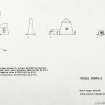
West Meikle Pinkerton Farm, Dovecot


Dovecot (17th Century), Windmill (Medieval) - (17th Century)
Site Name West Meikle Pinkerton Farm, Dovecot
Classification Dovecot (17th Century), Windmill (Medieval) - (17th Century)
Alternative Name(s) Doocot; Windmill
Canmore ID 58793
Site Number NT77NW 1
NGR NT 70276 75677
Datum OSGB36 - NGR
Permalink http://canmore.org.uk/site/58793


- Council East Lothian
- Parish Dunbar
- Former Region Lothian
- Former District East Lothian
- Former County East Lothian
NT77NW 1 70276 75677.
(NT 70276 75677) Dovecot (NR)
OS 6" map (1970)
Dovecot, Meikle Pinkerton: This dovecot, in the garden beside the farm, was extant before 1650. It is of beehive type, 67ft in circumference and 25ft high, with a conical slate roof. The coursed rubble wall, 5ft thick, is partly harled. There are 21 entry holes in a row below the eaves on the S side. In the interior are about 750 stone nests.
J Whitaker 1938; D C Bailey and M C Tindall 1963
This dovecot, as described by the previous authorities, is in a reasonable condition.
Visited by OS (WDJ) 23 March 1966.
Photographic Survey (September 1960 - 1962)
Photographic survey of dovecots in East Lothian by the Scottish National Buildings Record in 1960-1962.

