Pricing Change
New pricing for orders of material from this site will come into place shortly. Charges for supply of digital images, digitisation on demand, prints and licensing will be altered.
The Chesters
Fort (Prehistoric)
Site Name The Chesters
Classification Fort (Prehistoric)
Canmore ID 58517
Site Number NT74NW 7
NGR NT 7401 4749
Datum OSGB36 - NGR
Permalink http://canmore.org.uk/site/58517
- Council Scottish Borders, The
- Parish Fogo
- Former Region Borders
- Former District Berwickshire
- Former County Berwickshire
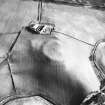
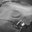
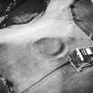
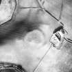
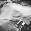
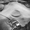
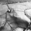
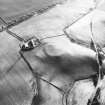
There are the remains of a medieval fort on a spur of land to the west of The Chesters farmsteading.
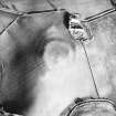
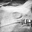
Roughly circular on plan, the fort measures 50m in diameter across the interior, and is enclosed by two earthen banks, divided by a broad ditch. On the north and south sides, the ditch and outer bank are no longer visible on the ground.
This earthwork may have surrounded a settlement or an important administrative site. The interior buildings were probably constructed from timber; these have left few traces, either on the ground or in aerial photographs.
Text prepared by RCAHMS as part of the Accessing Scotland's Past project
NT74NW 7 7401 4749.
(NT 7401 4749) Earthwork (NR)
OS 6"map, (1957).
A sub-circular fort measuring 62.0m NW-SE by 52.0m transversely, situated on a spur with a level approach from the E. The remains, much reduced by ploughing, consist, in the E, of an earthen rampart 1.5m high and a ditch 1.0m deep, with a simple scarp elsewhere. The interior is featureless. The RCAHMS 1915 plan, fig.82 shows a second rampart and ditch on the SW and suggest that it formerly encircled the fort. There is now no trace of this outer defence which is likely to have existed only on the E since elsewhere it would have been well down the natural slopes (D Christison 1895).
Resurveyed at 1:2500.
Visited by OS(JP) 11 December 1970.
This circular earthwork measures 50m in diameter within double banks and a broad medial ditch; on the N and S the ditch and outer bank have been removed by cultivation.
The earthwork is probably of medieval date.
RCAHMS 1980.
Visible on Ordnance Survey large scale vertical air photograph (OS 70/364/113).
Field Visit (5 August 1908)
159. Fort, The Chesters.
This construction (fig. 82) is situated beside the farm of that name and to the west of it, at an elevation of 500 feet above sea-level. The area has been frequently under cultivation, and the defences have been much destroyed. An inner rampart and a ditch, about 65 feet across and about 5 feet deep, remain apparent on the south, continuing in a curve westward for about 100 yards. The enclosure seems to have been circular with an approximate diameter of 200 feet, following on the north and northwest the edge of the bank on the top of which it is situated.
The remains about 1/3 mile north of The Chesters, marked on the O.S. map as a fort, are of doubtful origin.
See Antiquaries, xxix. p. 150.
RCAHMS 1915, visited 15th August 1908.
OS Map: Ber., xxii, NW.
Note (27 January 2016 - 30 May 2016)
This small fortification is situated on a spur projecting WNW immediately to the rear of the recently restored house in the old steading at Chesters. Roughly circular on plan, its defences are relatively massive, comprising two ploughed-down ramparts with a medial ditch forming a belt some 30m deep. On the E, where best preserved, the inner rampart is spread some 15m thick and stands 1.2m high internally and 1.5m above the bottom of the ditch, which is up to 13m in breadth, while the outer rampart is 10m thick and though it rises 2m above the bottom of the ditch, externally it is no more than 0.4m high. James Hewat Craw also depicts an outer ditch on the SE, but aerial photographs show that only the faintest of traces of such a feature can now be detected here. The featureless interior measures about 50m in diameter and though the entrance is not visible it may have lain in the most heavily damaged sector on the SW. The relatively massive scale of the defences has led to the suggestion that this may be an undocumented medieval ringwork.
Information from An Atlas of Hillforts of Great Britain and Ireland – 30 May 2016. Atlas of Hillforts SC4046
Sbc Note
Visibility: This is an upstanding earthwork or monument.
Information from Scottish Borders Council


