Pricing Change
New pricing for orders of material from this site will come into place shortly. Charges for supply of digital images, digitisation on demand, prints and licensing will be altered.
'Dere Street': Border - Newstead - Elginhaugh
Roman Road (Roman)
Site Name 'Dere Street': Border - Newstead - Elginhaugh
Classification Roman Road (Roman)
Alternative Name(s) Woden Law
Canmore ID 58061
Site Number NT71SE 84
NGR NT 7887 1054
NGR Description NT 7887 1054 to NT 7520 1499
Datum OSGB36 - NGR
Permalink http://canmore.org.uk/site/58061
- Council Scottish Borders, The
- Parish Oxnam
- Former Region Borders
- Former District Roxburgh
- Former County Roxburghshire
NT71SE 84 from7887 1054 to 7520 1499 RR 2.
Formerly RR 8f.
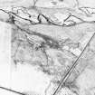
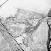
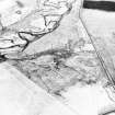
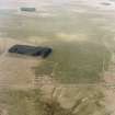
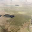
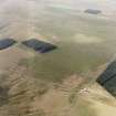
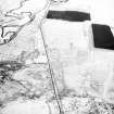
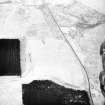
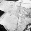
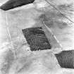
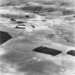
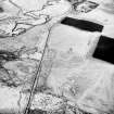
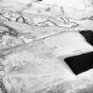
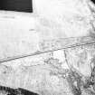
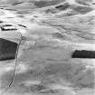
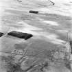
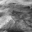
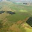
Dere Street crosses the Border once more at a point 200 yds NNE of the summit of Greystone Brae, and 50 yds SSE of the modern gate across the road itself. The road is here a low mound, covered with peat and heather and much worn away on either side by traffic, running in a low peaty flat. As it rises on its northward course, it clings to the rim of the steep slope that descends to the Gaisty Burn, and so avoids the flatter and very wet ground to the E. There are large quarries to the E of the road, which is now terraced along the edge of a slope which rises from W to E at a gradient of about 1 in 5'5. At the point selected for measurement the central road-mound, 16ft wide and up to 3ft high, is flanked on the W by a later track 7ft wide, below which the embankment extends 11ft downhill, the vertical drop being 4ft, to join the natural hillside; on the E side of the mound there is a shallow hollow slope of the terrace, 9ft 6in along its face and 4ft high vertically. The scarped slope is heavily pitted with small quarries in the form of bays opening on to the terrace. The road then crosses a modern drain and bends to NNW. Here it enters upon flatter and wetter ground and its traces become less distinct, although the mound can generally be made out; many quarry-pits line the course on the NE, and there is a traffic-track on the SW; while between spot-levels 1460 and 1449 there are large quarry-pits on the W also. Beyond this last point the mound disappears completely in a deep wet moss, in which the top of the causeway can be felt at 2 1/2 ft to 3 ft below the present surface of the bog. The whole scarp on the SE edge of the moss to E of the road has been heavily quarried to provide material for the causeway, which reappears some 370 yds farther on where it passes between two knolls which both have been also extensively quarried. It is evident that these large quarries produced stone, while many of the smaller pits or bays can have produced little more than brash for the mound.
Between the quarried knolls and the parish boundary E of the summit of Blackhall Hill there are many quarry-pits on the W of the road-mound and a hollow track appears on its NE side. The road mound is 21 ft wide where the boundary fence crosses it on the col.
From the parish boundary, the only trace of Dere Street is the inner edge of a terrace 100 yds long to the E of which deep traffic-tracks are seen at a lower level. The shelf becomes more marked as the road swings round the N side of Blackhall Hill, at an elevation of about 1350 ft, until the scarped cut is as deep as 20 ft. The general form of the terrace is a shelf up to 40 ft in width, in many places a good deal broken up by traffic and water. Below Greyhen Rock a linear earthwork (NT71SE 18) appears both above and below the line of the road, without however revealing the original relationship between them. From the fence that crosses the road almost due N of the summit of the hill the course is practically straight to the neck that joins Blackhall and Hunthall Hills; in the stretch of 300 yds or more lying NE of this point there are plentiful traces of the road-mound as well as a series of small quarry-bays which continue round the shoulder of the hill as it turns south-westwards away from the road.
Shortly before the road makes a sharp turn of seventy degrees, the mound is seen to be 24ft wide. After the turn the road runs along the NE side of Hunthall Hill; the road-mound is here reduced to a confused series of lumps, but quarry-pits and bays in the scarp continue and the inner edge of the terrace is clear. The course is not straight, but has followed the natural bays of the hillside. Just at the turn a linear earthwork (NT71SE 20) crosses the neck from S to N, and where it impinges on the edge of the road it seems to have been scarped in the formation of the terrace along with the adjacent ground. At this same point Dere Street is rejoined by the track that has passed to the S of Blackhall Hill, and also by another alternative track which has crossed the N side of the hill high up, by Greyhen Rock.
A narrow neck joins Hunthall Hill to Woden Law, and at the SE end of this, where Dere Street passes through a linear earthwork (NT71SE 21), the mound again becomes conspicuous, measuring 27 ft in breadth over all and standing about 4 ft above the bottoms of the hollow traffic-tracks that flank it and perhaps exaggerate its apparent height. The relationship of this earthwork to the roads and tracks that run along the neck is obscure, though surface indications suggest that it is at any rate earlier than the hollow tracks. One of these, which flanks the NE side of the Roman causeway along the W lip of Twise Hope, carries a roughly metalled and evidently quite modern roadway; a fresh-looking quarry-pit, which intervenes between the track and the end of one of the mounds, may be regarded as the source of some of this recent metalling. Excavation has shown that one of the three reduced earthworks (NT71SE 21) that cross the neck farther to the NW, is definitely later than the Roman road. For the reasons given under NT71SE 49 it is impossible to discuss the relationship of Dere Street with a fifth earthwork, which lies immediately under Woden Law and now ends on a rocky knoll, with a quarry-pit, just short of the Roman road. Here the road is represented by a rock-cut terrace from which the mound has been washed away, and there is a turn northwards along the edge of Twise Hope. From this turn to the gate in the fence near Woden Streethead the road-mound is largely preserved on a terraced shelf just above the modern track, which itself runs on a lower terrace cut in the clayey hillside, with the purpose of by-passing the washed-out portions of the Roman work, and is now beginning to slip into Twise Hope. At Woden Streethead there are a few quarry-pits, but the mound is washed out and worn away by tracks, reappearing at the head of the descent to Tow Ford. On the descent the mound is well preserved, except where washed out by two lateral cleuchs, the second just SE of the linear earthwork (NT71SE 8). The modern track keeps principally to the NE of the road, but there is an old terraced track on its SW side which now and then impinges upon it and cuts it up, while the crest of the mound is flattened or dished by traffic wear. There are quarry-pits in a rock outcrop just below the road. The gradient averages about 1 in 7 for the first half of the descent, but becomes somewhat less steep at the lower levels, where the road swerves slightly northwards to cross a boggy shelf at right angles and then fades out in the bracken just above the gate. Bottoming, however, and kerbing keep appearing on the same line down the hill almost as far as the Hindhope-Hownam road, and there is no reason to think that the road deviated from this line before reaching the stream. This account of the facts is not at variance with Roy's map, as the discrepancy is due only to a mistake in his delineation of the course of Hangingshaw Sike. No clearer indications of how the Romans approached Kale Water can be obtained on the W bank than on the E, and Roy's small-scale map is of no assistance. To the NW of Tow Ford the haugh is bounded, on its W side, by a cliff some 20 ft high; the modern road mounts this obliquely and then, some 430 yds farther on, turns NW towards Pennymuir Farm. This is the line taken by a massive turf dyke which no doubt, as elsewhere, flanked the drove-road, and 60 yds short of the turn towards Pennymuir there is a fragment of terracing quite suggestive of Roman work. It is thus likely that the modern road perpetuates the Roman line, which, if so, would have made a slight divergence from the general line to overcome a formidable natural obstacle. The Roman and modern lines certainly coincide from the corner to Pennymuir farm, towards which the road rises at a gradient of about 1 in 23, passing close to Pennymuir camps (NT71SE 5), and is still flanked on the SW, by the turf dyke. At the farm the modern road joins the Hownam-Oxnam road, running NE and SW, while Dere Street runs straight on for 800 yds as a green track. It is much broken up by bog-holes, but 200 yds N of the farm there is a 100-yd length of mound 21ft wide. It is clear that the whole of the stretch of 1500 yds lying between NT 7511 1513 and the turn near Tow Ford has been laid out on one and the same bearing.
Visited by RCAHMS 1944-5.
W Roy 1793; RCAHMS 1956.
NT 7887 1054 - NT 7868 1117 Drove road on line. (WDJ)
NT 7868 1117 - NT 7825 1175 Terrace. (WDJ)
NT 7825 1175 - NT 7808 1187 Shelf about 13m wide broken up by traffic and water. (WDJ)
NT 7808 1187 - NT 7762 1177
NT 7762 1177 - NT 7709 1273 Terraced shelf. Drove road on line. (WDJ) NT 7709 1273 - NT 7602 1330 Drove road on line. (WDJ)
NT 7602 1330 - NT 7551 1431 Modern road on line. (WDJ)
NT 7551 1431 - NT 7532 1472 Broken mound evident in places. (EGC)
NT 7532 1472 - NT 7527 1483 Mutilated E scarp of road visible. (RD)
NT 7527 1483 - NT 7520 1499 Mound 7.5m wide, 1.2m high. (BS)
Visited by OS (WDJ) September 1960, (RD) May 1968, (EGC) June 1968, (BS) April 1975.
Field Visit (20 October 1999)
NT71SE 84
Dere Street, Falla Knowe/Pennymuir
Roman Road
NT 7887 1054
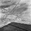
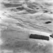
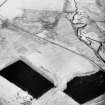
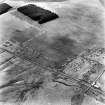
The Roman road was recorded as part of the Kale Water Survey Project and is largely as described previously. The route indicated by the OS is confirmed, and follows a course which curves intermittently across an area of rough pasture while rising towards an elevation on the skyline.
From the public road as far uphill as NT 7520 1500, the course of the agger is uncertain, no stone being visible in the various cuts and trenches that have been made through the raised surface that is apparent. Rock exposures in the small quarry-pits (of apparently recent date) along the W side of the road show that the native rock here is small and loose brash of a type unsuitable for construction. The wall that runs alongside the road on the W is, however, of larger stones, which have presumably been robbed from the road.
Visited by RCAHMS (RJCM), 20 October 1999.
Note (April 2017)
From the Border to the River Tweed
Early medieval charters indicate that 'Dere Street' was the contemporary name given to the Roman road which passed north through the Anglo-Saxon Kingdom of Deira into southern Scotland and then on towards Strathmore. The Romans developed this incrementally into a major element of the military infrastructure during the expansionist phase, in order to facilitate the movement of troops and supplies from about 71 AD. Thereafter, it continued to be used as the main highway into eastern Scotland for centuries, but some sections were eventually abandoned as the economic framework of the countryside evolved. Even where lost, the road's general course can still be traced by the incidence of Roman military installations (albeit often only detectable as cropmarks) or through its influence upon later landscape developments.
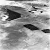
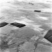
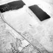
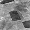
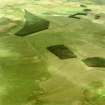
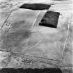
Dere Street enters Scotland above the north facing scarp of the Cheviots, where its’ metalling is intercut by hollow ways and later tracks. This is a zone of rough grazing and so the Roman roadside quarries, the earthworks of the fortlet on Brownhart Law, together with those of the four camps at Pennymuir are all well-preserved, alongside earlier features such as forts and settlements of various types, swaths of cord rig, cross-ridge dykes, standing stones, cairns and other remains, all of which suggest that the general wayfare was already of some antiquity. A short section of the Anglo-Scottish Border runs parallel to it, while in the lowlands south of the R. Tweed, where the road is characterised by long straight lengths, it frequently marks parish and property boundaries reaching back to medieval times. Fragmentary unenclosed rig-systems tell of intensive cultivation during this period, but the road was an important droving route and so a long stretch was subsequently confined by walls in the 18th-19th centuries, as it passed initially through a country characterised by large geometric enclosures of pasture, to another denoted by smaller arable fields and plantations - most of which were laid-off from its line. This evolution goes far to explain why every Roman site between the Pennymuir camps at the foot of the Cheviots and the crossing of the R. Tweed at Newstead is known only from cropmarks - although sometimes an individual field boundary may recall the line of a rampart as at Millside Wood II. Additionally, stone robbing of the fortlet at Cappuck and the fort at Newstead helped reduce and level more resistant strongholds. A minor road marks a short section of the Roman line between the farmsteads of Whitton Edge and Rennieston, while a length south of St Boswells is coincident with the A68.
From the River Tweed to Edinburgh
After crossing the River Tweed, charters and antiquarian accounts, in addition to cropmarks, signify that Dere Street passed up the west side of the Leader Water to the crossing of the Mountmill Burn at Oxton. However, few traces have been observed and the route has yet to be recovered in detail. Remnants of a camp’s defences at Channelkirk remain visible at Oxton, where the road, the wayside quarries and the trackways reappear on the rising ground to its north as they re-enter a zone of rough grazing centred upon Dun Law. This area is characterised by large geometric enclosures that again have been laid-off from its line. North of this hilly country, the road passes back into an improved landscape distinguished by smaller arable enclosures. It is partly overlain by the A68 as it approaches Pathhead, where cropmarks denote a cluster of camps north and south of the Tyne Water. Beyond this its course is uncertain until the North Esk is reached. Passing west of the fort site at Elginhaugh, its line is denoted by the A7 as it continues through the suburbs of Edinburgh to the foot of Liberton Brae, where it becomes lost in the 18th-19th century street plan. The only clues thereafter are cropmarks of two camps at Gogar and a milestone from Ingliston, but it plainly made for the Flavian fort at Camelon, where it has been observed heading north beyond the Antonine Wall.
Further Reading:
Jones, R H 2011 Roman Camps in Scotland (Edinburgh: The Society of Antiquaries of Scotland)
Margary, I. D. 1973 Roman Roads in Britain (3rd ed)
Ordnance Survey 2011 Roman Britain: Historical Map: [6th edition] (Southampton: Ordnance Survey)
RCAHMS 1929 Tenth Report with Inventory of Monuments and Constructions in the Counties of Midlothian and West Lothian (Edinburgh: HMSO)
RCAHMS 1956 An Inventory of the Ancient and Historical Monuments of Roxburghshire (Edinburgh: HMSO)
A. T. Welfare - Archaeology Projects Manager


