Pricing Change
New pricing for orders of material from this site will come into place shortly. Charges for supply of digital images, digitisation on demand, prints and licensing will be altered.
Pleasants
Fort (Iron Age)
Site Name Pleasants
Classification Fort (Iron Age)
Canmore ID 57650
Site Number NT67NE 47
NGR NT 65891 75514
NGR Description Centre
Datum OSGB36 - NGR
Permalink http://canmore.org.uk/site/57650
- Council East Lothian
- Parish Spott (East Lothian)
- Former Region Lothian
- Former District East Lothian
- Former County East Lothian
NT67NE 47 NT 65869 75492
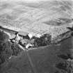
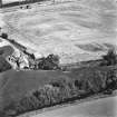
(NT 6584 7548) The crop-mark of a double-ditched enclosure is visible on aerial photographs (106G/Scot/UK121:3439-40, flown 1946; AO/57/296/5-6).
(Undated) information in NMRS.
No trace of the crop-mark can be seen on the ground. The site is at the edge of an arable field, overlooking a ravine.
Visited by OS (RD) 23 March 1966
(NT 6584 7548) Earthwork (NR) (site of)
OS 6" map (1971)
This is one of a number of native enclosed settlements which have been identified in East Lothian from aerial photography. Listed as a fort by the RCAHMS.
J K St Joseph 1967
Scheduled as Pleasants, promontory fort.
Information from Historic Scotland, scheduling document dated 14 October 1993.
Note (31 December 2015 - 18 October 2016)
This fort, which is known only from cropmarks, is situated on the low hill to the SW of Pleasants, occupying the gentle slope dropping down from the crest of the hill on the W to the lip of a steep escarpment above a tributary of the Spott Burn on the S and W. No defences are visible along the edge of this escarpment, but elsewhere the cropmarks reveal a complex arrangement of ditches which probably represent several periods of construction. At its core a belt of three concentric ditches encloses a roughly oval area measuring about 110m from E to W by 60m transversely (0.58ha), and allowing for the presence of an inner rampart on the N and E the interior would have extended to about 0.49ha. The belt of ditches is some 23m deep, the inner and middle ones measuring between 4m and 5m in breadth and the outermost rather less. A fourth ditch on the W also appears concentric, but diverges westwards, probably following the line of the outermost enclosure. The latter is on an altogether larger scale, with a ditch up to 6m in breadth pursuing a sinuous course to take in an overall area measuring about 185m from E to W by 100m transversely, and area of some 1.8ha. Towards the W end of its course, the ditch appears to bifurcates, continuing as double ditches and likely to represent two periods of construction; the fourth ditch also seems to join the general line at this point, though the cropmarks are too diffuse to be certain, and it is from adjacent this same place that a narrow ditch extends WNW across the field for a distance of about 90m, forming a triangular enclosure of about 0.28ha between the edge of the escarpment and the outermost defences of the fort; the ditch terminates just short of the fort defences, implying the presence of a broad entrance, but it is unclear whether this formed an annexe to the fort or was merely utilising its outer rampart as a convenient boundary. No entrances are visible into the fort itself, and apart from what appears to be a small quarry set immediately behind the innermost rampart at the E end, the interior is featureless.
Information from An Atlas of Hillforts of Great Britain and Ireland – 18 October 2016. Atlas of Hillforts SC3905
Aerial Photographic Transcription (22 March 2019)
An interpretative transcription, or mapping, of information on oblique aerial photographs was produced on 22 March 2019.
Note (10 June 2023)
The location, classification and period of this site have been reviewed and changed from FORT (PREHISTORIC).


