Smailholm Tower
Barmkin (Medieval), Tower House (Medieval)
Site Name Smailholm Tower
Classification Barmkin (Medieval), Tower House (Medieval)
Alternative Name(s) Smailholm Tower And Barmkin; Lady Hill; Sandyknowe Tower
Canmore ID 57231
Site Number NT63SW 2
NGR NT 63801 34671
Datum OSGB36 - NGR
Permalink http://canmore.org.uk/site/57231
First 100 images shown. See the Collections panel (below) for a link to all digital images.
- Council Scottish Borders, The
- Parish Smailholm
- Former Region Borders
- Former District Roxburgh
- Former County Roxburghshire
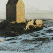
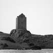
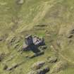
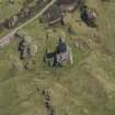
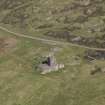
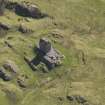
Smailholm Tower is a tower-house of sixteenth-century date which occupies a prominent position on the summit of Lady Hill.
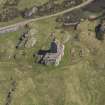
Standing five storeys high, the structure is oblong on plan, with walls over 2m thick. It is built predominantly of whinstone, with contrasting red sandstone dressings used for the corner stones or quoins. It lay within a walled enclosure or barmkin, which still stands over 2m high in places, and which contained a hall and outbuildings such as stables or kitchens. The tower itself was further protected by a pair of gunloops, that is, holes in the masonry to allow the use of hand firearms. One of these is located directly over the entrance.
Inside, the ground floor of the tower-house originally functioned as a store-room. A hatch in the roof allowed goods to be raised and lowered to and from the floor above. The first floor contained the hall, the main public room where the family gathered for meals and where public business was carried out. This room has large windows, which were protected by iron grilles. Bedrooms and private chambers were located on the floors above.
The top level shows evidence of rebuilding in the late sixteenth or early seventeenth century. This alteration was designed to station a watchman, probably in response to a 1587 Act of Council, which directed landowners in the Borders to keep watch night and day, and to burn bales of straw in event of trouble.
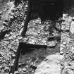
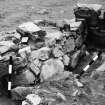
The Scotts, who bought Smailholm in the early seventeenth century, had another, probably two-storeyed, building erected within the barmkin. This was later removed. Excavations carried out between 1979 and 1981 revealed that this later addition was built on the site of an earlier structure, thought to be an outer hall used for entertaining guests, which had an adjoining smaller, private chamber. Opposite the hall was a kitchen, which revealed evidence for the consumption of mutton, beef, fowl and sea fish at the site.
Text prepared by RCAHMS as part of the Accessing Scotland's Past project
NT63SW 2 63801 34671.
(NT 6377 3467) Smailholm Tower (NR).
OS 6" map, Roxburghshire, (1924).
Smailholm Tower. This tower, erected on the highest of a series of parallel rocky outcrops on the summit of Lady Hill, about 5 miles NW of Kelso and the same distance NE of St. Boswells, commands a wide prospect from its elevation of 637ft above sea-level. The rock stands isolated between two larger crags. It rises sheer on the S side for 15ft but on its N side there is a slope interrupted by a natural terrace; its E end is precipitous, while its W end slopes gradually downwards and forms a natural way of access to the summit. The tower stands about the centre of the site. From its E gable and N side a barmkin wall, about 5ft 6in thick, has extended round the edge of the summit; it is now greatly reduced for most of its length, but at the W end of the enclosure it still shows a height of about 12ft in the neighbourhood of the entrance, the position of which is marked only by its bar-hole. The NW corner of the enclosure has evidently been occupied by outbuildings, which extended from the gateway up to the tower. Of these structures only one small fragment is still standing, but evidence for the former existence of another is provided by the weathering of a penthouse roof, which can still be seen on the nearest wall of the tower. The terrace on the N formed a natural lower enclosure, but whether this was utilised when the site was in occupation is uncertain as a rough but stout wall has been built across its access on the W.
The tower itself dates from the early 16th century. It is oblong on plan, measuring 39ft 9in by 32ft over walls averaging 7ft in thickness, and still stands almost entire throughout all five storeys, only the wooden floors being missing (RCAHMS 1956, figs. 536, and 539-41). The top floor was reconstructed either in the 16th or, more probably, in the 17th century, and the relatively late date of the superstructure would account for the parapet-walk being confined to the side walls and for the fact that it does not overhang. The extent of the alteration is not quite clear, although there is some slight evidence to suggest that most of the top storey is an addition and that the tower previously had no parapet-walk on the N side. The purpose served by the present N parapet-walk may be deduced from the provision on it of a seat for a watchman and of a recess for his lantern, this part of the walk looking directly across to Hume Castle about five miles distant in Berwickshire. (RCAHMS 1915). The provision of beacons on the bartizans of Border towers can probably be dated to about the year 1570, at the time when the Earl of Sussex gave orders as follows to the Wardens of the East and Middle Marches of England: "Everie man that hath a castle or towre of stone shall, upon everie fray raysed in the night, give warning to the countrie by fire in the topps of the castle or toure." (Laws of the Marches). For Scotland an Act of Council in 1587 directed the lieges to "keip watch nyght and day, and burn baillis according to the accoustomat ordour observit at sic tymes upoun the bordouris".
The masonry of the tower is random rubble quarried on the site and roughly coursed; but the dressings are of freestone, some of it gray but most of it deep red in colour. The quoins are very regularly built and are alternately long and short. The entrance is a round-arched doorway, heavily chamfered, situated in the S wall. All the windows are small and have chamfered arrises. In the whole building there are only two loopholes, the lower one, set immediately over the entrance, being of "key- hole" shape, while the other is an oval gun-loop facing W on the top storey. Garderobe shoots open from the N wall, serving closets on the first and second floors. At the level of the parapet-walk a string-course runs along the N wall and part of the E gable; it likewise occurs on the S wall, abutting on each side of a window, where its E part seems to have been raised about 2ft while the W stretch is original and returns along part of the W gable. The NW and NE corners bear skew-puts below the levels of the present wall-heads. The principal fireplaces are in the N wall, and their chimney-stack, accordingly, rises within the N parapet, preventing access to the W part of the N walk, which can only be reached by clambering across the roof. The roof itself has probably been flagged above the vault that covers the top floor. Both gables are crow-stepped. The W one must have included a chimney-stack when entire.
The entrance, which had two doors, both opening inwards, admits to a vaulted lobby within the thickness of the wall. On one side of this a newel-stair rises continuously to the top floor, while a doorway directly opposite opens into the lowest compartment of the tower. This was the storehouse and it has had an entresol above it, the whole being covered with a barrel-vault provided with a hatch for convenience in raising stores. A single window facing E lights both floors. It is to be noted that the entresol had no access from the staircase and must therefore have been reached by a ladder from the storeroom. The corbels for its floor are seen on the side walls. At first-floor level the stair gives access to a little angled lobby within the thickness of the wall, which opens into the hall. This has been a good room lit from all sides but the N. The windows, which have window-seats on their jambs, were originally protected by grilles; all have segmental rear-arches and one of them has a locker in one of its jambs. There is a larger locker in the S wall. The fireplace, which is immediately opposite the locker, is chamfered on the jambs, the chamfer stop on one side being a human head and on the other a foliaceous patera. The lintel projects and is supported on corbels. Within the wall-thickness of the NE corner of the hall there is an angular vaulted garderobe having a seat, flue, window, and lamp recess. The large moulded corbels which supported the floor above still project from the side walls.
The second floor shows a similar arrangement, but has no window to the E.The walls of the third floor are thinner than those below. Both gables are built on the outer thickness of the masonry, while the side walls are built on the inner thickness so as to leave room for the parapet-walk. The stair opens directly into the uppermost chamber and immediately opposite its doorway there is another one giving access to the N walk, while a third doorway at the W end of the S wall opens on the S parapet-walk. Beside the staircase there is a window with a deep embrasure, containing a locker and finished externally with a crow-stepped dormer-head, a smaller window being centred in the E gable. A plain fireplace occupies the middle of the gable opposite. This floor is covered with a very irregular barrel-vault (Fig. 539).
Historical Note: In 1546 Sir John Ellerker ran a foray to "Smallam-tower" (Information from the Letters and Papers of Henry VIII, xxi, pt.i No.1279). In 1558 David Hoppringill, son of John Hoppringill of Smailhame, received a charter in respect of the dominical lands -lie Manis de Smailhame, cum turre, fortalicio et manerie, etc. (Reg Magni Sig Reg Scot).
RCAHMS 1956, visited 7 July 1932.
Generally as described above.
Revised at 1/2500.
Visited by OS (RDL) 20 September 1962.
NT 637 346. A number of small test pits were excavated in the vicinity of Smailholm Tower in March 1999 to investigate the stability of the bedrock below the S wall of the tower. In particular, a substantive fissure apparent in the bedrock near the SE corner of the building was causing some concern.
The fissure(s) were shown to be ancient, and to pose no direct immediate threat to the stability of the tower.
Sponsor: Historic Scotland
P Sharman 1999
NT 637 346 A programme of archaeological monitoring was undertaken at Smailholm Tower (NMRS NT63SW 2) in late January 2000, during construction of an extension to the public car park. The shallowness of the excavation prevented any examination of the subsoil within the area, and no occupation material was uncovered. The only visible activities comprised a vaulted drain of uncertain age and a late attempt at improving the car parking along the side of the road.
Sponsor: Historic Scotland
D Stewart 2000
EXTERNAL REFERENCE
Scottish Magazine, Aug 1928 - Article.
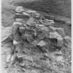
Excavation (1979 - 1981)
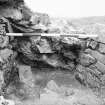
An archaeological investigation was carried out between 1979 and 1981
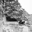
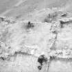
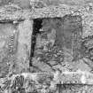
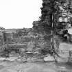
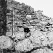
within and around the barmkin, or courtyard, attached to the medieval towerhouse. Excavation was unable to determine more precisely the date of construction of the towerhouse, but it did demonstrate that the original residence of the Pringle laird was altogether more complex than the surviving ruined tower would have us believe. The somewhat cramped and restricted accommodation within the towerhouse had been augmented by a second residential unit, interpreted as a hall and chamber, standing adjacent to the towerhouse in the west courtyard. Another free-standing building, also in the west courtyard, was shown to have been a service office housing the kitchen. The east courtyard seems always to have been open ground, perhaps a garden. In the later 17th century, following the acquisition of the estate by the Scotts of Harden, substantial alterations were made to the place before the exposed summit was finally abandoned as a lordly residence early in the 18th century.
Good and Tabraham 1989
Publication Account (1985)
'Smallam-tower' (Old English smael ham, small village), is recorded in 1546 when a Sir John Ellerker attacked it It is a simple rectangular tower now set beside a one-time mill pond and rising some 17.3 m from the highest of a series of rocky outcrops. The hill gives a fine panorama to the Cheviots, the Lammennuirs, east to the Eildon Hills and west down the Merse.
Five storeys high, with walls over 2m thick, and all its windows small, the tower was primarily defensive. Both the ground and uppermost compartments are barrel-vaulted. There are only two gun-loops-one oval and one keyhole-shaped; the chutes opening out of the north wall served the closets or toilets at first and second-floor level. The top floor had been reconstructed either in the 16th or more probably 17th century; earlier the parapet walk presumably overhung the walls on all sides.
''Everie man that hath a castle or towre of stone shall, upon everie fray raysed in the night, give warning to the countrie by fire in the topps of the castle or towre" . (Laws of the Marches).
Such was required c 1570 and the structure of the present north parapet wall doubtless relates to this law-it has a watchman's seat and a recess for his lantern.
Smailholm was surrounded by a bannkin or enclosing wall, surviving to some extent on the west side where a bar-hole confinns the entrance. 'The north-west part of the enclosure held various outbuildings, rebuilt c1650 for the new owners, the Scotts of Harden.
Information from 'Exploring Scotland's Heritage: Lothian and Borders', (1985).
Excavation (30 March 1999)
A number of small test pits were excavated in the vicinity of Smailholm Tower in March 1999 to investigate the stability of the bedrock below the S wall of the tower. In particular, a substantive fissure apparent in the bedrock near the SE corner of the building was causing some concern.
The fissure(s) were shown to be ancient, and to pose no direct immediate threat to the stability of the tower.
Sponsor: Historic Scotland
P Sharman 1999
Kirkdale Archaeology
Watching Brief (4 April 2012)
NT 6377 3466 An inspection was carried out on 4 April 2012 on a series of shallow foundation trenches for new steps leading to the main entrance through the barmkin at the W end of the site. The excavation of a bedding trench revealed natural soil overlying bedrock. The route into the barmkin enclosure may lie slightly further to the E, near a rough alignment of large rocks, which may well define the edge of an informal approach road.
Archive: RCAHMS (intended)
Funder: Historic Scotland
Gordon Ewart, Kirkdale Archaeology
2012
Sbc Note (15 April 2016)
Visibility: Standing structure or monument.
Information from Scottish Borders Council
Note (4 February 2016)
The entry in the Schedule of Monuments relating to this monument was amended in 2016.
Information from Historic Environment Scotland, 4th February 2016


![Excavation photograph - Room V "G.L. Good's excavation for the day]"](http://i.rcahms.gov.uk/canmore/l/SC01914252.jpg)


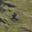










![Excavation photograph - Room V "G.L. Good's excavation for the day]"](http://i.rcahms.gov.uk/canmore/s/SC01914252.jpg)


