Harestanes Cottages
Stone Circle (Neolithic) - (Bronze Age)
Site Name Harestanes Cottages
Classification Stone Circle (Neolithic) - (Bronze Age)
Alternative Name(s) Sillary Knowe
Canmore ID 57102
Site Number NT62SW 24
NGR NT 642 244
Datum OSGB36 - NGR
Permalink http://canmore.org.uk/site/57102
- Council Scottish Borders, The
- Parish Ancrum
- Former Region Borders
- Former District Roxburgh
- Former County Roxburghshire
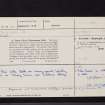
NT62SW 24 64 24.
This circle stood on mining ground, formerly known as 'Sillary Knowe', near Harestanes cottages.
(D Watson 1890).
Enquiries at Harestanes Cottages proved negative. A 91 year old resident had never heard of the name "Sillery Knowe". Perambulation of the area found an alluvial ridge, planted with trees, at NT 643 243. Whether this could be the 'Knowe' in question, however, is conjectural; the position does not agree with Stobie's map or the 1795 estate map.
Visited by OS (WDJ) 23 January 1967.
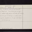
Field Visit (28 March 1947)
Stone Circle, Harestanes (Site).
The stone circle that stood in the vicinity of Harestanes Cottages had been reduced to a single stone by 1845 (NSA 1845, 244), and this stone has since disappeared. No details of the circle are recorded and the evidence for its exact position is contradictory. Stobie's Map of Roxburghshire (1770) marks the site a little to the NE of Harestanes Cottages, while an estate map of 1795 is said to have placed it at the SW corner of this group of buildings (G Watson 1908, 26).
RCAHMS 1956, visited 28 March 1947.
Sbc Note (21 March 2016)
Visibility: This was the site of an archaeological monument, which may no longer be visible.
Information from Scottish Borders Council
Previously also listed under duplicate site NT96SW 510 -CANCELLED. HES (LCK) 11.6.2024
Sbc Note
Ainslie's 1795 Ancrum Estate Map clearly shows the stone circle to the north and east of Harestanes farm steading. This seems to confirm the more conjectural location shown on Stobie's 1770 map of Roxburghshire. On Ainslie's Estate Map, the south-west portion of the stone circle (labelled 'Old City of Refuge a Druids Temple') coincides with a curvilinear enclosure dyke for the steading, and this appears to still have been extant by the time of the OS 1st Edtion 6" map. The circle is depicted as having 13-14 stones, with presumably others missing in a small woodland just inside the curvilinear dyke. The stone circle was removed in the intervening period between the 1795 map and the 1858 OS 1st Edition. On the balance of evidence, the location and shape of the circle shown on Ainslie's map may be accurate. This would place the hypothetical centre of the circle in the area of NT 6424 2449.
Source: John Ainslie's Ancrum Estate Map (1795)


