
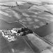
Preston Mains


Cursus (Neolithic)
Site Name Preston Mains
Classification Cursus (Neolithic)
Canmore ID 56228
Site Number NT57NE 29
NGR NT 59792 78060
NGR Description Centre
Datum OSGB36 - NGR
Permalink http://canmore.org.uk/site/56228


- Council East Lothian
- Parish Prestonkirk
- Former Region Lothian
- Former District East Lothian
- Former County East Lothian
NT57NE 29 NT 59920 78080
See also NT57NE 67.
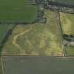
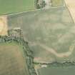
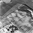
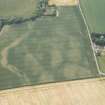
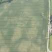
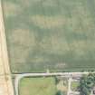
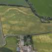
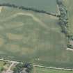
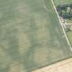
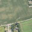
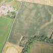
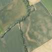
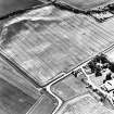
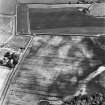
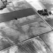
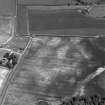
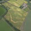
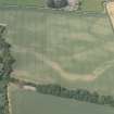
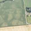
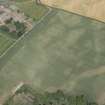
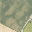
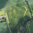
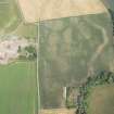
Aerial photography has revealed two linear cropmarks running parallel to one another, about 85m apart, aligned WSW - ENE, across a field 160m S of Preston Mains farmsteading. These were formerly classed as an enclosure, but may represent a possible cursus monument of at least 380m in length. The first linear cropmark runs from NT 5970 7807 to NT 6001 7813 and the second from NT 5965 7799 to NT 6000 7809, and there is a suggestion that they may meet at a rounded terminal at the ENE end. This possible cursus is of similar character to the cropmark of a cursus monument on the same alignment 470m to the WSW (NT57NE 67), and may form parts of the same.
The S linear cropmark intersects an enclosure (NT57NE 100) and a linear cropmark (NT57NE 101).
Information from RCAHMS (KB) 6 April 1999.
Note (7 June 2023)
The location, classification and period of this site have been reviewed.

