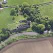
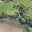
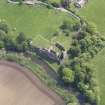
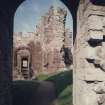
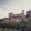
Hailes Castle
Castle (Medieval), Graffiti (19th Century) - (20th Century), Graffiti (21st Century)
Site Name Hailes Castle
Classification Castle (Medieval), Graffiti (19th Century) - (20th Century), Graffiti (21st Century)
Canmore ID 56207
Site Number NT57NE 1
NGR NT 57453 75792
Datum OSGB36 - NGR
Permalink http://canmore.org.uk/site/56207
First 100 images shown. See the Collections panel (below) for a link to all digital images.
- Council East Lothian
- Parish Prestonkirk
- Former Region Lothian
- Former District East Lothian
- Former County East Lothian
NMRS REFERENCE:
NT57NE 1.00 57453 75792 Castle
NT57NE 1.01 57472 75784 Garden
(NT 5746 7579) Hailes Castle (NR) (Remains of).
OS 6" map, (NG).
History: Hailes Castle, in the County of East Lothian, is situated on the south bank of the River Tyne a little over a mile to the west of East Linton and four miles to the east of the Royal Burgh of Haddington. Described in old charters as "the place and fortalice of Hailes," it was built in the 13th century, probably by an Earl of Dunbar and March, and was enlarged at the end of the 14th century by the Hepburns. Unlike the Castle of Dirleton, six miles northward, there is no documentary record to show that Hailes Castle was involved in the Wars of Independence.
The lands of South Halls and North Halls (Hailes) and Traprain, having been forfeited by Hew Gourlay, were held by charter by Adam Hepburn from King David II. Tradition affirms that he was an Englishman who received these lands from the Earl of Dunbar and March as a reward for having rescued that nobleman from the attack of a savage horse. For over two hundred years, until 1567, the Castle belonged to the Hepburns, and the last of this name to own it was James, fourth Earl of Bothwell, who was the principal instigator in the plot which brought about the murder of Darnley, second husband of Mary Queen of Scots. After her abduction near Edinburgh by Bothwell on the 24th April, 1567, she rested at Hailes when being conducted to Dunbar Castle, which was then in Bothwell's hands. The Earl, now Duke of Orkney, became the Queen's third husband.
Amongst other members of the Hepburn family who played a part in the history of their country were Sir Patrick Hepburn of Hailes and his son Patrick who, on the 19th August, 1388, together gallantly saved the banner of Douglas from falling into the hands of the English at Otterburn. It is also of interest to note that in 1363 Sir Patrick obtained a safe-conduct to visit the shrine of St Thomas at Canterbury, and in 1381 he was granted permission by the English King to pass through England with twelve men and twelve horses on the understanding that he was about to proceed to the Holy Land. His son, Patrick, was slain at West Nisbet, near Jedburgh, in a conflict against the Earls of Northumberland and March.
Another Patrick Hepburn, who died in 1482, was created Lord Hailes, and he was succeeded by his son, Patrick, who, in 1488, was belted Earl of Bothwell for services rendered to the Crown. One member of this family wsa Bishop of Moray, another Bishop of Brechin, while John Hepburn, Prior of St Andrews, founded St Leonard's College in the University of St Andrews in 1512, and some years later built the fine precinct wall and towers that enclose d the Cathedral and Priory.
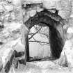
Owing to its situation Hailes Castle was not counted a place of Strategical importance, and played no prominent part in history. It was attacked on Candlemas 1400 by the Earl of March and Hotspur Percy, who, after burning the village of Hailes, and making two unsuccessful assaults on the fortalice, were surprised after sunset by the Master of Douglas with an armed force, and put to flight with the loss of camp and booty. The Castle was besieged and captured in 1443 by Archibald Dunbar, who "slew them that he found thairin." Building operations were in progress in 1507, as in October of that year King James IV visited the Castle and ordered drink silver to be distributed to the masons. In 1532 the Castle was burnt, and there is evidence of this on the arch of the large window of the Chapel. During the Duke of Somerset's incursion into Scotland in 1547 he passed Hailes. Lord Grey of Wilton, Governor of Berwick, when on his way to Haddington, occupied the Castle on the 26th February, 1547-48, and had the Earl of Bothwell's standard delivered to him. We can assume that the Castle was well furnished, as, in a letter to the Duke of Somerset, Wilton says:--"The house is fu the bigness of suche excellent bewtie within (presumably the furnishings) as I have seldom sene any in Englande except the Kinges Majesties and of verie good strengthe." In February and March, 1547-48, Hugh Douglas of Longniddry held the Castle for the English, as the Earl of Bothwell was favourable to their side. This is instanced in a minute of the Privy Council of Scotland when John, Lord Borthwick, was commanded by the Lord Governor (the Earl of Arran) to procure the Castle and "keep the samyn surlie fra our auld ynemies of Ingland and all uthairis" and not to deliver "the said place and fortalice to Patrick Erle Bothwell nor nain uthairie of his name." In July of that year French troops were encamped near the Castle.
After the forfeiture of "Mary's Bothwell" in 1567 the Castle was granted by James VI to Hercules Stewart (a natural son of Lord John Stewart, Commendator of the Priory of Coldingham), and during the greater part of the 17th century it belonged to the family of Seton. After Cromwell's victory at Dunbar the Castle was amongst the local strongholds "quitted" by the Scots; Sir George Seton was then 4,700 in English money for troops quartered on his tenants and for damage caused by them. The Setons sold Hailes about 1700 to David Dalrymple, better known as Lord Hailes. In 1926 the Earl of Balfour, then the owner, transferred the guardianship of the Castle to the Commissioners of HM Works.
To the south of Hailes, a mile distant, is Traprain Law or Dunpender, a fortified site of early date. During excavations on the west flank of this hill, carried out in 1919 by the Society of Antiquaries of Scotland, a remarkable hoard of silver objects was unexpectedly brought to light. The 'Treasure of Traprain', which lay buried for 1400 years, is now to be seen at the Natural Museum of Antiquities, Queen Street, Edinburgh.
Description: There are few castles in Scotland showing masonry of 13th century date. Three are in East Lothian; Dirleton, Yester, and Hailes.
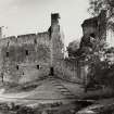
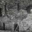
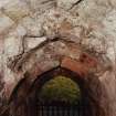
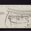
At Hailes the eastern half of the site was the part occupied by the original castle, and the western part by the 14th century addition. The lower part of tower "A" (see plan), the lower parts of the curtain wall extending eastward along the rocky bank of the river, and the vaulted stairway leading to a well are all that remain of the 13th century work. The tower, which was at the NW angle of the original castle, contains a dark, vaulted pit prison provided with a garderobe and air shaft; prisoners were lowered into the prison through a hatch in the roof. The upper part of the tower contained living rooms and the ruble masonry indicates a reconstruction. At a late period the interior was converted into a dovecot. The hall and other apartments appear to have been at the east end of the castle, where there are the remains of a massive outside wall, 7 feet 6 inches thick. Stone moulded details found during the operations indicate a rebuilding of this part of the castle in the early part of the 16th century.
The 14th century work is represented by the west tower "B," the lower part of the curtain wall connecting it with "A," and the massive curtain wall which now ends abruptly just beyond the entrance doorway. The tower has a vaulted basement with living rooms over. In its north wall is a pit prison, almost more horrible than the one in the older tower.
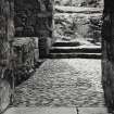
The building (15th century) set between the towers has a vaulted bakehouse in the basement with a chapel over. The chapel had a doorway entered from an external wooden platform, and at the east end is a piscina and the remains of a large arched tracery window, an insertion of early 16th century date. There were buildings against the south curtain wall, and outside, extending along the length of the wall, was a great ditch which is now filled in.
At the end of the 18th century the west tower was complete, and the chapel building was roofed and used as a granary.
J S Richardson 1954.
The remains of the castle are as described above but the outer edge of the field-in ditch, as shown on guide plan, cannot be distinguished on the ground.
Visited by OS (WDJ) 25 October 1962.
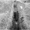
NT 574 757 A watching brief was maintained in July 2003 during the excavation of a series of small shallow pits for a new fence line on the S side of the service range immediately E of the Great Hall block. There were no features or finds of archaeological significance.
Archive to be deposited in the NMRS.
Sponsor: HS
G Ewart 2003
EXTERNAL REFERENCE
National Library of Scotland: uncatalogued manuscripts of General Hutton
No 35 dated 1782 - 1 drawing
Field Visit (3 July 1913)
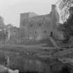
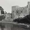
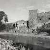
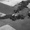
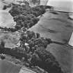
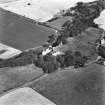
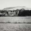
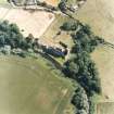
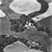
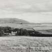
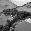
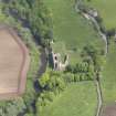
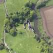
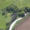
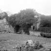
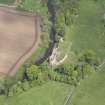
The ruin of this castle stands on the right bank of the River Tyne 1 ½ miles south-west of East Linton; although the bank at this point is precipitous and the castle is elevated considerably above the water, the conformation of the surroundings all but conceals the structure. The site has been conditioned by the extent of the rocky outcrop on which the castle is founded and is bounded and naturally strengthened on the west by a small ravine traversed by a burn, which flows into the Tyne.
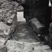
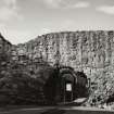
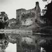
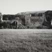
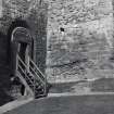
The castle (fig. 133) consists of an outer and inner ward encompassed by walls of enceinte, which abut on an oblong tower situated midway in the north stretch, and in a second oblong tower, which is salient, at the north-west angle; between these towers the curtain is embodied in a later building. The maximum length from east to west is 238 feet and the maximum width from north to south 93 feet. The outer ward lies to the east; at the north-east angle are the fragments of an arched postern. At the junction of the outer and inner wards there are, on the south, indications of a circular tower with a projection external to the wall of enceinte, which to the west of this is salient. In this portion of the wall, where it faces due south, there mains of the arched principal entrance are found. The north wall of enceinte is built on and follows the line of the rocks cresting the riverbank. At the junction of the west tower and the contiguous north wall of enceinte a semicircular headed postern opens on to the river bank, and about 30 feet east of the mid tower a postern stair, which is canted towards the west and has a ribbed and vaulted roof, leads from the enceinte by a straight flight to a landing some 15 feet above the water level. An isolated pier 5 feet out from the landing was intended to support the edge of a drawbridge reached from a movable ladder. The arch of the staircase is low and obtusely pointed; the ribs are chamfered. The masonry of the mid tower, where it has not been rebuilt, is of large cubical blocks of reddish freestone ashlar diagonally axed, but the dressings and mouldings have been polished. The masonry of the curtain wall east of this tower is similar, and similar work can be traced in the remaining portion of this curtain and in the north-west tower, although the tower and the latter portion of the curtain have been largely reconstructed. A heavy basement course returns along the north wall of the mid tower and probably continued along the curtain. The masonry of the curtains on the south and west is dissimilar and inferior, betokening a later period of building.
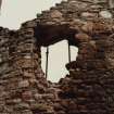
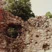
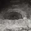
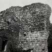
The north-west tower is quadrangular. It has contained five storeys beneath the wall head; the outer walls still stand, although in a ruinous state, for a height of 40 to 50 feet, but the east wall, which faces the ward and in which the entrance would be situated, is fragmentary. The basement storey contains two apartments. The larger, to the south, measures 15 ½ feet by 18 ¾ feet. It has had a vaulted ceiling, below which lay an entresol floor. The smaller chamber 14 feet by 6 ¼ feet, which was probably a ‘pit’, or prison (fig. 134) still retains its vaulted ceiling, in which there is a hatch, but this has been filled in. It is lit by two narrow aperture sin the north and west walls; the northern has a soil outlet in its sill, the other may be more correctly described as a ventilation flue, as the inner sill is at a considerably lower level than the daylight. A narrow bench returns along the lateral walls. A vice or wheel-stair, of which traces can still be seen, occupied the north-east angle. The two H-shaped apertures for crossbow fire in the north wall of this staircase are noteworthy. These are of the latter half of the 14th century. The fireplaces in the south wall of the tower on the upper floors have a bowtel with flanking hollows wrought on jambs and lintel; the lintel is joggle jointed.
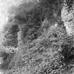
The large tower midway along the north curtain is incomplete in that the south and the greater portion of the east wall are amissing. The remaining walls still stand to a height of 20 feet above the present level of the enceinte with a total height of some 40 feet above the foundation. There appears to be at least one storey beneath the present level of the enceinte filled in with debris and inaccessible. At what is assumed as the first floor level there is a narrow lancet light in the north gable with small square recesses in the rectangular scoinsons; the scoinson arch is obtusely pointed and has a rib. Externally, below this window, there is seen a very beautiful little lancet with a trefoiled head. In the west wall, at first floor level, there are a garderobe and the remnants of a fireplace. Vestiges of two floors are visible above this level, the lower of which has a mural passage and garderobe with soil flue in the north wall and a window in the west wall similar to the north window of the first floor. The exterior of the north gable is divided into two tiers by a string-course, which returns above the head of the window mentioned as on the level of the enceinte; this string has also returned along the west wall and has been stepped, but when the adjoining later building was erected, the string-course was cleared off flush with the wall surface. The masonry below the string-course is of coursed ashlar and above of uncoursed rubble with ashlar dressings, denoting a reconstruction. There are four windows in the gable, one on each of the upper storeys; these are lancet and three have obtusely pointed heads, the fourth using the little lancet with a cusped trefoiled head which has already been mentioned.
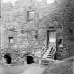
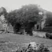
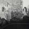
The north curtain and the towers are coeval and date from c. 13th century, but, while the mid tower and that portion of the curtain which lies eastward of it are comparatively untouched on the lower portion at least, the. remainder of the north curtain and the northwest tower have been extensively rebuilt. The later building (fig. 99), three storeys and an attic in height, which lies between the towers, was apparently erected in the 15th century and altered in the 16th century. The basement is barrel-vaulted, and windows are inserted where required in the curtain and in the southern wall. The upper floor, which does not communicate internally with the basement, was entered through a wide semicircular arched doorway, subsequently contracted, in the south wall, and was reached from a wooden forest air against the south wall as evidenced by the projecting corbels for the landing, which are still in situ. The windows have splayed jambs and lintels, the scoinson arches are semicircular and the arrises are chamfered off; the north windows are provided with seats. Internally in the south wall, west of the doorway, there is a recess 12 inches deep and 1 foot 10 inches wide. The head is ogival and is formed in one stone; the sill is hollowed and may originally have projected as a basin, as there is an outlet. This feature is not in situ, and the sill has afterwards been roughly rebated to receive a wooden door, thus forming a little cupboard. There is a precisely similar feature with ogival head, basin and outlet in the 15th century tower of Sauchie near Alva, Clackmannanshire.
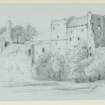
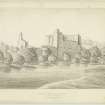
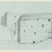
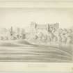
In the Antiquities of Scotland (vol. i., p. 88) by Francis Grose there is given a view of the Castle, drawn in 1787, showing the latest portion roofed and entire, and the upper portions of the towers, which are now destroyed, in a fairly complete state. The mid tower has a parapet and walk and on the north wall of the north-west tower near the north-west angle there is shown a projection borne on four heavy machicolated corbels, which was probably not defensive in purpose but merely an outlet from garderobes.
Since the illustration in Grose was drawn, large masses of masonry have fallen, and the unrestricted growth of vegetation on the walls, coupled with the elements, is slowly disintegrating the remains of this castle, one of a type gradually disappearing through neglect and misuse.
The walls of the north-west tower and curtain have a maximum thickness of 10 and 9 feet respectively. The mid tower on the north-east measures 43 feet by 241 feet over walls 6 and 7 ½ feet thick. The later wing, 53 feet by 23 ¾ feet, has walls 2 feet 10 inches thick, except on the north at the basement level where the curtain is embodied.
HISTORICAL NOTE. The writer of the account of The Expedicion into Scotlande by the Duke of Somerset in 1547 speaks of ‘a proper house and of sum strengthe bylyke, they call it Hayles Castell, and perteyneth to the Erle Bothwell’ (1). In February 1548 Lord Grey of Wilton (2) had the place delivered to him and wrote, ‘The house is for the bignes, of such eexcellent bewtie within, as I have seldom sene any in Englande except the Kinges Majesties, and of verie good strengthe’ (3). Thereafter Hugh Douglas with fifty men held it for the English invaders (4). This was apparently Hugh Douglas of Longniddry (5).
On the Hepburns of Hailes and Earls of Bothwell, see [RCAHMS 1924] lntrod. p. xxiv.
RCAHMS 1924, visited 3 July 1913.
(1) W. Patten in Fragments of Scottish History, Dalyell, p. 38; (2) cf. [RCAHMS 1924] lntrod. p. xxix .; (3) Cal. Scott. Papers i., p. 81; (4) lb. p. 85; (5) Ibid. cf. Nos. 190, 299.
Publication Account (1985)
A strange place to build a castle, perhaps, low down beside a lazy river, particularly with Traprain Law (no. 83), fortified so much earlier, rising up the south. But it is an attractive site - a steep, rocky outcrop above the river, bounded to the west by a small ravine; and not far to the east the river cuts through and falls more rapidly around East Linton. A site of some strategic importance, therefore.
The earliest parts of the castle pre·date the Wars of Independence and may suggest rather, a fortified manor-house comparable to Aydon Castle in Northumberland. In essence, however, it is a 13th-14th century castle of enclosure, comprising two towers (both with pit-prisons) and a curtain wall. A stone stair led through the earlier part of the riverside wall to a well; and possibly extended across a drawbridge,thence by way of a ladder, to the river itself The main gateway survives in the south curtain wall; a little postern or 'back gate' to the east The north range of buildings, between the towers, is mainly 15th century and includes a chapel with tunnel-vaulted basement below.
The castle was heavily involved in the 'Rough Wooing', 1544-45, when the English under Hertford attempted to force through by invasion the marriage of young Mary, Queen of Scots, to the boy prince Edward, later Edward VI. In 1547 Hertford, now Duke of Somerset, writing an account of his Scottish expedition speaks of "a proper house and of sum strengthe bylyke they call it Hayles Castle, and pertayneth to the Erle Bothwell". It was taken by the English in the following year and held for them, with 50 men, by Hugh Douglas (of Longniddry?). Cromwell finally demolished it a century later, in 1650.
Information from 'Exploring Scotland's Heritage: Lothian and Borders', (1985).
Watching Brief (25 July 2003)
Under the terms of its P.I.C. call-out contract with Historic Scotland, Kirkdale Archaeology was asked to undertake archaeological monitoring at Hailes Castle while a series of nine shallow pits were excavated for a new safety rail. The pits were roughly 350mm square and were dug to a maximum depth of 300mm. They were dug at regular intervals of approximately 1m along the S side of the S wall of the ‘storage cellar.’ The latter is part of an E range abutting the hall, and survives as a basement, built into a bedrock terrace overlooking the river to the N of the castle. Immediately to the S of the storage cellar, bedrock is visible, and defines the building platform for structures in the E courtyard area. The new fence is intended to provide a barrier between the courtyard/ bedrock head area, and the floor of the storage cellar, some 3m below.
Pits 1-7 all show how the bedrock at the top of the S bank of the river has been exploited to define the E courtyard surface and building platform. The naturally stepped or terraced slope down to the river’s edge has in turn been exploited as the undercroft level of a series of chambers within a secondary E range coming off the E side of the early hall.
With the exception of Pits 4-7, sensitive deposits were exposed. These comprised infill (between wall (F001) and bedrock) and masonry - including the S face of wall (F001) and the top step of the Watergate stair.
The broken and mixed rubble deposit seen in Pits 4-7 appear to be results of recent repairs.
G Ewart 2003
Sponsor: Historic Scotland
Kirkdale Archaeology
Field Visit (29 October 2017)
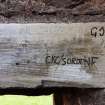
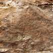
Graffiti, both historic and modern, have been recorded at Hailes Castle. In the hall it mainly comprises names, sets of initials and/or dates, carved into the soft sandstone of the window surrounds, but also elsewhere. Of particular interest at the NE end of the hall is the carving ‘A MELVILLE 1871’, which has been cut into the first floor level plasterwork of the NW wall. It is very likely that this was carved by Arthur Melville (1855-1904), a renowned Scottish artist who in 1871 was a 16 year old apprentice grocer living in nearby East Linton (https://www.nationalgalleries.org/art-and-artists/features/arthur-melville) accessed 20 November 2018).
More recent graffiti also takes the form of incisions in the sandstone surrounds of the windows, as well as elsewhere, but it is not as neatly executed as the 19th century carvings. The recent graffiti also includes the use of marker pens on the wooden lintel of the doorway at the NE end of the SE side-wall.
Visited by HES Survey and Recording (JRS) 29 Oct 2017.
Mortar Analysis (2018)
NT 5745 7579 A programme of landscape, buildings and materials analysis is being carried out at Hailes Castle within the framework of this project. Preliminary buildings analysis reported that the monument displays a range of contrasting and phase specific suites of masonry evidence, including stone dressing techniques, stone emplacement techniques and constructional mortar compositions. Further buildings analysis has concentrated on the W and mid-tower buildings, where relict-rich limestone-lime constructional mortars are exposed in continuous core to bedding contexts. A programme of sampling and landscape survey has subsequently been undertaken to further investigate the character and archaeological potential of these masonry materials.
Archive: NRHE (intended)
Funder: University of Stirling and Historic Environment Scotland
Mark Thacker – University of Stirling
(Source: DES Vol 19)


