Pricing Change
New pricing for orders of material from this site will come into place shortly. Charges for supply of digital images, digitisation on demand, prints and licensing will be altered.
West Addinston Hill
Fort (Prehistoric), Hut Circle(S) (Prehistoric), Settlement (Prehistoric), Sheepfold (Post Medieval)
Site Name West Addinston Hill
Classification Fort (Prehistoric), Hut Circle(S) (Prehistoric), Settlement (Prehistoric), Sheepfold (Post Medieval)
Canmore ID 56057
Site Number NT55SW 5
NGR NT 5232 5363
NGR Description Centred on NT 5232 5363
Datum OSGB36 - NGR
Permalink http://canmore.org.uk/site/56057
- Council Scottish Borders, The
- Parish Lauder
- Former Region Borders
- Former District Ettrick And Lauderdale
- Former County Berwickshire
NT55SW 5 Centred on 5232 5363
(NT 5230 5363) Camp (NR)
OS 6" map (1957)
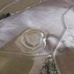
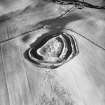
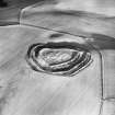
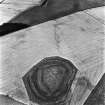
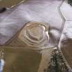
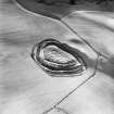
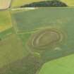
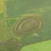
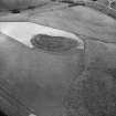
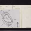
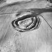
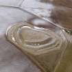
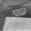
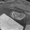
The fort at Addinston consists of an oval enclosure measuring some 280' by 160' within two massive ramparts with external ditches, the outer of which has an upcast mound along part of its course. In the NW both ramparts stand over 15' high. Several circular, grass-grown, stony foundations lie inside the fort, but the most conspicuous, which measures 42' in diameter, may be suspected of being of a later date than the rest and possibly even a fold. The RCAHMS notes two entrances; in front of each is a crescentric depression traversing the roadway - the western is 35' by 8' by 2' deep, and the south-eastern is 27' by 7' by less than 2' deep.
Sources: R W Feachem 1963; RCAHMS 1915; D Christison 1895
The remains of this well-preserved fort are generally as described above. Within are the outlines of two possible hut circles and a circular turf-banked enclosure which is probably a sheepfold.
Revised at 1:2500.
Visited by OS (WDJ) 4 November 1963
This work is situated in a non-defensive situation at the end of a gentle ridge and is generally as described. The interior is covered in tall grass and only the foundations of a turf-banked sheepfold can be seen. No trace can be seen of the crescentric depressions noted by the RCAHMS.
Despite the size of the ramparts, its position suggests that this is more likely to be a settlement.
Visited by OS (SFS) 5 August 1975
Field Visit (11 August 1908)
213. Fort, West Addinston.
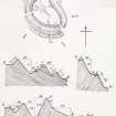
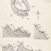
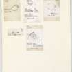
Situated about 550 yards north by east of Addinston farm, at the southern end of Addinston Hill, and at an elevation of some 1000 feet above sea-level, is a fort (fig. 102 [DP 228314]) in plan an irregular oval, with its east side almost straight, measuring in diameter some 285 feet by 168 feet. Two massive ramparts with a trench in front encircle it, while a third runs round the south end, but disappears in the cultivated land on the west. At the highest point, towards the north-west, the inner rampart is 17 feet high, and the outer one 16 feet on the inner and 9 feet on the outer face, while the defences measure 93 feet across from crest to crest. There are two entrances: one towards the south-east, and the other through the middle of the west side. In front of each entrance is a crescentic depression traversing the roadway which crosses the ditches. That at the south-east entrance measures 27 feet from point to point and 7 feet across the centre, and that at the west entrance 35 feet by 8 feet, the depth at the west entrance being 2 feet, and at the south-east somewhat less. In the centre of the interior is a circular enclosure measuring some 42 feet in diameter surrounded by a bank 7 feet across the base and 2 feet high; and on the left of the west entrance a circular foundation with an interior diameter of 32 feet having an entrance facing south-east. To the east of the entrance, and close to the large enclosure, there is another with an interior diameter of 27 feet.
See Antiquities, xxix. p. 131 (plan, illus., and secs.); Christison, p. 141.
RCAHMS 1915, visited 11th August 1908.
OS Map: Ber., xiii. SE.
Note (19 January 2016 - 21 October 2016)
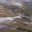
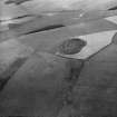
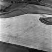
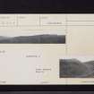
This fort is situated above the farm on the tip of the SE spur of Addinston Hill, dropping down gently from its W end which is set across the crest of the spur. Flattened along its NE flank, where it has been tailored to the underlying topography, it forms an irregular oval on plan and measures about 82m from NW to SE by 50m transversely (0.31ha) within one of the most impressive defences to be found anywhere in the Border counties. Comprising twin ramparts with external ditches, the outer flanked by a counterscarp bank surviving only in the S sector on the downslope side, they not only form a belt some 33m deep, but the inner rampart and ditch have been constructed on a massive scale, particularly where they cut across the crest of the spur on the NW; in this sector the ditch is in excess of 10m in breadth. While the ramparts and ditches have all the appearance of an unitary scheme, an unusual berm formed between the outer lip of the inner ditch and the outer rampart in the southern sector suggests that in its present form either the outer ramparts and ditch are an eccentric addition to the inner circuit, or possibly a more extensive reconstruction of the inner rampart within an earlier fort, reducing the interior at the SE end. A causeway across the inner ditch marks the position of an entrance at the SE end, but it is unclear whether such feature exists at a second gap in the ramparts on the SW. A ring-bank within the NW end of the interior is likely to be the remains of an old sheepfold, but there are traces of the backs of at least three circular platforms cut into the slope on the SW.
Information from An Atlas of Hillforts of Great Britain and Ireland – 21 October 2016. Atlas of Hillforts SC4009
Sbc Note
Visibility: This is an upstanding earthwork or monument.
Information from Scottish Borders Council


