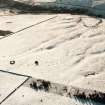
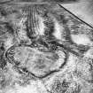
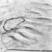
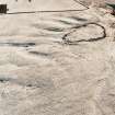
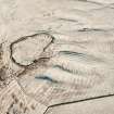
Harefaulds
Cultivation Remains (Period Unassigned), Fort (Prehistoric), Settlement (Prehistoric)
Site Name Harefaulds
Classification Cultivation Remains (Period Unassigned), Fort (Prehistoric), Settlement (Prehistoric)
Alternative Name(s) Haerfaulds
Canmore ID 56006
Site Number NT55SE 14
NGR NT 5745 5005
Datum OSGB36 - NGR
Permalink http://canmore.org.uk/site/56006
- Council Scottish Borders, The
- Parish Lauder
- Former Region Borders
- Former District Ettrick And Lauderdale
- Former County Berwickshire
NT55SE 14 5745 5005.
(NT 5745 5005) Hare Faulds (NAT)
Ancient Settlement (NAT)
OS 6" map (1957)
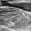
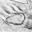
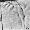
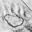
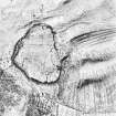
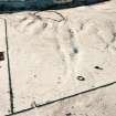
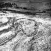
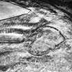
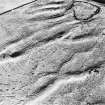
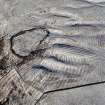
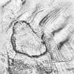
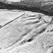
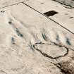
The name of this fort and settlement (R W Feachem 1963) is given as "Haerfaulds" by Feachem and Mackie, and "Harefaulds" by Home. The sub-oval fort measures about 116.0 by 73.0m with a ruined wall, spread to about 5.0m. Despite being heavily robbed and mutilated (in the mid-19th century, when most of the huts were removed (D M Home 1873)), the massive character of the ruin suggests it must have been at least 3.0m thick and possibly timber-laced. The secondary settlement is represented by numbers of circular stone foundations which have been built in and around fallen rubble of the fort wall, and are associated in places with linear walls up th 1.0m thick. Home notes that excavations had been made within the huts, but no mention of any finds, except for a Spanish coin dated 1639, said to have come from here.
RCAHMS 1915; E W Mackie 1975; J Tait 1885
Situated on the SW slope of a hill, overlooking a deep valley, this settlement is generally as described, though much dilapidated. Not all the enclosures indicated on plan are now evident. The broad wall crossing the main enclosure about 150ft from the N end is now reduced to a vague course about 0.1m high.
Surveyed at 1/2500.
Visited by OS (JD) 14 June 1955 and (EGC) 4 October 1962
The accepted local spelling of this fort and settlement is Harefaulds (J L McDougal, Blythe). Its massive construction probably reflects its generally poor defensive position with rising ground to the NW and N, but its siting takes advantage of steeply falling ground to the S and E. The overall dimensions are approximately as described. The wall has collapsed but some outer facing blocks and a few inner facing stones survive, indicating a consistent wall thickness of 3.5m. The only apparent entrance is on the E side where a natural depression forms a hollow way.
The original work is largely masked by the later rebuild of walling and enclosures, probably over several periods and all using the early material. Some of these enclosures appear no more than late, crudely built, stock or lambing pens while others A and B on plan, are strong orthostated cells.
Surveyed at 1/10,000.
Visited by OS (JRL) 6 June 1979
Field Visit (5 February 1914)
218. Fort, the Haerfaulds.
About ¾ mile west-north-west of Blythe on the gentle southern slope of a heathery muir, just before it falls away in a steep descent of some 200 feet to the left bank of the Blythe Water, at an elevation of 950 feet above sea-level, is the stone walled enclosure known as the Haerfaulds (fig. 107 [DP 225412]). In shape it is an irregular oval, with the main axis running almost north and south, along which it measures some 375 feet, while it is about 250 feet broad at its widest part. It is surrounded by a rampart of clean stones, the remains of a massive wall, which is spread over a width of more than 15 feet and rises to an average of about 3 feet. The present inner face rises to 4 feet 6 inches in height in parts, but this seems to be a very late construction. The remains of a straight stone wall, 8 feet in breadth and rising about 1 foot above the ground, cross the enclosure about 150 feet from the northern end.
Hut-circles.
The foundations of many impinging hut-circles can be traced along the inner face of the wall on the western flank and round the northern end. They are much dilapidated, but a group near the centre of the western side is in a fairly good state of preservation. One shows an internal diameter of 13 feet with a wall nearly 4 feet high and an entrance from the east 2 feet 3 inches in width formed by two upright pillar stones. Immediately to the north is an oval structure 16 feet in length by 14 feet in breadth with a wall nearly 3 feet in height. It opens into another oval chamber by a passage 2 feet 6 inches wide. This building, which partly cuts into the rampart, and measures 9 feet 9 inches in length and 5 feet in breadth, is rounded at the northern end and straight across the southern end. A small portion of the original outer facing of the main wall 'is seen here, showing a thickness of 8 feet between the chamber and the outside of the rampart. A large enclosure is seen against the south-eastern wall measuring about 60 feet in length 'by 40 feet in breadth. The entrance to the fort, 12 to 15 feet wide, is through the eastern flank, the approach to it being along a natural hollow from the north-east. To the north of the entrance abutting on the inside of the rampart are traces of further enclosures. Near this entrance is a well-formed cup-marking on the face of an upright stone, but this seems to be a natural weathering. Several other natural hollows are seen in different parts of the rampart.
‘Harrit's Dyke’ [NT55SE 29].
From the north-eastern wall of the Haerfaulds the remains of a stone wall 7 to 8 feet broad are seen running across the hillside following a tortuous course towards the east. It disappears when cultivated land is reached about 250 yards away, but a short section is again seen a short distance north of Blythe, crossing a corner of uncultivated ground. It is known locally as ‘Harrit's Dyke.’ (See also No. 172.)
These constructions were scheduled in the Ancient Monuments Act of 1882.
See Antiquaries, viii. p. 417; ibid., ix. p. 465 (plan and illus.); ibid., xxix. p. 137 (plan); Ber. Nat. Club, 1882-84, p. 310; ibid.,1901-2, p. 273 (plan); Christison, pp. 229 and 231.
RCAHMS 1915, visited 5th February 1914.
OS Map: Ber., xx. NW
Field Visit (23 August 1950)
This site was included within the RCAHMS Marginal Land Survey (1950-1962), an unpublished rescue project. Site descriptions, organised by county, are available to view online - see the searchable PDF in 'Digital Items'. These vary from short notes, to lengthy and full descriptions. Contemporary plane-table surveys and inked drawings, where available, can be viewed online in most cases - see 'Digital Images'. The original typecripts, notebooks and drawings can also be viewed in the RCAHMS search room.
Information from RCAHMS (GFG) 19 July 2013.
Note (20 January 2016 - 18 May 2016)
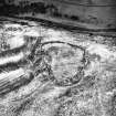
This fort or fortified settlement is set out across the contours at the southern end of a broad spur, where the ground begins to fall away steeply to the Blythe Water. An irregular oval on plan, flattened along its E flank, it measures about 117m from NNE to SSW by 77m transversely within what has probably been a thick wall, now forming a bare mound of rubble some 5m in thickness by 0.9m in height. The entrance has probably been in the E side, where there are two gaps in the rubble. The presence of so much freely available stone has proved attractive for subsequent use with the erection of a much more recent wall along its inner edge to enclose the interior, and almost certainly associated with a series of well-preserved small circular huts and other enclosures let into the rubble all round the perimeter. Although Richard Feachem has suggested that some of these are the remains of late Iron Age round-houses (1963, 113), it is likely that this later occupation relates to medieval or later pasturage and grazings.
Information from An Atlas of Hillforts of Great Britain and Ireland – 18 May 2016. Atlas of Hillforts SC4014
Sbc Note
Visibility: This is an upstanding earthwork or monument.
Information from Scottish Borders Council


