Heriot's Dyke
Linear Earthwork (Period Unassigned)
Site Name Heriot's Dyke
Classification Linear Earthwork (Period Unassigned)
Canmore ID 56000
Site Number NT55SE 29
NGR NT 5840 5004
NGR Description From NT c.5750 5008 to NT 5999 5012
Datum OSGB36 - NGR
Permalink http://canmore.org.uk/site/56000
- Council Scottish Borders, The
- Parish Lauder
- Former Region Borders
- Former District Ettrick And Lauderdale
- Former County Berwickshire
NT55SE 29 from c.5750 5008 to 5999 5012. LIN 6.
Formerly LIN 531.
NT 5750 5008 to NT 5778 5003: Winding low wall of stones 0.8m high (JD 1955)
Remains of a stone wall 2m wide and 0.3m maximum height (WDJ 1963).
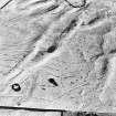
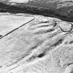
A stretch of Heriot's Dyke is still extant between NT5749 5008 and NT 5777 5003, as a low stony wall c.0.3m max height and c.2m wide deteriorating to a mutilated bank as it approaches the modern stone wall at NT 5777 5003. No trace remains between NT 5777 5003 and NT 5832 5004 but from this point to NT 5843 5001 are the remains of a stony bank 2.2m wide by c.0.5m high which may be part of Heriots Dyke although it is possible that it is connected with the small reservoir at NT 5843 5001. Extant portions surveyed at 1/2500 (WDJ 1963).
NT 5843 5002 to NT 5999 5012: No trace was seen of any remains of the dyke except at NT 5977 5010 where a short stretch of a turf bank ascends a natural steep bank on the east bank of the Brunta Burn.
This bank is c.3m wide and 0.5m high with a ditch 0.6m deep on its N side (WDJ 1963).
It is probable that this bank is part of Heriots Dike. No definite traces of a similar mound was seen on the W bank of the Brunta Burn. Extant portions surveyed at 1/2500 (WDJ 1963).
NT 5749 5008 to NT 5777 5002: Extant portion from Harefaulds (NT 5749 5008) eastwards to field boundary (at NT 5777 5002) is as described. Surveyed at 1:10,000 (JRL 1979)
NT 5778 5003 to NT 5833 5004: There is no trace of the earthwork (JD 1955).
Pecks denote fragmentary remains of dyke (WDJ 1963).
NT 5832 5005 to NT 5843 5001: This extant length of a 0.4m high stony bank is similar to the section from Harefaulds (MJF 1979).
At NT 5836 5004 and NT 5839 5003: The dyke is visible as a stony bank 2.2m wide, 0.5m high on the North side (WDJ 1963).
NT 5843 5001 to NT 5999 5012: There is no trace of the earthwork (JD 2 May 1955)
At 5900 5000: The dyke is "visible on corner of the moor 400yds. NNW of Blythe". 14ft. wide (Craw 1928)
At NT 5975 5010: A mound is visible on both sides of Bruntaburn 400yds North of Bruntaburn Mill (on mapsheet at NT 5963 4973) (Craw 1928).
At NT 5978 5010: 20m long turf bank 3m by 0.5m high with ditch 0.6m deep on N side (WDJ 1963).
At NT 5977 5010: This 20m long section runs down a valley slope and is as described. It is not possible to deduce whether this section is part of a linear or simply a local drainage ditch (MJF 1979).
Visited by OS (JD) 30 April 1955; 2 May 1955; (WDJ) 12 November 1963; (JRL) 8 June 1979; (MJF) 28 June 1979.
J H Craw 1928.
Field Visit (April 1912)
235. ‘Harrit's Dyke’ (O.S. ‘Heriot's Dyke’).
From the northeast entrance of the Haerfaulds (No. 218 [NT55SE 14]) this ‘dyke’ or trench and rampart runs east for about ¼ mile, and thereafter, becoming obliterated across cultivated land, reappears for a short distance immediately to the north of Blythe farm-steading. (See also No. 172.)
RCAHMS 1915, visited April 1912.
OS Map: Ber., xx. NW. and xx. NE.
Field Visit (5 February 1914)
218. Fort, the Haerfaulds.
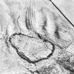
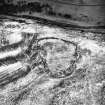
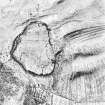
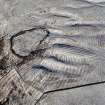
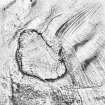
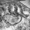
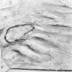
About ¾ mile west-north-west of Blythe on the gentle southern slope of a heathery muir, just before it falls away in a steep descent of some 200 feet to the left bank of the Blythe Water, at an elevation of 950 feet above sea-level, is the stone walled enclosure known as the Haerfaulds (fig. 107 [DP 225412]). In shape it is an irregular oval, with the main axis running almost north and south, along which it measures some 375 feet, while it is about 250 feet broad at its widest part. It is surrounded by a rampart of clean stones, the remains of a massive wall, which is spread over a width of more than 15 feet and rises to an average of about 3 feet. The present inner face rises to 4 feet 6 inches in height in parts, but this seems to be a very late construction. The remains of a straight stone wall, 8 feet in breadth and rising about 1 foot above the ground, cross the enclosure about 150 feet from the northern end.
Hut-circles.
The foundations of many impinging hut-circles can be traced along the inner face of the wall on the western flank and round the northern end. They are much dilapidated, but a group near the centre of the western side is in a fairly good state of preservation. One shows an internal diameter of 13 feet with a wall nearly 4 feet high and an entrance from the east 2 feet 3 inches in width formed by two upright pillar stones. Immediately to the north is an oval structure 16 feet in length by 14 feet in breadth with a wall nearly 3 feet in height. It opens into another oval chamber by a passage 2 feet 6 inches wide. This building, which partly cuts into the rampart, and measures 9 feet 9 inches in length and 5 feet in breadth, is rounded at the northern end and straight across the southern end. A small portion of the original outer facing of the main wall 'is seen here, showing a thickness of 8 feet between the chamber and the outside of the rampart. A large enclosure is seen against the south-eastern wall measuring about 60 feet in length 'by 40 feet in breadth. The entrance to the fort, 12 to 15 feet wide, is through the eastern flank, the approach to it being along a natural hollow from the north-east. To the north of the entrance abutting on the inside of the rampart are traces of further enclosures. Near this entrance is a well-formed cup-marking on the face of an upright stone, but this seems to be a natural weathering. Several other natural hollows are seen in different parts of the rampart.
‘Harrit's Dyke’ [NT55SE 29].
From the north-eastern wall of the Haerfaulds the remains of a stone wall 7 to 8 feet broad are seen running across the hillside following a tortuous course towards the east. It disappears when cultivated land is reached about 250 yards away, but a short section is again seen a short distance north of Blythe, crossing a corner of uncultivated ground. It is known locally as ‘Harrit's Dyke.’ (See also No. 172.)
These constructions were scheduled in the Ancient Monuments Act of 1882.
See Antiquaries, viii. p. 417; ibid., ix. p. 465 (plan and illus.); ibid., xxix. p. 137 (plan); Ber. Nat. Club, 1882-84, p. 310; ibid.,1901-2, p. 273 (plan); Christison, pp. 229 and 231.
RCAHMS 1915, visited 5th February 1914.
OS Map: Ber., xx. NW
Field Visit (9 February 2010 - 12 August 2010)
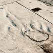
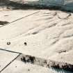
The NMRS and SMR note that Craw (1928) recorded that a section of the ‘dyke’ is visible on a corner of the moor 400 yds NNW of Blythe. Further survey in 1963 carried out by the RCAHMS records that the remains of a bank, measuring 2.2 m wide by 0.5 m high is present running from NT 5832 5004 to NT 5843 5001 and this may be part of Heriot’s Dyke. A short section of stone and turf bank is visible running around the base of a SW facing slope approximately 300 m north of Blythe (running from NT 58357 50045 to NT 58426 50013). The bank measures 100 m long, 1.2 m wide and 0.4 m high (max). It follows the alignment recorded for ‘Heriots Dyke’ on the Ordnance Survey maps. A further section of bank is also visible on aerial photographs approximately 100 m to the SE. No obvious structure is visible on the ground at this location.
Information from Oasis (cfaarcha1-74119) 15 November 2013


